Area Overview for NG17 1JD
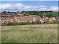
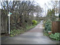
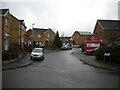
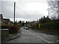
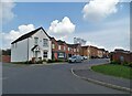
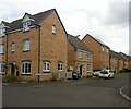
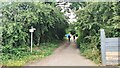
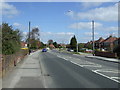
Photos of NG17 1JD

Area Information
Living in NG17 1JD means inhabiting a tightly packed residential cluster in England, where 1,215 people reside across just 1.0 hectare. The area’s high population density — 117,443 people per square kilometre — reflects its compact nature, with homes clustered closely together. This postcode is defined by its small scale, offering a mix of established housing stock and a community centred around local amenities. The median age of 47 suggests a mature demographic, with adults aged 30–64 forming the majority. Proximity to Mapplewells Primary and Nursery School and multiple railway stations adds practicality to daily life. While the area lacks natural constraints like protected woodlands or AONBs, its appeal lies in accessibility and the presence of essential services. For those seeking a quiet, close-knit environment with easy access to transport and education, NG17 1JD offers a focused, no-frills living experience.
- Area Type
- Postcode
- Area Size
- 1.0 hectares
- Population
- 1215
- Population Density
- 2541 people/km²
NG17 1JD is primarily an owner-occupied area, with 70% of homes owned by residents rather than rented. The accommodation type is exclusively houses, which is unusual for a small postcode but aligns with the area’s traditional housing stock. This suggests a market where property ownership is the norm, and rental options are limited. The compact size of the area — just 1.0 hectare — means the housing stock is finite, with little scope for new development. For buyers, this creates a niche market where properties are likely to be long-standing and well-established. The lack of commercial or mixed-use development reinforces the residential character. However, the limited size of the area may also mean that buyers must consider nearby locations for additional property options, as the immediate surroundings are constrained by the postcode’s boundaries.
House Prices in NG17 1JD
Showing 20 properties
| Address | Type | Beds | Baths | Last Sale Price | Last Sale Date | |
|---|---|---|---|---|---|---|
| 268 Alfreton Road, Sutton In Ashfield, NG17 1JD | house | 3 | - | £230,000 | Oct 2021 | |
| 282 Alfreton Road, Sutton In Ashfield, NG17 1JD | house | 3 | - | £180,000 | Sep 2021 | |
| 256 Alfreton Road, Sutton In Ashfield, NG17 1JD | Semi-detached | 3 | 2 | £165,000 | Jun 2018 | |
| 264 Alfreton Road, Sutton In Ashfield, NG17 1JD | Semi-detached | 3 | 1 | £135,000 | Jun 2016 | |
| 252 Alfreton Road, Sutton In Ashfield, NG17 1JD | Bungalow | 5 | - | £250,000 | Jan 2016 | |
| 254 Alfreton Road, Sutton In Ashfield, NG17 1JD | Semi-detached | 4 | - | £180,000 | May 2015 | |
| 262 Alfreton Road, Sutton In Ashfield, NG17 1JD | Semi-detached | 3 | - | £120,000 | Sep 2014 | |
| 286 Alfreton Road, Sutton In Ashfield, NG17 1JD | Semi-detached | 3 | - | £115,000 | Sep 2014 | |
| 258 Alfreton Road, Sutton In Ashfield, NG17 1JD | Semi-detached | - | - | £114,500 | Aug 2007 | |
| 270 Alfreton Road, Sutton In Ashfield, NG17 1JD | Semi-detached | - | - | £125,000 | Jul 2005 |
Energy Efficiency in NG17 1JD
The lifestyle in NG17 1JD is shaped by its proximity to retail and transport hubs. Within practical reach are five retail venues, including Tesco Sutton and Co-op Sutton, offering essential shopping options for daily needs. The area’s rail connectivity, with stations like Sutton Parkway and Kirkby in Ashfield, provides easy access to broader regional networks, facilitating travel for work, leisure, or socialising. While the data does not mention parks or leisure facilities, the presence of multiple retail and transport options suggests a focus on convenience over expansive recreational spaces. The compact nature of the area means amenities are closely clustered, reducing the need for long commutes. For residents prioritising accessibility and practicality, NG17 1JD delivers a straightforward, no-nonsense lifestyle.
Amenities
Schools
The nearest school to NG17 1JD is Mapplewells Primary and Nursery School, which serves the local community with an Ofsted rating of outstanding. As a primary school, it caters to younger children, providing a critical educational foundation for families in the area. The presence of a single primary school highlights the area’s focus on early education, though no secondary schools are listed in the data. For families prioritising high-quality primary education, Mapplewells offers a strong option, with its outstanding rating indicating effective teaching and facilities. The absence of secondary schools may necessitate travel for older students, but the proximity to rail stations like Sutton Parkway and Kirkby in Ashfield could ease this. Overall, the school’s rating and accessibility make it a key asset for residents.
| Rank | School | Type | Entry gender | Ages |
|---|
Explore more schools in this area
Go to Schools tabDemographics
NG17 1JD’s population of 1,215 is predominantly composed of adults aged 30–64, with a median age of 47. This suggests a community of long-term residents, many of whom are likely to be homeowners, as 70% of properties are owner-occupied. The accommodation type is exclusively houses, reflecting a traditional, low-density housing stock. The predominant ethnic group is White, with no data indicating significant diversity beyond this. The area’s high population density — 117,443 people per square kilometre — implies tightly packed living, which may influence the character of local interactions. While no specific deprivation data is provided, the age profile and home ownership rate suggest a stable, middle-aged population with established roots. This demographic mix creates a community focused on local amenities and services, with a strong emphasis on residential continuity.
Household Size
Accommodation Type
Tenure
Ethnic Group
Religion
Household Composition
Age
Household Deprivation
NS-SEC
Explore more demographic insights in this area
Go to Demographics tabPlanning
Planning Constraints
- Flood RiskPremium
- Ramsar Wetland SitesPremium
- Area of Outstanding Natural BeautyPremium
- Protected Nature ReservePremium
- Protected WoodlandPremium