Area Overview for NG17 1EE
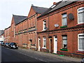
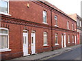
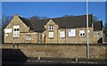
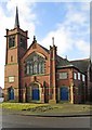
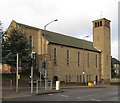
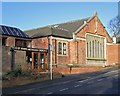
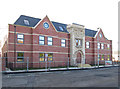
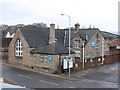
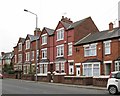
Photos of NG17 1EE


Area Information
Living in NG17 1EE means inhabiting a compact, densely populated residential cluster in England. The area spans just 1.3 hectares, housing 2013 residents in a high-density arrangement of 151,999 people per square kilometre. This small postcode area is characterised by its tight-knit community, with homes predominantly occupied by adults aged 30-64. Daily life here is shaped by proximity to essential services, including retail outlets and rail connections. The area’s compact size means residents can access amenities within walking distance, though the high population density may influence the pace of life. NG17 1EE sits at the intersection of practicality and convenience, offering a blend of local shops, schools, and transport links. For those prioritising accessibility over space, this area provides a functional base, though its small footprint means every decision about living here involves balancing proximity with personal needs. The presence of two schools and multiple railway stations underscores its role as a hub for commuters and families. While the area lacks expansive green spaces, its strategic location and infrastructure make it appealing to those seeking a connected, efficient lifestyle.
- Area Type
- Postcode
- Area Size
- 1.3 hectares
- Population
- 2013
- Population Density
- 4441 people/km²
The property market in NG17 1EE reflects a community where 43% of homes are owner-occupied, with the remaining 57% likely rented. The accommodation type is predominantly houses, which is unusual for a high-density area but may indicate a mix of older, larger properties and newer developments. This suggests a market where homeownership is possible but not dominant, creating a dynamic between private buyers and renters. The small area size—just 1.3 hectares—means the housing stock is limited, which could drive competition among buyers. For those seeking homes in NG17 1EE, the focus is on individual properties rather than flats or apartments. The proximity to rail links and schools may make the area attractive to families or commuters, though the high population density could influence property values. Buyers should consider the compact nature of the area and its reliance on nearby amenities for a complete living experience.
House Prices in NG17 1EE
Showing 8 properties
Energy Efficiency in NG17 1EE
The lifestyle in NG17 1EE is shaped by its proximity to essential amenities. Within practical reach are retail outlets such as Iceland, Lidl, and Heron Carsic Estate Sutton in, providing everyday shopping options. The area’s rail links, including Sutton Parkway and Mansfield stations, offer easy access to broader regional networks. While there is no explicit mention of parks or leisure facilities in the data, the compact layout suggests a focus on convenience over expansive recreational spaces. Residents can access a mix of retail, dining, and transport hubs, though the absence of named parks or leisure venues means outdoor activities may require travel. The presence of two schools and multiple shops indicates a community-oriented environment where daily needs are met locally. For those valuing accessibility over space, NG17 1EE’s amenities contribute to a functional, if tightly packed, lifestyle.
Amenities
Schools
Residents of NG17 1EE have access to two notable educational institutions. Sutton Centre Community College is a primary school, providing early education for local children. Nearby, Sutton Community Academy is an academy with a ‘good’ Ofsted rating, indicating a standard of education that meets national benchmarks. The combination of a primary school and an academy offers families a range of options, from foundational learning to secondary education. The presence of two schools within practical reach suggests the area is well-served for educational needs, though the lack of further schools or specialist provisions means families may need to travel for additional services. The ‘good’ rating at Sutton Community Academy implies a reliable, if not exceptional, educational environment. For parents prioritising proximity and quality, NG17 1EE’s schools provide a solid foundation for children’s schooling.
| Rank | School | Type | Entry gender | Ages |
|---|
Explore more schools in this area
Go to Schools tabDemographics
NG17 1EE’s population skews towards middle-aged adults, with a median age of 47 and 64% of residents falling within the 30-64 age range. This suggests a community with established careers and families, though the 43% home ownership rate indicates a mix of owner-occupied properties and rental units. The area is predominantly composed of houses, reflecting a preference for standalone living spaces over flats. Ethnically, the population is largely White, with no specific data provided on other groups. The high population density—151,999 people per square kilometre—means limited space per resident, which may influence the character of the area. While no deprivation data is explicitly stated, the combination of high density and moderate home ownership suggests a balance between affordability and cost of living. For families, the presence of two schools within reach adds to the area’s appeal, though the lack of detailed diversity metrics means broader demographic trends remain unexplored.
Household Size
Accommodation Type
Tenure
Ethnic Group
Religion
Household Composition
Age
Household Deprivation
NS-SEC
Explore more demographic insights in this area
Go to Demographics tabPlanning
Planning Constraints
- Flood RiskPremium
- Ramsar Wetland SitesPremium
- Area of Outstanding Natural BeautyPremium
- Protected Nature ReservePremium
- Protected WoodlandPremium