Area Overview for NG17 1DL
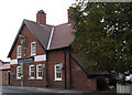
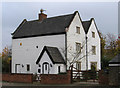
Photos of NG17 1DL


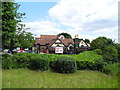
Area Information
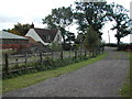
Living in NG17 1DL offers a compact, tightly knit residential experience. The area covers just 1.3 hectares, housing 1,215 residents in a densely populated cluster. With a population density of 91,682 people per square kilometre, this postcode is a microcosm of suburban life. The community is predominantly composed of adults aged 30–64, with a median age of 47, suggesting a stable, established demographic. Most residents own their homes—70% of households are owner-occupied—reflecting a long-term presence in the area. The housing stock is almost entirely composed of houses, not flats, which aligns with the area’s character as a traditional residential cluster. Daily life here is shaped by proximity to local amenities, with rail links and retail options within easy reach. While the area is small, its strategic location near multiple railway stations and well-rated schools makes it an attractive option for families and commuters. The high broadband score of 100 ensures seamless digital connectivity, supporting both work and leisure. However, the medium crime risk score of 54 means residents should remain vigilant about standard security measures. For those seeking a quiet, well-serviced community, NG17 1DL balances practicality with a sense of place.
- Area Type
- Postcode
- Area Size
- 1.3 hectares
- Population
- 1215
- Population Density
- 2541 people/km²
The property market in NG17 1DL is characterised by a high proportion of owner-occupied homes, with 70% of households owning their properties. This suggests a community of long-term residents rather than a transient rental market. The accommodation type is predominantly houses, not flats, which is unusual for a small postcode area but aligns with the suburban nature of the cluster. Given the limited area size of 1.3 hectares, the housing stock is likely constrained, meaning buyers may find few options within NG17 1DL itself. However, the proximity to nearby towns and railway stations could expand the search radius for those seeking additional properties. The high broadband score of 100 ensures that homes here are well-suited for remote work, a growing consideration for buyers. For those prioritising stability, the area’s established demographic and low flood risk make it a pragmatic choice. However, the medium crime risk score of 54 means potential buyers should assess local security measures carefully.
House Prices in NG17 1DL
Showing 41 properties
| Address | Type | Beds | Baths | Last Sale Price | Last Sale Date | |
|---|---|---|---|---|---|---|
| 41 Rothwell Close, Sutton In Ashfield, NG17 1DL | house | 3 | 1 | - | - | |
| 43 Rothwell Close, Sutton In Ashfield, NG17 1DL | house | - | - | - | - | |
| 38 Rothwell Close, Sutton In Ashfield, NG17 1DL | Detached | 3 | 1 | - | - | |
| 33 Rothwell Close, Sutton In Ashfield, NG17 1DL | Detached | 3 | 1 | - | - | |
| 32 Rothwell Close, Sutton In Ashfield, NG17 1DL | Semi-detached | 3 | 1 | - | - | |
| 30 Rothwell Close, Sutton In Ashfield, NG17 1DL | Semi-detached | 3 | 1 | - | - | |
| 36 Rothwell Close, Sutton In Ashfield, NG17 1DL | Semi-detached | 3 | 1 | - | - | |
| 34 Rothwell Close, Sutton In Ashfield, NG17 1DL | Semi-detached | 3 | 1 | - | - | |
| 37 Rothwell Close, Sutton In Ashfield, NG17 1DL | house | - | - | - | - | |
| 15 Rothwell Close, Sutton In Ashfield, NG17 1DL | Semi-detached | 3 | 1 | - | - |
Energy Efficiency in NG17 1DL
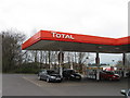
The lifestyle in NG17 1DL is shaped by its proximity to essential amenities. Within practical reach are five retail outlets, including major names like Tesco Sutton, Co-op Sutton, and Spar, providing everyday shopping convenience. The area’s rail links to Sutton Parkway, Kirkby in Ashfield, and Alfreton offer easy access to broader regional services and leisure opportunities. While the data does not mention parks or recreational spaces, the compact nature of the postcode suggests that residents may rely on nearby towns for green spaces and community facilities. The presence of multiple retail options and transport links enhances the area’s practicality, making it suitable for those who value accessibility over expansive local amenities. For families, the outstanding primary school adds to the appeal, while the high broadband score supports modern lifestyles. The combination of convenience and connectivity ensures that daily life in NG17 1DL is efficient, though residents may need to venture slightly beyond the postcode for more diverse leisure options.
Amenities
Schools
The nearest school to NG17 1DL is Mapplewells Primary and Nursery School, which serves as the sole primary education option for the area. Notably, this school has an outstanding Ofsted rating, indicating high-quality teaching and facilities. While no secondary schools are listed in the data, the proximity to rail links suggests that families may access larger educational institutions in nearby towns. The presence of a well-rated primary school is a significant draw for families, as it reduces the need for long commutes. However, the absence of secondary schools within the immediate area means that parents should consider the availability of secondary education in surrounding districts. The outstanding rating at Mapplewells ensures that children receive a strong foundation in early education, which can be a decisive factor for homebuyers prioritising schooling.
| Rank | School | Type | Entry gender | Ages |
|---|
Explore more schools in this area
Go to Schools tabDemographics
The community in NG17 1DL is defined by its age profile and home ownership patterns. With a median age of 47 and the majority of residents aged 30–64, this area is home to a mature, stable population. The 70% home ownership rate indicates a strong presence of long-term residents, with most households owning rather than renting their properties. The accommodation type is predominantly houses, not flats, which is typical for smaller postcode clusters in England. The predominant ethnic group is White, reflecting the broader demographic trends in the region. The population density of 91,682 people per square kilometre is exceptionally high, which may influence the character of public spaces and community interactions. While no specific deprivation data is provided, the high home ownership and age profile suggest a relatively stable socioeconomic environment. However, the medium crime risk score of 54 implies that residents should consider standard security measures. For families, the presence of a primary school with an outstanding Ofsted rating adds to the area’s appeal.
Household Size
Accommodation Type
Tenure
Ethnic Group
Religion
Household Composition
Age
Household Deprivation
NS-SEC
Explore more demographic insights in this area
Go to Demographics tabPlanning
Planning Constraints
- Flood RiskPremium
- Ramsar Wetland SitesPremium
- Area of Outstanding Natural BeautyPremium
- Protected Nature ReservePremium
- Protected WoodlandPremium