Area Overview for NG16 6PD
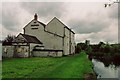
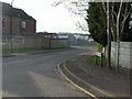
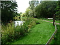
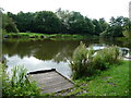
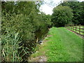
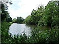
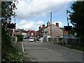
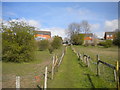
Photos of NG16 6PD
Area Information
NG16 6PD is a small, tightly knit residential area in England, covering just 1.9 hectares and home to 1,333 residents. Its compact size means it feels like a close-knit community, with a population density of 760 people per square kilometre. The area’s character is defined by its mix of older and newer housing stock, predominantly family homes. Residents are largely adults aged 30-64, with a median age of 47, suggesting a stable, established population. Daily life here is shaped by proximity to essential services, including five retail outlets such as Co-op Pinxton and Morrisons, and access to five railway stations, including Alfreton and Sutton Parkway. The area’s low flood risk and absence of environmental constraints make it a practical choice for those prioritising safety and planning certainty. While the crime risk is average, with a score of 61, it remains a functional, accessible place to live, particularly for commuters and families seeking a balance between urban and rural living.
- Area Type
- Postcode
- Area Size
- 1.9 hectares
- Population
- 1333
- Population Density
- 760 people/km²
NG16 6PD is primarily an owner-occupied area, with 65% of properties in private hands. The housing stock consists almost entirely of houses, with no flats or apartments listed, indicating a focus on traditional family homes. This makes the area more attractive to buyers seeking larger properties rather than rental opportunities. The small size of the postcode—just 1.9 hectares—means the property market is limited, with few options available within the immediate vicinity. For buyers, this could mean a need to look beyond the postcode boundary for additional choices. The high home ownership rate suggests a stable market, but the limited stock may lead to competition among buyers. Those prioritising a quiet, family-friendly environment with established housing may find NG16 6PD appealing, though the lack of newer developments could be a consideration.
House Prices in NG16 6PD
Showing 62 properties
| Address | Type | Beds | Baths | Last Sale Price | Last Sale Date | |
|---|---|---|---|---|---|---|
| 44 Talbot Street, Pinxton, NG16 6PD | Terraced | 3 | 1 | £106,000 | Jun 2025 | |
| 42 Talbot Street, Pinxton, NG16 6PD | Terraced | 3 | 1 | £130,000 | Nov 2024 | |
| 62 Talbot Street, Pinxton, NG16 6PD | Terraced | 3 | 2 | £125,000 | Aug 2024 | |
| 27 Talbot Street, Pinxton, NG16 6PD | Terraced | 3 | 1 | £120,000 | Aug 2023 | |
| 34 Talbot Street, Pinxton, NG16 6PD | Terraced | 3 | 1 | £100,000 | Sep 2022 | |
| 68 Talbot Street, Pinxton, NG16 6PD | Terraced | 3 | 1 | £103,000 | Oct 2021 | |
| 3 Talbot Street, Pinxton, NG16 6PD | Terraced | 3 | 1 | £120,000 | Sep 2021 | |
| 65 Talbot Street, Pinxton, NG16 6PD | Terraced | 3 | 1 | £100,000 | Aug 2021 | |
| 64 Talbot Street, Pinxton, NG16 6PD | Terraced | 3 | 1 | £124,000 | Aug 2021 | |
| 60 Talbot Street, Pinxton, NG16 6PD | Terraced | 3 | - | £100,000 | Feb 2021 |
Energy Efficiency in NG16 6PD
Daily life in NG16 6PD is shaped by its proximity to essential retail and transport hubs. Five retail outlets, including Co-op Pinxton and Morrisons, provide access to groceries, petrol, and everyday goods, reducing the need for long trips. The five railway stations, such as Alfreton and Sutton Parkway, offer convenient links to regional centres, supporting both commuters and shoppers. While the area lacks dedicated parks or leisure facilities, the absence of environmental constraints like protected woodlands or AONB status means residents can access nearby green spaces without planning restrictions. The compact size of the area means amenities are closely grouped, enhancing convenience. However, the limited range of venues means those seeking extensive leisure options may need to travel further. The mix of retail and transport options makes NG16 6PD practical for those prioritising accessibility over expansive recreational facilities.
Amenities
Schools
Residents of NG16 6PD have access to two primary educational institutions. Longwood Community Infant School serves as a primary school, while Longwood Infant Academy, an academy with an outstanding Ofsted rating, provides early years and primary education. The presence of both a traditional school and an academy offers parents a choice between established institutions and schools with a focus on innovation and performance. The outstanding rating at Longwood Infant Academy indicates high standards of teaching and student outcomes, which could be a key draw for families prioritising quality education. However, the absence of secondary schools in the immediate area means students may need to commute to nearby towns for further education. The mix of school types reflects a balance between tradition and modern approaches to learning.
| Rank | School | Type | Entry gender | Ages |
|---|
Explore more schools in this area
Go to Schools tabDemographics
The population of NG16 6PD is predominantly adults aged 30-64, with a median age of 47, reflecting a mature, settled community. Home ownership is high at 65%, indicating a strong presence of long-term residents. The area is largely composed of houses, with no mention of flats or apartments, suggesting a focus on family-oriented living. The predominant ethnic group is White, with no specific data on other demographics. The age profile and ownership figures imply a low turnover of residents, fostering a stable social environment. However, the lack of detailed diversity data means the community’s full composition remains unclear. The absence of deprivation metrics in the data makes it difficult to assess economic challenges, but the high home ownership rate and age distribution suggest a relatively secure financial profile for most residents.
Household Size
Accommodation Type
Tenure
Ethnic Group
Religion
Household Composition
Age
Household Deprivation
NS-SEC
Explore more demographic insights in this area
Go to Demographics tabPlanning
Planning Constraints
- Flood RiskPremium
- Ramsar Wetland SitesPremium
- Area of Outstanding Natural BeautyPremium
- Protected Nature ReservePremium
- Protected WoodlandPremium