Area Overview for NG16 6PA
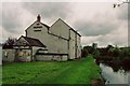
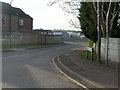
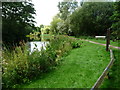
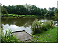
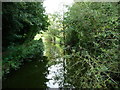
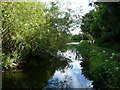
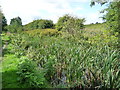
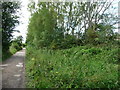
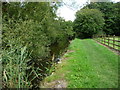
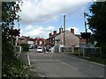
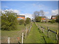
Photos of NG16 6PA

Area Information
NG16 6PA is a small, compact postcode area in England, covering just 1303 square metres and home to 1333 residents. Its population density of 760 people per square kilometre suggests a tightly knit community, with a focus on residential living. The area’s size means it is likely a cluster of homes rather than a sprawling suburb, offering a quiet, localised environment. Daily life here is shaped by proximity to nearby amenities, including shops, rail links, and schools. The area’s demographics, with a median age of 47 and a majority of adults aged 30–64, suggest a stable, family-oriented population. While it is not a high-density urban area, it is well-connected to surrounding towns through rail networks and has a strong digital infrastructure, making it suitable for those who work remotely or need reliable internet access. Living in NG16 6PA feels like being part of a small, manageable community with access to essential services without the hustle of a larger town.
- Area Type
- Postcode
- Area Size
- 1303 m²
- Population
- 1333
- Population Density
- 760 people/km²
The property market in NG16 6PA is characterised by a high rate of home ownership (65%), indicating that most properties are owner-occupied rather than rented. The area is primarily composed of houses, which contrasts with regions where flats or apartments dominate. This suggests a residential landscape suited to families or individuals seeking more space and privacy. Given the small size of the postcode area, the housing stock is limited, and properties are likely concentrated in a compact cluster. Buyers should consider the proximity to nearby amenities, such as schools and rail links, which enhance the area’s appeal. The predominance of houses may also mean fewer rental options, making it a less dynamic market for tenants. For those seeking a home in NG16 6PA, the focus is on securing a property in a stable, low-density environment with access to local services.
House Prices in NG16 6PA
No properties found in this postcode.
Energy Efficiency in NG16 6PA
Living in NG16 6PA offers access to a range of nearby amenities, including retail and transport hubs. The area is within reach of five retail outlets, such as Co-op Pinxton and Morrisons Daily, providing everyday shopping convenience. Rail stations like Alfreton and Kirkby in Ashfield offer easy access to public transport, connecting residents to broader networks. While the data does not specify parks or leisure facilities, the proximity to retail and rail suggests a practical, service-oriented lifestyle. The compact nature of the area means amenities are close, reducing the need for long journeys. For residents, this balance of local shops, transport links, and a small community feel creates a functional, accessible environment.
Amenities
Schools
Residents of NG16 6PA have access to two primary schools within practical reach. Longwood Community Infant School is a standard primary institution, while Longwood Infant Academy is an academy with an outstanding Ofsted rating. The presence of an academy with a top rating suggests high educational standards, which is a significant advantage for families. The combination of a traditional primary school and a high-performing academy provides flexibility for parents, whether they prioritise a conventional curriculum or seek the benefits of an academy’s resources. Both schools are likely to serve the local community, reducing the need for long commutes. For families, this mix of school types ensures options that align with different educational preferences and needs.
| Rank | School | Type | Entry gender | Ages |
|---|
Explore more schools in this area
Go to Schools tabDemographics
The population of NG16 6PA is predominantly adults, with 65% of residents aged 30–64 years and a median age of 47. This indicates a mature, settled community with a strong presence of middle-aged households. Home ownership is high at 65%, suggesting a mix of long-term residents and owner-occupied properties. The area is primarily composed of houses rather than flats, reflecting a suburban or semi-rural character. The predominant ethnic group is White, with no specific data provided on other demographics. The absence of detailed diversity statistics means the community’s composition is not fully defined, but the data highlights a stable, family-focused population. With no mention of deprivation levels, it is unclear how socioeconomic factors might influence quality of life, though the high home ownership rate suggests a degree of financial stability.
Household Size
Accommodation Type
Tenure
Ethnic Group
Religion
Household Composition
Age
Household Deprivation
NS-SEC
Explore more demographic insights in this area
Go to Demographics tabPlanning
Planning Constraints
- Flood RiskPremium
- Ramsar Wetland SitesPremium
- Area of Outstanding Natural BeautyPremium
- Protected Nature ReservePremium
- Protected WoodlandPremium