Area Overview for NG16 6FZ
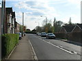
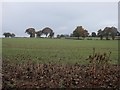
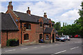
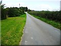
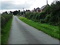
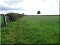
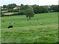
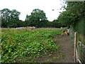
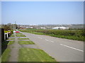
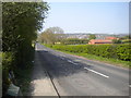
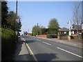
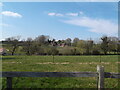
Photos of NG16 6FZ
Area Information
Living in NG16 6FZ means being part of a small, tightly knit residential cluster in England. This postcode area spans 5.6 hectares and is home to 1,564 people, giving it a population density of 559 people per square kilometre. The community here is predominantly composed of adults aged 30 to 64, with a median age of 47. This suggests a mature, stable population, many of whom likely own their homes, as 67% of households are owner-occupied. Daily life in NG16 6FZ balances suburban tranquillity with practical access to nearby amenities. The area’s compact size means residents can reach essential services, including shops and transport links, within a short distance. While the population is modest, the density ensures a sense of community without the overcrowding of larger urban areas. For those considering a move, NG16 6FZ offers a blend of residential comfort and proximity to infrastructure, making it a viable option for those seeking a settled, low-maintenance lifestyle.
- Area Type
- Postcode
- Area Size
- 5.6 hectares
- Population
- 1564
- Population Density
- 559 people/km²
The property market in NG16 6FZ is characterised by a high rate of home ownership, with 67% of residents living in owner-occupied homes. This suggests a stable, long-term demographic rather than a transient rental market. The accommodation type is predominantly houses, which is typical for a small residential area with limited high-density development. Given the area’s compact size and low population density, the housing stock is likely to be modest in scale, with properties designed for family living rather than larger urban dwellings. For buyers, this means a focus on individual homes rather than flats or apartments. The limited size of NG16 6FZ also means the immediate surrounding areas may hold more options, but within the postcode itself, the market is likely to be niche. Buyers should consider the proximity to transport links and amenities when evaluating properties, as these are key factors for residents in a small, semi-rural setting.
House Prices in NG16 6FZ
Showing 44 properties
| Address | Type | Beds | Baths | Last Sale Price | Last Sale Date | |
|---|---|---|---|---|---|---|
| 8 Valentine Avenue, Selston, NG16 6FZ | Semi-detached | 3 | 1 | £180,500 | Aug 2025 | |
| 28 Valentine Avenue, Selston, NG16 6FZ | Flat | 2 | - | £88,000 | Oct 2023 | |
| 4 Valentine Avenue, Selston, NG16 6FZ | Semi-detached | 4 | 1 | £175,000 | Feb 2022 | |
| 12 Valentine Avenue, Selston, NG16 6FZ | Semi-detached | 4 | 1 | £112,000 | Sep 2016 | |
| 20 Valentine Avenue, Selston, NG16 6FZ | Semi-detached | 3 | - | £120,000 | May 2015 | |
| 16 Valentine Avenue, Selston, NG16 6FZ | Semi-detached | 4 | - | £112,000 | Jan 2015 | |
| 24 Valentine Avenue, Selston, NG16 6FZ | house | - | - | £37,500 | Jul 2000 | |
| 26 Valentine Avenue, Selston, NG16 6FZ | Flat | - | - | £20,000 | Mar 1999 | |
| 2 Valentine Avenue, Selston, NG16 6FZ | Semi-detached | 3 | 1 | - | - | |
| 18 Valentine Avenue, Selston, NG16 6FZ | Semi-detached | - | - | - | - |
Energy Efficiency in NG16 6FZ
Residents of NG16 6FZ have access to a range of local amenities within practical reach. The area is served by five retail outlets, including Co-op stores in Selston, Pinxton, and Jacksdale, providing everyday shopping options. These stores likely cater to household needs, from groceries to household goods. For transport, the proximity to rail stations and a tram stop enhances mobility, allowing residents to travel to nearby towns or cities for work, leisure, or socialising. While the area itself is small, the surrounding infrastructure suggests a lifestyle that combines local convenience with regional accessibility. The presence of multiple retail points and transport links indicates a community that values practicality, with amenities designed to meet daily needs without requiring long commutes. This balance of retail and transport options supports a lifestyle that is both self-sufficient and connected to broader networks.
Amenities
Schools
| Rank | School | Type | Entry gender | Ages |
|---|
Explore more schools in this area
Go to Schools tabDemographics
The demographics of NG16 6FZ reflect a community skewed towards middle-aged adults, with a median age of 47 and the majority of residents falling within the 30–64 age range. This suggests a population that is largely established, with many likely in their prime working years or nearing retirement. Home ownership is strong, with 67% of households owning their homes, indicating a preference for long-term residency over rental living. The accommodation type is predominantly houses, which aligns with the area’s character as a residential cluster rather than a high-density development. The predominant ethnic group is White, though the data does not specify further diversity metrics. The population density of 559 people per square kilometre is moderate, balancing privacy with the convenience of shared amenities. This density supports a community feel without the pressures of overpopulation, allowing for a manageable quality of life with access to nearby services.
Household Size
Accommodation Type
Tenure
Ethnic Group
Religion
Household Composition
Age
Household Deprivation
NS-SEC
Explore more demographic insights in this area
Go to Demographics tabPlanning
Planning Constraints
- Flood RiskPremium
- Ramsar Wetland SitesPremium
- Area of Outstanding Natural BeautyPremium
- Protected Nature ReservePremium
- Protected WoodlandPremium