Area Overview for NG16 6FY
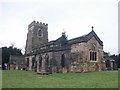
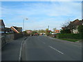
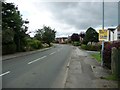
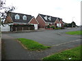
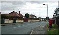
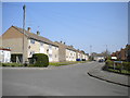
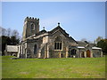
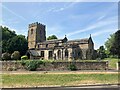
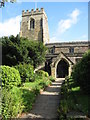
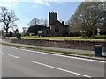
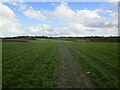
Photos of NG16 6FY

Area Information
NG16 6FY is a small, compact residential postcode in England, covering 5,035 square metres and home to 1,564 residents. It is a mature community, with a median age of 47, dominated by adults aged 30–64. The area’s size and population suggest a close-knit, stable environment, where most properties are owner-occupied. Its proximity to rail networks and a tram stop ensures reasonable connectivity, while broadband quality is near-excellent, supporting remote work and daily digital needs. The low flood risk and absence of protected natural sites mean planning restrictions are minimal, offering flexibility for buyers. Living here feels practical rather than sprawling, with a focus on local amenities and community-centric living. The area’s character is defined by its small-scale charm, with homes clustered around accessible transport links and nearby retail hubs. For those seeking a balanced life between suburban comfort and urban reach, NG16 6FY provides a straightforward, no-frills foundation.
- Area Type
- Postcode
- Area Size
- 5035 m²
- Population
- 1564
- Population Density
- 559 people/km²
In NG16 6FY, 67% of properties are owner-occupied, with houses forming the majority of the housing stock. This suggests a community of long-term residents rather than a rental-heavy area. The small postcode size means the property market is limited in scale, with fewer options compared to larger towns. Buyers should consider nearby areas for broader choices, though the immediate vicinity offers a compact, family-friendly environment. The predominance of houses indicates a focus on single-family living, which may appeal to those prioritising space and privacy. However, the limited number of properties means competition could be fierce, and buyers may need to act quickly. The absence of protected sites or flood risks adds to the area’s appeal, offering a straightforward, low-risk investment for those seeking a stable, owner-occupied home.
House Prices in NG16 6FY
Showing 8 properties
| Address | Type | Beds | Baths | Last Sale Price | Last Sale Date | |
|---|---|---|---|---|---|---|
| 1 Desborough Road, Selston, NG16 6FY | house | 6 | - | £175,000 | Feb 2011 | |
| 17 Desborough Road, Selston, NG16 6FY | Semi-detached | - | - | £40,000 | Dec 1995 | |
| 5 Desborough Road, Selston, NG16 6FY | Semi-detached | - | - | - | - | |
| 3 Desborough Road, Selston, NG16 6FY | Semi-detached | - | - | - | - | |
| 15 Desborough Road, Selston, NG16 6FY | house | - | - | - | - | |
| 9 Desborough Road, Selston, NG16 6FY | Semi-detached | - | - | - | - | |
| 7 Desborough Road, Selston, NG16 6FY | Semi-detached | - | - | - | - | |
| 11 Desborough Road, Selston, NG16 6FY | house | - | - | - | - |
Energy Efficiency in NG16 6FY
NG16 6FY offers a modest but functional lifestyle, with nearby amenities including five retail outlets such as Co-op Selston, Co-op Pinxton, and Co-op Jacksdale. These stores provide everyday essentials, though dining options and leisure facilities are not specified in the data. The rail network is a key feature, with stations like Alfreton and Kirkby in Ashfield offering access to broader services. The Butler’s Hill Tram Stop adds to local mobility, connecting residents to nearby areas. While the area lacks detailed information on parks or recreational spaces, the absence of protected natural sites suggests open land may be available for informal use. The community feel is likely shaped by its proximity to retail and transport, creating a practical, service-oriented daily life.
Amenities
Schools
| Rank | School | Type | Entry gender | Ages |
|---|
Explore more schools in this area
Go to Schools tabDemographics
The population of NG16 6FY is 1,564, with a median age of 47, indicating a community skewed towards middle-aged adults. The most common age range is 30–64, suggesting a mix of established professionals and families. Home ownership stands at 67%, with houses being the predominant accommodation type. This reflects a settled, long-term resident base rather than a transient rental market. The predominant ethnic group is White, though specific diversity metrics are not provided. The population density of 559 people per square kilometre is moderate, balancing privacy with proximity to services. While no data on deprivation is available, the high home ownership rate and mature age profile imply a relatively stable economic environment. This makes NG16 6FY a practical choice for buyers seeking a low-maintenance, community-focused lifestyle with minimal planning constraints.
Household Size
Accommodation Type
Tenure
Ethnic Group
Religion
Household Composition
Age
Household Deprivation
NS-SEC
Explore more demographic insights in this area
Go to Demographics tabPlanning
Planning Constraints
- Flood RiskPremium
- Ramsar Wetland SitesPremium
- Area of Outstanding Natural BeautyPremium
- Protected Nature ReservePremium
- Protected WoodlandPremium