Area Overview for NG16 5NP
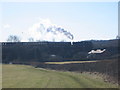
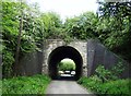
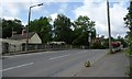
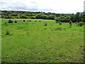
Photos of NG16 5NP


Area Information
Living in NG16 5NP means inhabiting a compact, residential cluster of 27.6 hectares that accommodates 1,476 people. The area’s high population density of 1,217 people per square kilometre reflects its small footprint and tightly woven community. This postcode is not a sprawling suburb but a focused neighbourhood where daily life revolves around nearby amenities and local connections. The median age of 47 suggests a mature demographic, with the majority of residents falling between 30 and 64 years old. While the area is small, it offers practical access to essential services, including retail outlets and rail networks. For those seeking a quiet, established community with proximity to shops and transport, NG16 5NP provides a balance of convenience and space. However, its limited size means it is not suited to those needing expansive housing or extensive green spaces. The area’s character is defined by its residential focus, with homes predominating over other property types. For buyers, this is a niche market where every property is within a short distance of local hubs, making it ideal for those prioritising accessibility over scale.
- Area Type
- Postcode
- Area Size
- 27.6 hectares
- Population
- 1476
- Population Density
- 1217 people/km²
The property market in NG16 5NP is shaped by its small size and high population density. With only 31% of homes owned by residents, the area leans more towards a rental market than owner-occupation. The accommodation type is predominantly houses, but the compact nature of the postcode means housing stock is limited. Buyers should consider that the area’s size restricts the availability of properties, and competition may be fierce. For those seeking a home, the focus is on existing houses rather than newer developments. The high population density suggests that properties are closely spaced, which could be a consideration for those prioritising space. The small footprint of NG16 5NP means that buyers must evaluate not only the property itself but also its integration into a tightly knit community. While the market may lack variety, it offers the advantage of proximity to local amenities, making it appealing to those valuing convenience over expansive living areas.
House Prices in NG16 5NP
Showing 7 properties
| Address | Type | Beds | Baths | Last Sale Price | Last Sale Date | |
|---|---|---|---|---|---|---|
| The Cottage, Bullock Lane, Ironville, NG16 5NP | house | - | - | £243,000 | Jun 2017 | |
| Highfield House, Bullock Lane, Ironville, NG16 5NP | Detached | 4 | 2 | £370,000 | Aug 2016 | |
| 2, Highfield Villas, Bullock Lane, Ironville, NG16 5NP | Semi-detached | 3 | 1 | £87,000 | Feb 2016 | |
| Creative Care, The Old Vicarage, Bullock Lane, Ironville, NG16 5NP | house | - | - | £550,000 | Sep 2007 | |
| Steam Cottage, Bullock Lane, Ironville, NG16 5NP | Detached | 2 | 1 | - | - | |
| Oak Cottage, Bullock Lane, Ironville, NG16 5NP | Detached | - | - | - | - | |
| The Lodge, Creative Care, The Old Vicarage, Bullock Lane, Ironville, NG16 5NP | Bungalow | - | - | - | - |
Energy Efficiency in NG16 5NP
Residents of NG16 5NP have access to a range of local amenities within practical reach. The area includes five retail outlets, such as Co-op Jacksdale, Heron Greenhill, and Co-op Leabrooks, providing essential shopping options. These stores cater to daily needs, from groceries to household supplies, reducing the necessity for long trips to larger centres. The proximity to rail stations like Alfreton and Langley Mill enhances mobility, allowing residents to commute to nearby towns for additional services or leisure. While the data does not specify parks or recreational facilities, the area’s compact nature suggests that public spaces may be limited. Nonetheless, the combination of retail options and rail connectivity contributes to a convenient lifestyle, where essentials are nearby and travel options are accessible. The character of NG16 5NP is defined by its practicality, offering a balance between local convenience and the need to venture slightly further for broader amenities.
Amenities
Schools
The nearest school to NG16 5NP is Ironville and Codnor Park Primary School, which serves the area’s primary education needs. This school is rated ‘good’ by Ofsted, indicating a solid standard of teaching and facilities. Families in NG16 5NP have access to a primary school within practical reach, though secondary education options are not listed in the data. The presence of a ‘good’ rated primary school is a positive factor for parents seeking reliable early education for their children. However, the absence of secondary schools nearby means that students may need to travel further for secondary education, which could be a consideration for families planning long-term. The school’s rating suggests that it meets acceptable standards, but buyers should verify whether the school’s capacity aligns with the area’s population, particularly given the high density of residents.
| Rank | School | Type | Entry gender | Ages |
|---|
Explore more schools in this area
Go to Schools tabDemographics
The community in NG16 5NP is predominantly composed of adults aged 30 to 64, with a median age of 47. This reflects a mature population, likely with long-term ties to the area. Home ownership rates are relatively low at 31%, indicating that a majority of residents are either renting or living in properties owned by others. The accommodation type is primarily houses, though the small area size and high population density suggest that properties are closely spaced. The predominant ethnic group is White, with no specific data provided on other demographics. The population density of 1,217 people per square kilometre is notably high, which may influence the character of the area, fostering a sense of closeness among residents. However, this density also means limited space for expansion or new developments. For buyers, understanding the demographic profile is key: this is not a young, growing suburb but a stable, established community where housing stock is limited and demand may outstrip supply.
Household Size
Accommodation Type
Tenure
Ethnic Group
Religion
Household Composition
Age
Household Deprivation
NS-SEC
Explore more demographic insights in this area
Go to Demographics tabPlanning
Planning Constraints
- Flood RiskPremium
- Ramsar Wetland SitesPremium
- Area of Outstanding Natural BeautyPremium
- Protected Nature ReservePremium
- Protected WoodlandPremium