Area Overview for NG14 7ES
Photos of NG14 7ES
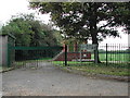
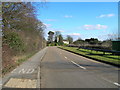


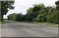


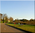
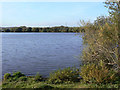
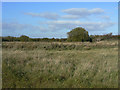
18 photos from this area
Area Information
Key information about the NG14 7ES including its size, population, and administrative classification.
- Area Type
- Postcode
- Area Size
- 90.7 hectares
- Population
- 1519
- Population Density
- 209 people/km²
House Prices in NG14 7ES
34
Properties
£350,319
Average Sold Price
£16,647
Lowest Price
£606,000
Highest Price
Showing 34 properties
| Address | Type | Beds | Baths | Last Sale Price | Last Sale Date | |
|---|---|---|---|---|---|---|
| 2, Prospect Villas, Lowdham Road, Gunthorpe, NG14 7ES | Semi-detached | 2 | 1 | £315,000 | Dec 2025 | |
| Beechcroft, Lowdham Road, Gunthorpe, NG14 7ES | Detached | 4 | 2 | £570,000 | Dec 2022 | |
| The Elms, Lowdham Road, Gunthorpe, NG14 7ES | house | - | - | £606,000 | Nov 2021 | |
| Ashleigh, Lowdham Road, Gunthorpe, NG14 7ES | Detached | 5 | 3 | £598,950 | Apr 2021 | |
| 1, Prospect Villas, Lowdham Road, Gunthorpe, NG14 7ES | Semi-detached | 3 | 1 | £310,000 | Dec 2020 | |
| Lilac Cottage, Lowdham Road, Gunthorpe, NG14 7ES | Semi-detached | 3 | 1 | £150,000 | Apr 2020 | |
| Ashbrook House, Lowdham Road, Gunthorpe, NG14 7ES | house | - | - | £555,000 | Apr 2018 | |
| Wingates, Lowdham Road, Gunthorpe, NG14 7ES | Detached | 4 | 3 | £520,000 | Oct 2017 | |
| Peartrees, Lowdham Road, Gunthorpe, NG14 7ES | Bungalow | 2 | 1 | £253,000 | Nov 2016 | |
| Park House, Lowdham Road, Gunthorpe, NG14 7ES | Detached | 4 | 1 | £420,000 | Jun 2016 |
Page 1 of 4
Energy Efficiency in NG14 7ES
Amenities
Schools
| Rank | School | Type | Entry gender | Ages |
|---|
Explore more schools in this area
Go to Schools tabDemographics
Household Size
Two person
most common
Accommodation Type
Houses
most common
Tenure
89
majority
Ethnic Group
White
most common
Religion
N/A
most common
Household Composition
N/A
most common
Age
47
median
Adults (30-64 years)
most common
Household Deprivation
N/A
with no deprivation
NS-SEC
45
in Lower managerial occupations
Explore more demographic insights in this area
Go to Demographics tabPlanning
Planning Constraints
- Flood RiskPremium
- Ramsar Wetland SitesPremium
- Area of Outstanding Natural BeautyPremium
- Protected Nature ReservePremium
- Protected WoodlandPremium