Area Overview for NG11 0AW
Photos of NG11 0AW

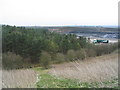
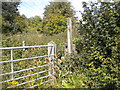
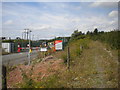
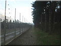

43 photos from this area
Area Information
Key information about the NG11 0AW including its size, population, and administrative classification.
- Area Type
- Postcode
- Area Size
- 71.2 hectares
- Population
- 2786
- Population Density
- 148 people/km²
House Prices in NG11 0AW
20
Properties
£362,385
Average Sold Price
£248,000
Lowest Price
£592,500
Highest Price
Showing 20 properties
| Address | Type | Beds | Baths | Last Sale Price | Last Sale Date | |
|---|---|---|---|---|---|---|
| 56 Church Lane, Thrumpton, NG11 0AW | house | 4 | 2 | £570,000 | Aug 2024 | |
| 52 Church Lane, Thrumpton, NG11 0AW | house | 5 | - | £550,000 | Feb 2024 | |
| 64 Church Lane, Thrumpton, NG11 0AW | Detached | 4 | 2 | £592,500 | Sep 2023 | |
| 55 Church Lane, Thrumpton, NG11 0AW | Semi-detached | 3 | 1 | £270,000 | Mar 2021 | |
| 57 Church Lane, Thrumpton, NG11 0AW | Semi-detached | 3 | 1 | £266,000 | Jul 2018 | |
| 53 Church Lane, Thrumpton, NG11 0AW | Semi-detached | 3 | 1 | £270,000 | Jan 2017 | |
| 51 Church Lane, Thrumpton, NG11 0AW | Semi-detached | 3 | 1 | £272,500 | Aug 2016 | |
| 62 Church Lane, Thrumpton, NG11 0AW | house | 5 | 1 | £265,000 | Apr 2016 | |
| 54 Church Lane, Thrumpton, NG11 0AW | house | - | - | £265,000 | Jul 2015 | |
| Oakwood Barn, Church Lane, Thrumpton, NG11 0AW | Bungalow | 3 | - | £375,000 | Nov 2012 |
Page 1 of 2
Energy Efficiency in NG11 0AW
Amenities
Schools
| Rank | School | Type | Entry gender | Ages |
|---|
Explore more schools in this area
Go to Schools tabDemographics
Household Size
Two person
most common
Accommodation Type
Houses
most common
Tenure
77
majority
Ethnic Group
White
most common
Religion
N/A
most common
Household Composition
N/A
most common
Age
47
median
Young Adults (15-29 years)
most common
Household Deprivation
N/A
with no deprivation
NS-SEC
32
in Lower managerial occupations
Explore more demographic insights in this area
Go to Demographics tabPlanning
Planning Constraints
- Flood RiskPremium
- Ramsar Wetland SitesPremium
- Area of Outstanding Natural BeautyPremium
- Protected Nature ReservePremium
- Protected WoodlandPremium