Area Overview for NG10 5ET
Photos of NG10 5ET
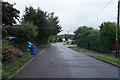
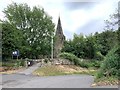
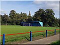
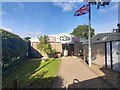
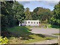
34 photos from this area
Area Information
Key information about the NG10 5ET including its size, population, and administrative classification.
- Area Type
- Postcode
- Area Size
- 1.0 hectares
- Population
- 1624
- Population Density
- 784 people/km²
House Prices in NG10 5ET
14
Properties
£212,100
Average Sold Price
£41,000
Lowest Price
£430,000
Highest Price
Showing 14 properties
| Address | Type | Beds | Baths | Last Sale Price | Last Sale Date | |
|---|---|---|---|---|---|---|
| 19 Poplar Avenue, Sandiacre, NG10 5ET | Detached | 5 | - | £430,000 | Mar 2022 | |
| 20 Poplar Avenue, Sandiacre, NG10 5ET | Detached | 3 | 3 | £372,500 | Jun 2021 | |
| 23 Poplar Avenue, Sandiacre, NG10 5ET | Detached | 4 | 3 | £360,000 | Nov 2020 | |
| 16 Poplar Avenue, Sandiacre, NG10 5ET | house | 2 | - | £95,000 | Feb 2013 | |
| 2 Poplar Avenue, Sandiacre, NG10 5ET | Semi-detached | 2 | 1 | £125,000 | Sep 2007 | |
| 21 Poplar Avenue, Sandiacre, NG10 5ET | Detached | - | - | £290,000 | Mar 2007 | |
| 8 Poplar Avenue, Sandiacre, NG10 5ET | Terraced | 2 | 1 | £113,500 | Dec 2006 | |
| 18 Poplar Avenue, Sandiacre, NG10 5ET | house | 2 | - | £116,000 | Apr 2005 | |
| The Briars, 22 Poplar Avenue, Sandiacre, NG10 5ET | Detached | - | - | £178,000 | Dec 2003 | |
| 4 Poplar Avenue, Sandiacre, NG10 5ET | Terraced | - | - | £41,000 | Dec 1999 |
Page 1 of 2
Energy Efficiency in NG10 5ET
Amenities
Schools
| Rank | School | Type | Entry gender | Ages |
|---|
Explore more schools in this area
Go to Schools tabDemographics
Household Size
Family (3-5 people)
most common
Accommodation Type
Houses
most common
Tenure
84
majority
Ethnic Group
White
most common
Religion
N/A
most common
Household Composition
N/A
most common
Age
47
median
Adults (30-64 years)
most common
Household Deprivation
N/A
with no deprivation
NS-SEC
35
in Lower managerial occupations
Explore more demographic insights in this area
Go to Demographics tabPlanning
Planning Constraints
- Flood RiskPremium
- Ramsar Wetland SitesPremium
- Area of Outstanding Natural BeautyPremium
- Protected Nature ReservePremium
- Protected WoodlandPremium