Area Overview for NG10 4AA
Photos of NG10 4AA
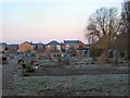
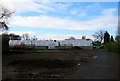

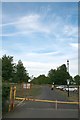
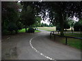

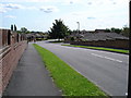
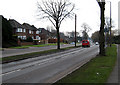
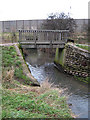


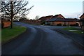
100 photos from this area
Area Information
Key information about the NG10 4AA including its size, population, and administrative classification.
- Area Type
- Postcode
- Area Size
- 18.0 hectares
- Population
- 1808
- Population Density
- 2890 people/km²
House Prices in NG10 4AA
44
Properties
£402,341
Average Sold Price
£135,000
Lowest Price
£1,949,993
Highest Price
Showing 44 properties
| Address | Type | Beds | Baths | Last Sale Price | Last Sale Date | |
|---|---|---|---|---|---|---|
| 368 Wilsthorpe Road, Long Eaton, NG10 4AA | Detached | 3 | 2 | £550,000 | Aug 2024 | |
| 304 Wilsthorpe Road, Long Eaton, NG10 4AA | Detached | 4 | 2 | £365,000 | Apr 2024 | |
| 312 Wilsthorpe Road, Long Eaton, NG10 4AA | Detached | 4 | 2 | £393,000 | Oct 2022 | |
| 300 Wilsthorpe Road, Long Eaton, NG10 4AA | Semi-detached | 5 | 3 | £575,000 | Jul 2022 | |
| Alexandra Nursing Home, 370 Wilsthorpe Road, Long Eaton, NG10 4AA | hospital_care_home | - | - | £1,949,993 | Jan 2022 | |
| 362 Wilsthorpe Road, Long Eaton, NG10 4AA | Detached | 4 | 2 | £320,000 | Feb 2019 | |
| 366 Wilsthorpe Road, Long Eaton, NG10 4AA | Detached | 4 | 2 | £330,000 | Nov 2018 | |
| 318 Wilsthorpe Road, Long Eaton, NG10 4AA | house | 4 | 1 | £255,000 | Nov 2017 | |
| 316 Wilsthorpe Road, Long Eaton, NG10 4AA | Detached | 3 | 1 | £235,000 | Oct 2017 | |
| 348A Wilsthorpe Road, Long Eaton, NG10 4AA | Detached | 4 | 2 | £320,000 | Jul 2017 |
Page 1 of 5
Energy Efficiency in NG10 4AA
Amenities
Schools
| Rank | School | Type | Entry gender | Ages |
|---|
Explore more schools in this area
Go to Schools tabDemographics
Household Size
Two person
most common
Accommodation Type
Houses
most common
Tenure
89
majority
Ethnic Group
White
most common
Religion
N/A
most common
Household Composition
N/A
most common
Age
47
median
Adults (30-64 years)
most common
Household Deprivation
N/A
with no deprivation
NS-SEC
44
in Lower managerial occupations
Explore more demographic insights in this area
Go to Demographics tabPlanning
Planning Constraints
- Flood RiskPremium
- Ramsar Wetland SitesPremium
- Area of Outstanding Natural BeautyPremium
- Protected Nature ReservePremium
- Protected WoodlandPremium