Area Overview for NG10 2AU
Photos of NG10 2AU
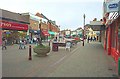
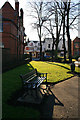
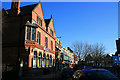
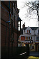
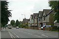
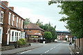
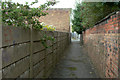
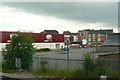
100 photos from this area
Area Information
Key information about the NG10 2AU including its size, population, and administrative classification.
- Area Type
- Postcode
- Area Size
- 3.1 hectares
- Population
- 1946
- Population Density
- 4639 people/km²
House Prices in NG10 2AU
16
Properties
£173,650
Average Sold Price
£37,500
Lowest Price
£272,500
Highest Price
Showing 16 properties
| Address | Type | Beds | Baths | Last Sale Price | Last Sale Date | |
|---|---|---|---|---|---|---|
| 64 Nottingham Road, Long Eaton, NG10 2AU | Semi-detached | 4 | 1 | £272,500 | Aug 2019 | |
| 78 Nottingham Road, Long Eaton, NG10 2AU | Semi-detached | 3 | 1 | £181,000 | Sep 2018 | |
| 68 Nottingham Road, Long Eaton, NG10 2AU | Detached | 3 | 2 | £239,950 | Nov 2016 | |
| 82 Nottingham Road, Long Eaton, NG10 2AU | Semi-detached | 4 | 2 | £220,000 | Mar 2012 | |
| 66 Nottingham Road, Long Eaton, NG10 2AU | house | - | - | £127,000 | Apr 2009 | |
| 84 Nottingham Road, Long Eaton, NG10 2AU | Semi-detached | - | - | £232,000 | Sep 2007 | |
| 62 Nottingham Road, Long Eaton, NG10 2AU | Semi-detached | - | - | £79,250 | Jul 2004 | |
| 74 Nottingham Road, Long Eaton, NG10 2AU | Semi-detached | - | - | £37,500 | Jan 1999 | |
| 60 Nottingham Road, Long Eaton, NG10 2AU | Detached | 3 | 1 | - | - | |
| 58 Nottingham Road, Long Eaton, NG10 2AU | Semi-detached | - | - | - | - |
Page 1 of 2
Energy Efficiency in NG10 2AU
Amenities
Schools
| Rank | School | Type | Entry gender | Ages |
|---|
Explore more schools in this area
Go to Schools tabDemographics
Household Size
Family (3-5 people)
most common
Accommodation Type
Houses
most common
Tenure
79
majority
Ethnic Group
White
most common
Religion
N/A
most common
Household Composition
N/A
most common
Age
47
median
Adults (30-64 years)
most common
Household Deprivation
N/A
with no deprivation
NS-SEC
38
in Lower managerial occupations
Explore more demographic insights in this area
Go to Demographics tabPlanning
Planning Constraints
- Flood RiskPremium
- Ramsar Wetland SitesPremium
- Area of Outstanding Natural BeautyPremium
- Protected Nature ReservePremium
- Protected WoodlandPremium