Area Overview for LN7 6TA
Photos of LN7 6TA
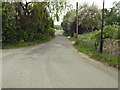
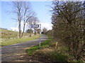
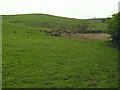
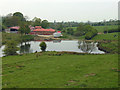
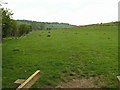
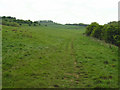
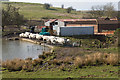
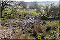
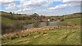
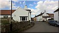
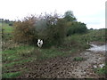
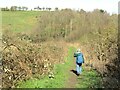
43 photos from this area
Area Information
Key information about the LN7 6TA including its size, population, and administrative classification.
- Area Type
- Postcode
- Area Size
- 3.5 km²
- Population
- 1320
- Population Density
- 27 people/km²
House Prices in LN7 6TA
15
Properties
£266,337
Average Sold Price
£46,000
Lowest Price
£757,080
Highest Price
Showing 15 properties
| Address | Type | Beds | Baths | Last Sale Price | Last Sale Date | |
|---|---|---|---|---|---|---|
| Denswood House, Normanby Road, Nettleton, Market Rasen, LN7 6TA | Detached | 6 | 2 | £757,080 | May 2023 | |
| Little Beck, Normanby Road, Nettleton, Market Rasen, LN7 6TA | Semi-detached | 3 | 2 | £220,000 | Feb 2021 | |
| Normanby House, Normanby Road, Nettleton, Market Rasen, LN7 6TA | Detached | 5 | 1 | £425,000 | Sep 2020 | |
| Hillcrest, Normanby Road, Nettleton, Market Rasen, LN7 6TA | house | - | - | £320,000 | Nov 2019 | |
| The Evergreen, Normanby Road, Nettleton, Market Rasen, LN7 6TA | Detached | 5 | - | £320,000 | Apr 2014 | |
| Hazeldene, Normanby Road, Nettleton, Market Rasen, LN7 6TA | Detached | - | - | £93,000 | Dec 2000 | |
| Holbeck Rise, Normanby Road, Nettleton, Market Rasen, LN7 6TA | house | - | - | £124,000 | Feb 2000 | |
| Holly Lodge, Normanby Road, Nettleton, Market Rasen, LN7 6TA | Detached | - | - | £91,950 | Aug 1995 | |
| Wayside Cottage, Normanby Road, Nettleton, Market Rasen, LN7 6TA | Semi-detached | - | - | £46,000 | Feb 1995 | |
| The Grange, Normanby Road, Nettleton, Market Rasen, LN7 6TA | Detached | - | - | - | - |
Page 1 of 2
Energy Efficiency in LN7 6TA
Amenities
Schools
| Rank | School | Type | Entry gender | Ages |
|---|
Explore more schools in this area
Go to Schools tabDemographics
Household Size
Two person
most common
Accommodation Type
Houses
most common
Tenure
63
majority
Ethnic Group
White
most common
Religion
N/A
most common
Household Composition
N/A
most common
Age
47
median
Adults (30-64 years)
most common
Household Deprivation
N/A
with no deprivation
NS-SEC
36
in Lower managerial occupations
Explore more demographic insights in this area
Go to Demographics tabPlanning
Planning Constraints
- Flood RiskPremium
- Ramsar Wetland SitesPremium
- Area of Outstanding Natural BeautyPremium
- Protected Nature ReservePremium
- Protected WoodlandPremium