Area Overview for LN7 6SW
Photos of LN7 6SW
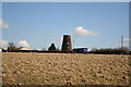

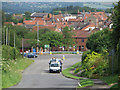
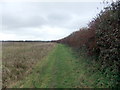
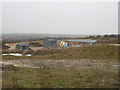
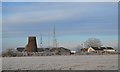

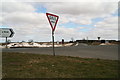
30 photos from this area
Area Information
Key information about the LN7 6SW including its size, population, and administrative classification.
- Area Type
- Postcode
- Area Size
- 53.8 hectares
- Population
- 1320
- Population Density
- 27 people/km²
House Prices in LN7 6SW
19
Properties
£180,936
Average Sold Price
£48,000
Lowest Price
£362,499
Highest Price
Showing 19 properties
| Address | Type | Beds | Baths | Last Sale Price | Last Sale Date | |
|---|---|---|---|---|---|---|
| 3 Whitegate Hill, Caistor, Market Rasen, LN7 6SW | Detached | 3 | 1 | £215,000 | Feb 2025 | |
| 15 Whitegate Hill, Caistor, Market Rasen, LN7 6SW | house | - | - | £362,499 | Oct 2022 | |
| 12 Whitegate Hill, Caistor, Market Rasen, LN7 6SW | house | - | - | £250,055 | Aug 2022 | |
| The Mill Bungalow, Whitegate Hill, Caistor, Market Rasen, LN7 6SW | Bungalow | - | - | £190,000 | Oct 2021 | |
| 10 Whitegate Hill, Caistor, Market Rasen, LN7 6SW | house | - | - | £125,000 | Aug 2018 | |
| 4 Whitegate Hill, Caistor, Market Rasen, LN7 6SW | Semi-detached | - | - | £48,000 | May 2000 | |
| 13 Whitegate Hill, Caistor, Market Rasen, LN7 6SW | Detached | - | - | £76,000 | May 1996 | |
| 5 Whitegate Hill, Caistor, Market Rasen, LN7 6SW | house | - | 1 | - | - | |
| 2 Whitegate Hill, Caistor, Market Rasen, LN7 6SW | Land | 1 | - | - | - | |
| Honeysuckle House, 8 Whitegate Hill, Caistor, Market Rasen, LN7 6SW | Semi-detached | 3 | - | - | - |
Page 1 of 2
Energy Efficiency in LN7 6SW
Amenities
Schools
| Rank | School | Type | Entry gender | Ages |
|---|
Explore more schools in this area
Go to Schools tabDemographics
Household Size
Two person
most common
Accommodation Type
Houses
most common
Tenure
63
majority
Ethnic Group
White
most common
Religion
N/A
most common
Household Composition
N/A
most common
Age
47
median
Adults (30-64 years)
most common
Household Deprivation
N/A
with no deprivation
NS-SEC
36
in Lower managerial occupations
Explore more demographic insights in this area
Go to Demographics tabPlanning
Planning Constraints
- Flood RiskPremium
- Ramsar Wetland SitesPremium
- Area of Outstanding Natural BeautyPremium
- Protected Nature ReservePremium
- Protected WoodlandPremium