Area Overview for LN7 6HA
Photos of LN7 6HA
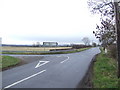
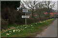
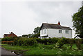
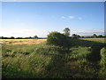
10 photos from this area
Area Information
Key information about the LN7 6HA including its size, population, and administrative classification.
- Area Type
- Postcode
- Area Size
- 80.7 hectares
- Population
- 2676
- Population Density
- 34 people/km²
House Prices in LN7 6HA
19
Properties
£229,421
Average Sold Price
£78,500
Lowest Price
£387,500
Highest Price
Showing 19 properties
| Address | Type | Beds | Baths | Last Sale Price | Last Sale Date | |
|---|---|---|---|---|---|---|
| East Lodge, Easthall Road, North Kelsey, Market Rasen, LN7 6HA | Bungalow | 3 | 2 | £240,000 | Jan 2025 | |
| 5 Easthall Road, North Kelsey, Market Rasen, LN7 6HA | Bungalow | 3 | 1 | £250,000 | Oct 2022 | |
| Oak Lee, Easthall Road, North Kelsey, Market Rasen, LN7 6HA | Detached | 4 | 2 | £265,000 | Aug 2017 | |
| Colton, Easthall Road, North Kelsey, Market Rasen, LN7 6HA | Detached | 4 | 3 | £274,950 | Jan 2015 | |
| East Hall Barn, Easthall Road, North Kelsey, Market Rasen, LN7 6HA | Semi-detached | 4 | - | £387,500 | Aug 2014 | |
| The Hawthorns, Easthall Road, North Kelsey, Market Rasen, LN7 6HA | Detached | - | - | £110,000 | Mar 2005 | |
| Vicarage House, Easthall Road, North Kelsey, Market Rasen, LN7 6HA | house | - | - | £78,500 | Aug 1998 | |
| The Old Barn, Easthall Road, North Kelsey, Market Rasen, LN7 6HA | Semi-detached | 5 | 3 | - | - | |
| The Old Vicarage, Easthall Road, North Kelsey, Market Rasen, LN7 6HA | Equestrian | 6 | 3 | - | - | |
| Wheelgate, Easthall Road, North Kelsey, Market Rasen, LN7 6HA | Detached | - | - | - | - |
Page 1 of 2
Energy Efficiency in LN7 6HA
Amenities
Schools
| Rank | School | Type | Entry gender | Ages |
|---|
Explore more schools in this area
Go to Schools tabDemographics
Household Size
Two person
most common
Accommodation Type
Houses
most common
Tenure
82
majority
Ethnic Group
White
most common
Religion
N/A
most common
Household Composition
N/A
most common
Age
47
median
Adults (30-64 years)
most common
Household Deprivation
N/A
with no deprivation
NS-SEC
39
in Lower managerial occupations
Explore more demographic insights in this area
Go to Demographics tabPlanning
Planning Constraints
- Flood RiskPremium
- Ramsar Wetland SitesPremium
- Area of Outstanding Natural BeautyPremium
- Protected Nature ReservePremium
- Protected WoodlandPremium