Area Overview for LN7 6EZ
Photos of LN7 6EZ
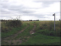
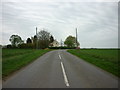
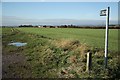
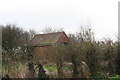
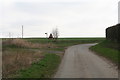
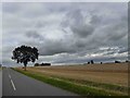
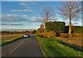
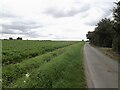
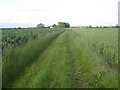

15 photos from this area
Area Information
Key information about the LN7 6EZ including its size, population, and administrative classification.
- Area Type
- Postcode
- Area Size
- 39.5 hectares
- Population
- 2676
- Population Density
- 34 people/km²
House Prices in LN7 6EZ
20
Properties
£257,417
Average Sold Price
£126,500
Lowest Price
£450,000
Highest Price
Showing 20 properties
| Address | Type | Beds | Baths | Last Sale Price | Last Sale Date | |
|---|---|---|---|---|---|---|
| Byways, Grange Lane, North Kelsey, Market Rasen, LN7 6EZ | Bungalow | 2 | 1 | £230,000 | Mar 2025 | |
| Whitegate Cottage, Grange Lane, North Kelsey, Market Rasen, LN7 6EZ | Semi-detached | 2 | 1 | £200,000 | Dec 2024 | |
| Grange View, Grange Lane, North Kelsey, Market Rasen, LN7 6EZ | Bungalow | - | - | £278,000 | Jan 2022 | |
| Leyburn House, Grange Lane, North Kelsey, Market Rasen, LN7 6EZ | house | - | - | £450,000 | Nov 2021 | |
| Orchard House, Grange Lane, North Kelsey, Market Rasen, LN7 6EZ | Detached | 3 | 2 | £260,000 | Nov 2018 | |
| Lyncroft, Grange Lane, North Kelsey, Market Rasen, LN7 6EZ | Bungalow | 3 | - | £126,500 | Dec 2016 | |
| Grange Court, Grange Lane, North Kelsey, Market Rasen, LN7 6EZ | Semi-detached | 2 | 2 | - | - | |
| Woodspring, Grange Lane, North Kelsey, Market Rasen, LN7 6EZ | Detached | 4 | 2 | - | - | |
| The Vicarage, Grange Lane, North Kelsey, Market Rasen, LN7 6EZ | house | 4 | - | - | - | |
| Lilac Cottage, Grange Lane, North Kelsey, Market Rasen, LN7 6EZ | house | 3 | - | - | - |
Page 1 of 2
Energy Efficiency in LN7 6EZ
Amenities
Schools
| Rank | School | Type | Entry gender | Ages |
|---|
Explore more schools in this area
Go to Schools tabDemographics
Household Size
Two person
most common
Accommodation Type
Houses
most common
Tenure
82
majority
Ethnic Group
White
most common
Religion
N/A
most common
Household Composition
N/A
most common
Age
47
median
Adults (30-64 years)
most common
Household Deprivation
N/A
with no deprivation
NS-SEC
39
in Lower managerial occupations
Explore more demographic insights in this area
Go to Demographics tabPlanning
Planning Constraints
- Flood RiskPremium
- Ramsar Wetland SitesPremium
- Area of Outstanding Natural BeautyPremium
- Protected Nature ReservePremium
- Protected WoodlandPremium