Area Overview for LN5 0TA
Photos of LN5 0TA

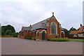
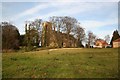

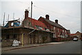
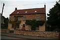
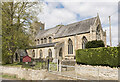
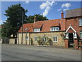
97 photos from this area
Area Information
Key information about the LN5 0TA including its size, population, and administrative classification.
- Area Type
- Postcode
- Area Size
- 4204 m²
- Population
- 1897
- Population Density
- 51 people/km²
House Prices in LN5 0TA
9
Properties
£249,707
Average Sold Price
£200,000
Lowest Price
£340,000
Highest Price
Showing 9 properties
| Address | Type | Beds | Baths | Last Sale Price | Last Sale Date | |
|---|---|---|---|---|---|---|
| 8 Winton Gardens, Navenby, Lincoln, LN5 0TA | Bungalow | 2 | 2 | £340,000 | Jul 2023 | |
| 5 Winton Gardens, Navenby, Lincoln, LN5 0TA | Bungalow | - | - | £270,000 | Jan 2023 | |
| 1 Winton Gardens, Navenby, Lincoln, LN5 0TA | Bungalow | 2 | 1 | £227,000 | May 2021 | |
| 2 Winton Gardens, Navenby, Lincoln, LN5 0TA | Bungalow | - | - | £282,000 | Oct 2017 | |
| 6 Winton Gardens, Navenby, Lincoln, LN5 0TA | Bungalow | - | - | £207,500 | Jun 2014 | |
| 7 Winton Gardens, Navenby, Lincoln, LN5 0TA | Bungalow | - | - | £200,000 | Aug 2013 | |
| 9 Winton Gardens, Navenby, Lincoln, LN5 0TA | Bungalow | 2 | 1 | £221,447 | Jul 2012 | |
| 3 Winton Gardens, Navenby, Lincoln, LN5 0TA | Bungalow | - | - | - | - | |
| 4 Winton Gardens, Navenby, Lincoln, LN5 0TA | Bungalow | - | - | - | - |
Energy Efficiency in LN5 0TA
Amenities
Schools
| Rank | School | Type | Entry gender | Ages |
|---|
Explore more schools in this area
Go to Schools tabDemographics
Household Size
Two person
most common
Accommodation Type
Houses
most common
Tenure
83
majority
Ethnic Group
White
most common
Religion
N/A
most common
Household Composition
N/A
most common
Age
47
median
Adults (30-64 years)
most common
Household Deprivation
N/A
with no deprivation
NS-SEC
45
in Lower managerial occupations
Explore more demographic insights in this area
Go to Demographics tabPlanning
Planning Constraints
- Flood RiskPremium
- Ramsar Wetland SitesPremium
- Area of Outstanding Natural BeautyPremium
- Protected Nature ReservePremium
- Protected WoodlandPremium