Area Overview for LN5 0JJ
Photos of LN5 0JJ


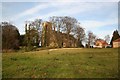

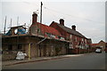
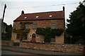
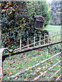
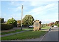
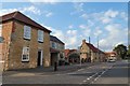
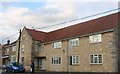

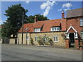
97 photos from this area
Area Information
Key information about the LN5 0JJ including its size, population, and administrative classification.
- Area Type
- Postcode
- Area Size
- 6.3 hectares
- Population
- 1897
- Population Density
- 51 people/km²
House Prices in LN5 0JJ
30
Properties
£255,121
Average Sold Price
£56,000
Lowest Price
£575,000
Highest Price
Showing 30 properties
| Address | Type | Beds | Baths | Last Sale Price | Last Sale Date | |
|---|---|---|---|---|---|---|
| Orchard House, 22 Grantham Road, Navenby, Lincoln, LN5 0JJ | Detached | 3 | 1 | £279,995 | Jun 2025 | |
| Lynton, 37 Grantham Road, Navenby, Lincoln, LN5 0JJ | Detached | 4 | 2 | £480,000 | Dec 2024 | |
| 39 Grantham Road, Navenby, Lincoln, LN5 0JJ | house | - | - | £575,000 | Mar 2024 | |
| The Gale, 15 Grantham Road, Navenby, Lincoln, LN5 0JJ | Bungalow | - | - | £295,000 | Mar 2020 | |
| The Manse, 25 Grantham Road, Navenby, Lincoln, LN5 0JJ | house | - | - | £421,000 | Nov 2018 | |
| Winton House, 3 Grantham Road, Navenby, Lincoln, LN5 0JJ | house | - | - | £355,000 | Apr 2018 | |
| Acubia, 24 Grantham Road, Navenby, Lincoln, LN5 0JJ | Detached | 4 | - | £355,000 | Oct 2017 | |
| Poplar House, 20 Grantham Road, Navenby, Lincoln, LN5 0JJ | house | - | - | £270,000 | May 2016 | |
| Hillcrest, 11 Grantham Road, Navenby, Lincoln, LN5 0JJ | Bungalow | 3 | 1 | £115,000 | Dec 2015 | |
| The Pines, 9 Grantham Road, Navenby, Lincoln, LN5 0JJ | Bungalow | 4 | - | £268,000 | Dec 2015 |
Page 1 of 3
Energy Efficiency in LN5 0JJ
Amenities
Schools
| Rank | School | Type | Entry gender | Ages |
|---|
Explore more schools in this area
Go to Schools tabDemographics
Household Size
Two person
most common
Accommodation Type
Houses
most common
Tenure
83
majority
Ethnic Group
White
most common
Religion
N/A
most common
Household Composition
N/A
most common
Age
47
median
Adults (30-64 years)
most common
Household Deprivation
N/A
with no deprivation
NS-SEC
45
in Lower managerial occupations
Explore more demographic insights in this area
Go to Demographics tabPlanning
Planning Constraints
- Flood RiskPremium
- Ramsar Wetland SitesPremium
- Area of Outstanding Natural BeautyPremium
- Protected Nature ReservePremium
- Protected WoodlandPremium