Area Overview for LN3 4EF
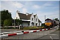
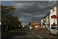
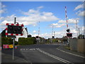
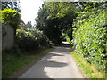
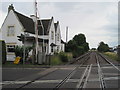
Photos of LN3 4EF


Area Information
Living in LN3 4EF offers a quiet, tightly knit residential experience within a small cluster of 29.6 hectares. With a population of 1,240 people, the area maintains a low density of 253 people per square kilometre, ensuring a sense of space and privacy. This postcode is characterised by its predominantly owner-occupied housing stock, with 92% of homes owned outright. The community is largely composed of adults aged 30–64, reflecting a mature demographic with established roots. Daily life here is shaped by proximity to Lincoln Central Railway Station, offering easy access to the city, and a modest network of local retail outlets. While the area lacks large-scale amenities, its compact size means residents can navigate essentials on foot or by car. The absence of environmental constraints, such as protected woodlands or wetlands, simplifies planning for homeowners. LN3 4EF is ideal for those seeking a stable, low-maintenance lifestyle with strong broadband connectivity and a low crime risk. Its small footprint ensures a close-knit community, though buyers should consider the limited housing stock when exploring the local market.
- Area Type
- Postcode
- Area Size
- 29.6 hectares
- Population
- 1240
- Population Density
- 253 people/km²
The property market in LN3 4EF is dominated by owner-occupied homes, with 92% of properties owned outright. This high rate of home ownership indicates a stable, long-term resident base with little reliance on rental markets. The area is composed almost entirely of houses, with no flats or apartments, reflecting a preference for traditional family homes. Given the small size of the postcode—just 29.6 hectares—housing stock is limited, making it a niche market for buyers seeking exclusive, low-density living. The compact nature of the area means properties are closely spaced, though the low population density of 253 people per square kilometre ensures a sense of privacy. Proximity to Lincoln Central Railway Station adds value for commuters, while the absence of planning constraints, such as protected woodlands or wetlands, simplifies development. Buyers should consider the limited availability of homes and the potential for slower price growth compared to larger urban areas.
House Prices in LN3 4EF
Showing 42 properties
| Address | Type | Beds | Baths | Last Sale Price | Last Sale Date | |
|---|---|---|---|---|---|---|
| Belmont, 48 Fiskerton Road, Reepham, Lincoln, LN3 4EF | Bungalow | 3 | 1 | £275,000 | Aug 2025 | |
| 58 Fiskerton Road, Reepham, Lincoln, LN3 4EF | Detached | 4 | 3 | £687,000 | Mar 2025 | |
| Kincaid, 38 Fiskerton Road, Reepham, Lincoln, LN3 4EF | Bungalow | 3 | 1 | £200,000 | Mar 2025 | |
| White Rose, 31 Fiskerton Road, Reepham, Lincoln, LN3 4EF | Bungalow | 3 | 1 | £314,000 | Mar 2025 | |
| Knaresborough, 27 Fiskerton Road, Reepham, Lincoln, LN3 4EF | house | - | - | £295,000 | Nov 2023 | |
| Lodore, 37 Fiskerton Road, Reepham, Lincoln, LN3 4EF | Bungalow | - | - | £265,000 | May 2022 | |
| Pirbright, 21 Fiskerton Road, Reepham, Lincoln, LN3 4EF | Retail | 3 | 1 | £242,500 | Apr 2022 | |
| 47 Fiskerton Road, Reepham, Lincoln, LN3 4EF | Retail | 5 | 3 | £630,000 | Apr 2022 | |
| 51 Fiskerton Road, Reepham, Lincoln, LN3 4EF | Detached | 5 | 3 | £495,000 | Apr 2021 | |
| Tigersville, 42 Fiskerton Road, Reepham, Lincoln, LN3 4EF | Detached | 4 | 3 | £415,000 | Feb 2021 |
Energy Efficiency in LN3 4EF
Residents of LN3 4EF have access to a modest but functional range of amenities within practical reach. The area includes five retail outlets, notably three branches of Lincolnshire Co-operative Co, providing essentials like groceries and household goods. These shops cater to daily needs, reducing the necessity for long trips to larger centres. The nearest major transport hub is Lincoln Central Railway Station, offering connections to the city and beyond. While the area lacks parks or leisure facilities, the absence of environmental constraints means residents are not restricted by protected landscapes or conservation areas. The small scale of LN3 4EF ensures that amenities are closely clustered, making it easy to access services on foot or by car. This compact network supports a self-contained lifestyle, though those seeking extensive recreational options may need to look beyond the immediate postcode.
Amenities
Schools
| Rank | School | Type | Entry gender | Ages |
|---|
Explore more schools in this area
Go to Schools tabDemographics
The population of LN3 4EF is 1,240, with a median age of 47, indicating a mature demographic. The most common age range is 30–64, suggesting a community of established professionals and families. Home ownership is exceptionally high at 92%, reflecting a preference for long-term residency over rental properties. The area is composed almost entirely of houses, with no flats or apartments recorded. The predominant ethnic group is White, comprising the majority of the population. This demographic profile aligns with a low population density of 253 people per square kilometre, ensuring a spread-out, less congested living environment. The age distribution implies a community with stable employment patterns and lower turnover rates. While no specific data on deprivation is provided, the high home ownership and low crime risk suggest a relatively affluent and secure neighbourhood. The absence of significant diversity metrics means the area remains culturally homogenous, which may appeal to those seeking a familiar social environment.
Household Size
Accommodation Type
Tenure
Ethnic Group
Religion
Household Composition
Age
Household Deprivation
NS-SEC
Explore more demographic insights in this area
Go to Demographics tabPlanning
Planning Constraints
- Flood RiskPremium
- Ramsar Wetland SitesPremium
- Area of Outstanding Natural BeautyPremium
- Protected Nature ReservePremium
- Protected WoodlandPremium