Area Overview for LN3 4EB
Photos of LN3 4EB
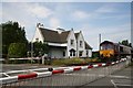
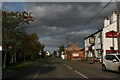

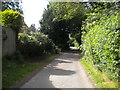
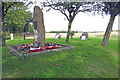


19 photos from this area
Area Information
Key information about the LN3 4EB including its size, population, and administrative classification.
- Area Type
- Postcode
- Area Size
- 12.4 hectares
- Population
- 1240
- Population Density
- 253 people/km²
House Prices in LN3 4EB
20
Properties
£210,625
Average Sold Price
£54,000
Lowest Price
£370,000
Highest Price
Showing 20 properties
| Address | Type | Beds | Baths | Last Sale Price | Last Sale Date | |
|---|---|---|---|---|---|---|
| Newlands, 6 Fiskerton Road, Reepham, Lincoln, LN3 4EB | Detached | 3 | 1 | £256,000 | Aug 2022 | |
| 10 Fiskerton Road, Reepham, Lincoln, LN3 4EB | Bungalow | 2 | 1 | £370,000 | Sep 2021 | |
| Anford, 26 Fiskerton Road, Reepham, Lincoln, LN3 4EB | Bungalow | 3 | 1 | £180,000 | Dec 2019 | |
| Sagamoor, 16 Fiskerton Road, Reepham, Lincoln, LN3 4EB | Bungalow | 3 | 1 | £165,000 | May 2019 | |
| Ancholme, 12 Fiskerton Road, Reepham, Lincoln, LN3 4EB | Bungalow | 3 | - | £235,000 | Feb 2017 | |
| Mockerkin, 24 Fiskerton Road, Reepham, Lincoln, LN3 4EB | Bungalow | - | - | £130,000 | Jul 2014 | |
| Leigh Farm, Fiskerton Road, Reepham, Lincoln, LN3 4EB | house | 3 | - | £295,000 | Sep 2010 | |
| El Dene, 22 Fiskerton Road, Reepham, Lincoln, LN3 4EB | Bungalow | - | - | £54,000 | Sep 1999 | |
| Cheverelles, 18 Fiskerton Road, Reepham, Lincoln, LN3 4EB | Bungalow | 2 | 1 | - | - | |
| Woodlands, 8 Fiskerton Road, Reepham, Lincoln, LN3 4EB | Bungalow | 3 | 1 | - | - |
Page 1 of 2
Energy Efficiency in LN3 4EB
Amenities
Schools
| Rank | School | Type | Entry gender | Ages |
|---|
Explore more schools in this area
Go to Schools tabDemographics
Household Size
Two person
most common
Accommodation Type
Houses
most common
Tenure
92
majority
Ethnic Group
White
most common
Religion
N/A
most common
Household Composition
N/A
most common
Age
47
median
Adults (30-64 years)
most common
Household Deprivation
N/A
with no deprivation
NS-SEC
38
in Lower managerial occupations
Explore more demographic insights in this area
Go to Demographics tabPlanning
Planning Constraints
- Flood RiskPremium
- Ramsar Wetland SitesPremium
- Area of Outstanding Natural BeautyPremium
- Protected Nature ReservePremium
- Protected WoodlandPremium