Area Overview for LN2 5RZ
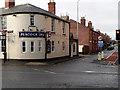
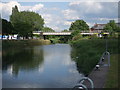
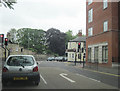
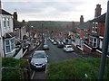
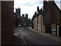
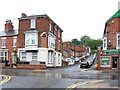
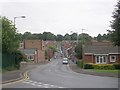
Photos of LN2 5RZ

Area Information
LN2 5RZ is a small, densely populated residential postcode area in England, covering 4,441 square metres and home to 1,827 residents. Its compact size and high population density of 411,425 people per square kilometre suggest a tightly knit community. The area is characterised by a predominance of houses, reflecting a traditional, family-oriented environment. With a median age of 47 and a strong presence of adults aged 30–64, the population skews towards middle-aged residents, many of whom may be long-term residents or professionals working in nearby towns. Daily life here is likely shaped by proximity to local amenities, schools, and transport links, offering a balance between residential tranquillity and practical connectivity. The area’s small footprint means it is likely surrounded by similar postcode clusters, creating a cohesive local network. For buyers, this compactness may present both opportunities and challenges, with limited housing stock but potentially strong community ties and established infrastructure.
- Area Type
- Postcode
- Area Size
- 4441 m²
- Population
- 1827
- Population Density
- 2768 people/km²
The property market in LN2 5RZ is largely owner-occupied, with 56% of homes owned by residents rather than rented. The accommodation type is predominantly houses, which implies a focus on family homes and a lack of high-density housing such as flats. This suggests a traditional, suburban or semi-rural character, possibly with larger plots and private gardens. The small area size and limited housing stock mean the market is likely constrained, with limited scope for new development. Buyers should consider the proximity to nearby amenities and schools as key selling points, as the area’s appeal may hinge on its established infrastructure rather than expansion. The high home ownership rate also indicates a stable market, with properties potentially retaining value due to the community’s cohesion. However, the compact nature of the area may limit options for those seeking larger or more diverse housing types.
House Prices in LN2 5RZ
Showing 21 properties
| Address | Type | Beds | Baths | Last Sale Price | Last Sale Date | |
|---|---|---|---|---|---|---|
| 9 Winnowsty Lane, Lincoln, LN2 5RZ | Terraced | 2 | 2 | £210,000 | Mar 2025 | |
| 6 Winnowsty Lane, Lincoln, LN2 5RZ | house | - | - | £207,500 | Aug 2022 | |
| 3 Winnowsty Lane, Lincoln, LN2 5RZ | house | 2 | - | £230,000 | Aug 2021 | |
| 14 Winnowsty Lane, Lincoln, LN2 5RZ | house | - | - | £135,000 | Jan 2021 | |
| 17 Winnowsty Lane, Lincoln, LN2 5RZ | house | - | - | £211,500 | Nov 2018 | |
| 8 Winnowsty Lane, Lincoln, LN2 5RZ | Terraced | 2 | 1 | £169,950 | Aug 2017 | |
| 18 Winnowsty Lane, Lincoln, LN2 5RZ | house | - | - | £328,000 | Apr 2016 | |
| 2 Winnowsty Lane, Lincoln, LN2 5RZ | Terraced | 2 | 1 | £125,000 | Nov 2014 | |
| 1 Winnowsty Lane, Lincoln, LN2 5RZ | Terraced | 3 | 1 | £125,000 | Nov 2014 | |
| 4 Winnowsty Lane, Lincoln, LN2 5RZ | house | 2 | - | £145,000 | Jul 2010 |
Energy Efficiency in LN2 5RZ
Living in LN2 5RZ provides access to a range of amenities within practical reach. The area is close to retail options such as Tesco Lincoln, Heron Lincoln, and Lincolnshire Co-operative Co, offering everyday shopping and dining choices. Nearby rail stations, including Lincoln Central and Hykeham, connect residents to broader transport networks, facilitating travel to nearby towns and cities. The proximity to RAF Waddington and RAF Scampton may appeal to those with military or aviation-related interests. While the data does not specify parks or leisure facilities, the presence of multiple retail and transport hubs suggests a convenient, practical lifestyle. The mix of shops, rail links, and airports ensures residents can meet daily needs without long commutes, contributing to a balanced, accessible living environment.
Amenities
Schools
LN2 5RZ is served by a mix of state and independent schools, offering families a range of educational choices. The Lincoln St Peter-in-Eastgate Church of England (Controlled) Infants School is a primary school with an Ofsted rating of satisfactory, providing a state-funded option for younger children. Independent schools such as St Mary’s School, The Cathedral School, and Stonefield House School cater to those seeking private education, while Lincolnshire College of Art and Design offers further education opportunities. This diversity ensures families can choose between public and private schooling, depending on their priorities. The presence of multiple school types reflects the area’s appeal to households with varying educational preferences, from traditional state education to specialist independent institutions. Parents should consider the specific needs of their children when evaluating the suitability of LN2 5RZ for their family.
| Rank | School | Type | Entry gender | Ages |
|---|
Explore more schools in this area
Go to Schools tabDemographics
The community in LN2 5RZ is predominantly middle-aged, with a median age of 47 and the largest age group being adults aged 30–64. Home ownership is high at 56%, indicating a stable population with long-term residency. The accommodation type is primarily houses, which aligns with the area’s residential character. The predominant ethnic group is White, reflecting a homogenous demographic profile. The high population density of 411,425 people per square kilometre suggests a compact, possibly urbanised setting, though the exact nature of deprivation is not specified. However, the absence of notable planning constraints or environmental risks may contribute to a stable quality of life. The age profile suggests a mature community, potentially with established family structures and a focus on local services. This demographic mix may appeal to buyers seeking a settled, low-turnover area with clear community identity.
Household Size
Accommodation Type
Tenure
Ethnic Group
Religion
Household Composition
Age
Household Deprivation
NS-SEC
Explore more demographic insights in this area
Go to Demographics tabPlanning
Planning Constraints
- Flood RiskPremium
- Ramsar Wetland SitesPremium
- Area of Outstanding Natural BeautyPremium
- Protected Nature ReservePremium
- Protected WoodlandPremium