Area Overview for LN2 4RE
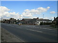
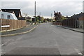
Photos of LN2 4RE


Area Information
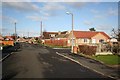
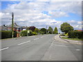
LN2 4RE is a small residential cluster in England, spanning just 2.2 hectares and home to 2,353 residents. Its compact size creates a close-knit community feel, with a population density of 133 people per square kilometre. This area is characterised by its mature demographic, with a median age of 47 and a majority of residents aged between 30 and 64. The housing stock is predominantly owner-occupied, with 74% of properties in private hands, suggesting a stable, long-term community. Daily life here is shaped by proximity to Lincoln Central Railway Station, which connects to broader regional networks, and two nearby airports, RAF Scampton and RAF Waddington, offering easy access to travel. The area’s small footprint means amenities are concentrated, with five retail outlets nearby, including three branches of Lincolnshire Co-operative Co. While the landscape lacks protected natural sites, the absence of flood risk or planning constraints makes it a practical choice for those prioritising safety and straightforward development. Living in LN2 4RE balances practicality with a quiet, established residential environment.
- Area Type
- Postcode
- Area Size
- 2.2 hectares
- Population
- 2353
- Population Density
- 133 people/km²
The property market in LN2 4RE is dominated by owner-occupied homes, with 74% of properties in private hands. This high rate of home ownership suggests a community of long-term residents rather than a transient rental market. The accommodation type is exclusively houses, which is unusual for areas with higher population densities. This configuration may reflect a preference for standalone properties, possibly due to the area’s small size and limited development constraints. For buyers, this means a focus on single-family homes rather than apartments or shared housing. The lack of rental properties indicates a lower turnover of properties, which could benefit buyers seeking stability. However, the small area size means the housing stock is limited, and buyers should consider proximity to nearby towns for additional options. The absence of planning constraints and low flood risk further supports the appeal of this area for those prioritising security and straightforward property ownership.
House Prices in LN2 4RE
Showing 36 properties
| Address | Type | Beds | Baths | Last Sale Price | Last Sale Date | |
|---|---|---|---|---|---|---|
| 21 Westfield Drive, North Greetwell, Lincoln, LN2 4RE | Bungalow | 3 | 1 | £272,000 | Jun 2025 | |
| 77 Westfield Drive, North Greetwell, Lincoln, LN2 4RE | Bungalow | - | - | £200,000 | Feb 2022 | |
| 45 Westfield Drive, North Greetwell, Lincoln, LN2 4RE | Bungalow | - | - | £200,000 | Nov 2021 | |
| 55 Westfield Drive, North Greetwell, Lincoln, LN2 4RE | Bungalow | 3 | 1 | £200,000 | Oct 2021 | |
| 67 Westfield Drive, North Greetwell, Lincoln, LN2 4RE | Bungalow | 3 | 1 | £175,000 | Aug 2021 | |
| 59 Westfield Drive, North Greetwell, Lincoln, LN2 4RE | Detached | 3 | 1 | £205,000 | Mar 2021 | |
| 79 Westfield Drive, North Greetwell, Lincoln, LN2 4RE | Bungalow | - | - | £160,000 | Mar 2021 | |
| 85 Westfield Drive, North Greetwell, Lincoln, LN2 4RE | house | - | - | £185,000 | Aug 2020 | |
| 49 Westfield Drive, North Greetwell, Lincoln, LN2 4RE | Bungalow | 3 | 1 | £140,000 | Aug 2020 | |
| 39 Westfield Drive, North Greetwell, Lincoln, LN2 4RE | Bungalow | 3 | 1 | £180,000 | Mar 2020 |
Energy Efficiency in LN2 4RE
Daily life in LN2 4RE is shaped by its compact size and proximity to essential amenities. Five retail outlets, including three branches of Lincolnshire Co-operative Co, provide access to groceries and general goods. The Lincoln Central Railway Station offers regular services to nearby towns and cities, while the nearby RAF Scampton and RAF Waddington airports cater to those requiring air travel. The area’s small footprint means residents can reach these amenities within a short distance, enhancing convenience. While there are no parks or leisure facilities listed in the data, the absence of planning constraints suggests potential for local development. The character of the area is defined by its practicality, with a focus on functional living rather than expansive recreational spaces. For those prioritising ease of access to shopping, transport, and travel, LN2 4RE offers a straightforward, efficient lifestyle.
Amenities
Schools
Residents of LN2 4RE have access to two independent schools: High Leas Education Centre and Northmoor Primary School - Lincoln Campus. Both institutions are private, offering an alternative to state education. The presence of independent schools may attract families seeking specific curricula or smaller class sizes, though no Ofsted ratings are provided in the data. The mix of school types is limited, with no state-run options listed, which could be a consideration for families prioritising public education. The proximity of these schools to the area suggests a focus on convenience for parents, though the absence of detailed information on academic performance or facilities means prospective families would need to conduct further research. For those valuing independent education, the availability of these two schools provides a clear advantage.
| Rank | School | Type | Entry gender | Ages |
|---|
Explore more schools in this area
Go to Schools tabDemographics
The community in LN2 4RE is predominantly composed of adults aged 30 to 64, with a median age of 47. This suggests a population skewed towards middle-aged individuals, likely with established careers and family commitments. Home ownership is high, at 74%, indicating a stable demographic with long-term residency. The accommodation type is primarily houses, which aligns with the area’s low population density and suggests a focus on single-family dwellings rather than apartments or flats. The predominant ethnic group is White, reflecting a homogenous demographic profile. While no specific data on deprivation is provided, the high home ownership rate and age distribution imply a community with relatively stable economic conditions. The absence of detailed diversity metrics means the area’s social composition remains largely unexplored in the data, but the figures provided offer a clear snapshot of a mature, settled population.
Household Size
Accommodation Type
Tenure
Ethnic Group
Religion
Household Composition
Age
Household Deprivation
NS-SEC
Explore more demographic insights in this area
Go to Demographics tabPlanning
Planning Constraints
- Flood RiskPremium
- Ramsar Wetland SitesPremium
- Area of Outstanding Natural BeautyPremium
- Protected Nature ReservePremium
- Protected WoodlandPremium