Area Overview for LN2 4WR
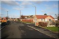
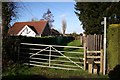
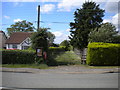
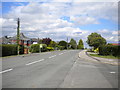
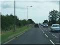
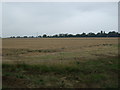
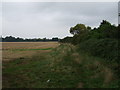
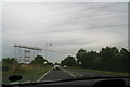
Photos of LN2 4WR
Area Information
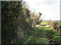
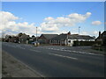
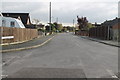
Living in LN2 4WR means being part of a compact, residential community in Lincolnshire with a population of 2,353 spread across 11.3 hectares. The area’s low density—133 people per square kilometre—suggests a quiet, low-traffic environment. This postcode is not a sprawling suburb but a focused cluster of homes, likely centred around local amenities and transport links. The demographic profile leans towards middle-aged residents, with a median age of 47 and the majority of households falling within the 30-64 age range. This suggests a stable, established community with a strong presence of owner-occupied properties, as 74% of homes are owned by residents. Daily life here is likely shaped by proximity to nearby rail stations, independent schools, and a mix of retail outlets. The area’s small size means residents are close to essential services, though its character is defined by its residential focus rather than commercial or industrial activity.
- Area Type
- Postcode
- Area Size
- 11.3 hectares
- Population
- 2353
- Population Density
- 133 people/km²
The property market in LN2 4WR is characterised by high home ownership—74% of residents own their homes—which suggests a strong preference for long-term residency over renting. The accommodation type is predominantly houses, indicating a lack of high-rise or apartment blocks. This aligns with the area’s small size and residential focus, where properties are likely to be single-family homes. For buyers, this means the housing stock is not dominated by rental properties or speculative developments. The limited area size (11.3 hectares) implies that the immediate surroundings may offer few additional properties, making LN2 4WR a niche market for those seeking established, owner-occupied homes. The absence of data on property prices or recent transactions means the market’s affordability remains unclear, but the high ownership rate suggests a degree of stability and desirability for those prioritising homeownership.
House Prices in LN2 4WR
Showing 2 properties
| Address | Type | Beds | Baths | Last Sale Price | Last Sale Date | |
|---|---|---|---|---|---|---|
| Foxfields, 1 Westacre Court, North Greetwell, Lincoln, LN2 4WR | Bungalow | 4 | 1 | - | - | |
| 2 Westacre Court, North Greetwell, Lincoln, LN2 4WR | Bungalow | 3 | 2 | - | - |
Energy Efficiency in LN2 4WR
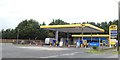
The lifestyle in LN2 4WR is supported by nearby amenities within practical reach. Five retail outlets, including Lincolnshire Co-operative Co and Lidl Deacon Road, provide everyday shopping needs. The area’s rail stations—Lincoln Central and Hykeham—offer connections to major towns and cities, while proximity to RAF Scampton and RAF Waddington airports adds versatility for travel. Though the data does not specify parks or leisure facilities, the low population density suggests space for outdoor activities. The mix of retail, transport, and travel options contributes to a convenient, if modest, lifestyle. Residents can access groceries, public transport, and regional airports without long commutes, making daily life efficient. The character of the area is likely defined by its quiet residential nature, with amenities focused on practicality rather than luxury.
Amenities
Schools
Residents of LN2 4WR have access to two independent schools: High Leas Education Centre and Northmoor Primary School – Lincoln Campus. Both are private institutions, which may appeal to families seeking alternative educational pathways outside the state system. The presence of independent schools suggests a community that values choice in education, though no Ofsted ratings are provided to assess quality. For families prioritising private schooling, these options offer proximity to the area’s residential cluster. However, the absence of state schools in the data means it is unclear whether the area’s schools cater to all age groups or if parents must travel further for secondary education. The mix of school types reflects a demographic that may be more inclined to invest in private education, though this does not necessarily indicate the overall quality of local schooling.
| Rank | School | Type | Entry gender | Ages |
|---|
Explore more schools in this area
Go to Schools tabDemographics
The community in LN2 4WR is predominantly composed of adults aged 30-64, with a median age of 47. This indicates a mature population, likely with long-term ties to the area. Home ownership is high at 74%, suggesting a stable housing market and a focus on long-term residency rather than rental turnover. The accommodation type is primarily houses, which aligns with the higher proportion of owner-occupied properties. The predominant ethnic group is White, reflecting the broader demographic trends in Lincolnshire. While no specific data on deprivation is provided, the low population density and high home ownership suggest a relatively affluent or stable community. The absence of detailed diversity metrics means the area’s social fabric is likely homogenous, though this does not necessarily imply a lack of inclusivity. The age profile and ownership rates indicate a community that values stability, with fewer transient residents compared to areas with higher rental markets.
Household Size
Accommodation Type
Tenure
Ethnic Group
Religion
Household Composition
Age
Household Deprivation
NS-SEC
Explore more demographic insights in this area
Go to Demographics tabPlanning
Planning Constraints
- Flood RiskPremium
- Ramsar Wetland SitesPremium
- Area of Outstanding Natural BeautyPremium
- Protected Nature ReservePremium
- Protected WoodlandPremium