Area Overview for LN2 4AL
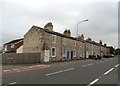
Photos of LN2 4AL


Area Information
LN2 4AL is a compact residential postcode area in England, covering just 1.9 hectares and home to 1,495 residents. Its high population density of 79,140 people per square kilometre reflects a tightly knit community, typical of small urban clusters. The area’s proximity to Lincoln and its rail network offers easy access to the city’s amenities while retaining a quiet, residential character. With five retail outlets nearby, including Tesco Lincoln and Aldi St, daily essentials are within reach. Three rail stations—Lincoln Central, Hykeham, and Saxilby—provide reliable connections to regional hubs, while nearby RAF Waddington and Scampton airports cater to those needing frequent travel. This postcode blends practicality with convenience, appealing to those seeking a balance between suburban calm and urban accessibility. Its small size means a strong sense of local identity, though the high population density may feel intimate rather than crowded. For buyers, the area’s compact footprint and strategic transport links make it a viable option for those prioritising connectivity over expansive living space.
- Area Type
- Postcode
- Area Size
- 1.9 hectares
- Population
- 1495
- Population Density
- 2490 people/km²
LN2 4AL’s property market is characterised by a mix of owner-occupied homes and a smaller proportion of rental properties. With 57% of homes owned by residents, the area leans towards a stable, long-term demographic rather than a transient rental market. The accommodation type is predominantly houses, which suits families and individuals seeking more space than apartments. Given the postcode’s small size—just 1.9 hectares—properties are likely to be closely spaced, making the area ideal for those prioritising proximity to amenities over expansive gardens or open land. Buyers should consider that the high population density may mean limited scope for property expansion or redevelopment. The presence of nearby rail stations and retail outlets suggests that the area is well-served for practical living, though its compact nature may limit options for those seeking larger homes or more secluded settings.
House Prices in LN2 4AL
Showing 21 properties
| Address | Type | Beds | Baths | Last Sale Price | Last Sale Date | |
|---|---|---|---|---|---|---|
| 17 Geralds Close, Lincoln, LN2 4AL | house | - | - | £414,000 | Jul 2024 | |
| 2 Geralds Close, Lincoln, LN2 4AL | Bungalow | - | - | £430,000 | Dec 2023 | |
| 14 Geralds Close, Lincoln, LN2 4AL | Bungalow | 4 | 2 | £450,000 | May 2023 | |
| 6 Geralds Close, Lincoln, LN2 4AL | Detached | 4 | 3 | £528,000 | Feb 2022 | |
| 5 Geralds Close, Lincoln, LN2 4AL | house | - | - | £450,000 | Feb 2022 | |
| 22 Geralds Close, Lincoln, LN2 4AL | house | - | - | £485,000 | Oct 2021 | |
| 24 Geralds Close, Lincoln, LN2 4AL | house | 6 | 5 | £525,000 | Dec 2020 | |
| 23 Geralds Close, Lincoln, LN2 4AL | house | - | - | £420,000 | Jul 2018 | |
| 1 Geralds Close, Lincoln, LN2 4AL | house | - | - | £545,000 | Mar 2018 | |
| 10 Geralds Close, Lincoln, LN2 4AL | Semi-detached | 4 | 1 | £235,000 | Aug 2016 |
Energy Efficiency in LN2 4AL
Living in LN2 4AL offers a blend of practicality and accessibility. Five retail outlets, including Tesco Lincoln and Aldi St, provide everyday shopping needs within walking or short driving distance. The three rail stations—Lincoln Central, Hykeham, and Saxilby—connect residents to the city and beyond, while nearby RAF Waddington and Scampton airports cater to travel demands. Though the area lacks large parks or leisure facilities, its proximity to Lincoln ensures access to cultural and recreational amenities in the city. The compact nature of LN2 4AL means that essential services are close, reducing the need for long commutes. However, the absence of specific data on dining or entertainment options suggests that residents may rely on Lincoln for more varied social experiences. Overall, the area is well-suited for those prioritising convenience over expansive leisure opportunities.
Amenities
Schools
| Rank | School | Type | Entry gender | Ages |
|---|
Explore more schools in this area
Go to Schools tabDemographics
The population of LN2 4AL skews towards middle-aged adults, with a median age of 47 and the majority (30–64 years) in their prime working years. Home ownership is relatively high at 57%, suggesting a stable community where many residents are long-term residents rather than renters. The area is predominantly composed of houses, which aligns with the demographic profile of families and individuals seeking more space than apartments. The predominant ethnic group is White, reflecting broader trends in the region. While the data does not specify deprivation levels, the high home ownership rate and age profile suggest a community with established economic foundations. However, the lack of diversity in ethnic composition may limit cultural vibrancy. The absence of specific data on income or deprivation means that quality of life factors such as affordability or social services remain unquantified, though the area’s infrastructure and amenities imply a functional, if unremarkable, living environment.
Household Size
Accommodation Type
Tenure
Ethnic Group
Religion
Household Composition
Age
Household Deprivation
NS-SEC
Explore more demographic insights in this area
Go to Demographics tabPlanning
Planning Constraints
- Flood RiskPremium
- Ramsar Wetland SitesPremium
- Area of Outstanding Natural BeautyPremium
- Protected Nature ReservePremium
- Protected WoodlandPremium