Area Overview for LN2 4AH
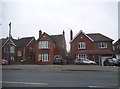
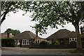
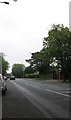
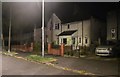
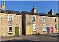
Photos of LN2 4AH


Area Information
LN2 4AH is a small, densely populated residential postcode in England, covering just 1.0 hectares and home to 1,495 residents. Despite its compact size, the area is a tightly knit community with a strong local character. The population density of 147,066 people per square kilometre reflects its compact nature, where homes are closely spaced. Most residents are adults aged 30–64, with a median age of 47, suggesting a stable, mature demographic. The area is predominantly owner-occupied, with 57% of homes owned by residents, and houses are the primary accommodation type. This makes it a place where many people live long-term, contributing to a sense of continuity. The digital infrastructure is robust, with a broadband score of 97 and mobile coverage scoring 85, ensuring reliable connectivity. However, the area’s safety profile is mixed: while flood risk is negligible, crime rates are above average, with a safety score of 0/100. For those seeking a compact, connected community with practical amenities, LN2 4AH offers a blend of convenience and proximity to key services.
- Area Type
- Postcode
- Area Size
- 1.0 hectares
- Population
- 1495
- Population Density
- 2490 people/km²
The property market in LN2 4AH is characterised by a high rate of home ownership, with 57% of homes owned by residents. This suggests a stable, long-term demographic, with fewer rental properties compared to other areas. The accommodation type is predominantly houses, which is notable given the small size of the postcode. This likely means that properties are smaller, single-family homes, possibly with limited scope for expansion. The compact nature of the area means the housing stock is finite, and buyers should consider the proximity to nearby towns and amenities. While the area is small, its proximity to rail stations and major roads may make it appealing for those seeking a base near transport hubs. However, the high population density and limited space mean that property availability is constrained, and buyers should prioritise locations with easy access to nearby services and infrastructure.
House Prices in LN2 4AH
Showing 17 properties
| Address | Type | Beds | Baths | Last Sale Price | Last Sale Date | |
|---|---|---|---|---|---|---|
| 28 Queensway, Lincoln, LN2 4AH | Retail | 3 | 1 | £380,000 | Dec 2022 | |
| 26 Queensway, Lincoln, LN2 4AH | house | - | - | £612,000 | Sep 2022 | |
| 20 Queensway, Lincoln, LN2 4AH | house | - | - | £436,000 | Feb 2018 | |
| 24 Queensway, Lincoln, LN2 4AH | house | - | - | £510,000 | Feb 2017 | |
| 6 Queensway, Lincoln, LN2 4AH | Semi-detached | 4 | 2 | £255,000 | Jan 2015 | |
| 34 Queensway, Lincoln, LN2 4AH | house | 5 | - | £350,000 | Oct 2012 | |
| 14 Queensway, Lincoln, LN2 4AH | house | 4 | - | £260,000 | Feb 2011 | |
| 16 Queensway, Lincoln, LN2 4AH | Semi-detached | - | - | £315,000 | Jul 2007 | |
| 18 Queensway, Lincoln, LN2 4AH | house | - | - | £249,999 | Jan 2007 | |
| 10 Queensway, Lincoln, LN2 4AH | Semi-detached | - | - | £249,999 | Nov 2005 |
Energy Efficiency in LN2 4AH
Living in LN2 4AH offers access to a range of nearby amenities within practical reach. The area is close to five retail outlets, including Lincolnshire Co-operative Co, Tesco Lincoln, and Aldi St, ensuring everyday shopping needs are met. Three rail stations—Lincoln Central, Hykeham, and Saxilby—provide direct links to nearby towns and cities, enhancing mobility. For air travel, RAF Waddington and RAF Scampton are within reach, offering connectivity to regional and international destinations. While the area itself is small, its proximity to Lincoln and surrounding towns means residents can access larger leisure, cultural, and professional opportunities. The compact nature of the area means that daily life is centred around local shops and transport hubs, creating a convenient but limited lifestyle. Those prioritising convenience over space may find this a practical choice, though the lack of expansive parks or recreational areas is notable.
Amenities
Schools
| Rank | School | Type | Entry gender | Ages |
|---|
Explore more schools in this area
Go to Schools tabDemographics
The community in LN2 4AH is predominantly composed of adults aged 30–64, with a median age of 47. This suggests a mature, established population, many of whom may be in their prime working years or nearing retirement. Home ownership is relatively high at 57%, indicating a stable housing market where many residents have long-term ties to the area. The accommodation type is primarily houses, which is unusual for a small postcode but may reflect a mix of older properties and newer builds. The predominant ethnic group is White, though specific diversity statistics are not provided. The high population density—147,066 people per square kilometre—means the area is highly compact, with limited open space. This density can impact quality of life, though it also ensures proximity to amenities. The demographic profile suggests a community focused on practical living, with a balance between family-oriented and single-adult households.
Household Size
Accommodation Type
Tenure
Ethnic Group
Religion
Household Composition
Age
Household Deprivation
NS-SEC
Explore more demographic insights in this area
Go to Demographics tabPlanning
Planning Constraints
- Flood RiskPremium
- Ramsar Wetland SitesPremium
- Area of Outstanding Natural BeautyPremium
- Protected Nature ReservePremium
- Protected WoodlandPremium