Area Overview for LN2 2ND
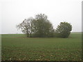
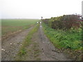
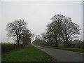
Photos of LN2 2ND


Area Information
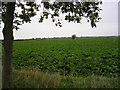
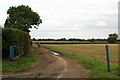
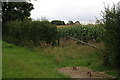
Living in LN2 2ND offers a compact, residential experience within a 2.1 km² area, home to 2,353 people. The postcode covers a small cluster of homes, reflecting a quiet, low-density neighbourhood. With a median age of 47, the community is predominantly composed of adults aged 30–64, suggesting a mature, stable population. The area’s 74% home ownership rate indicates a strong presence of long-term residents, many of whom live in traditional houses rather than flats. Daily life here is likely characterised by a mix of local amenities, including nearby schools, retail outlets, and transport links. The proximity to Lincoln Central Railway Station and RAF Scampton provides practical connectivity, while the broadband score of 92 ensures reliable internet access. LN2 2ND is not a sprawling suburb but a focused, manageable area where residents can enjoy a blend of suburban comfort and easy access to regional services. Its small size means the community is likely close-knit, with a sense of familiarity among neighbours. For those seeking a balanced lifestyle, this area balances residential tranquillity with functional infrastructure.
- Area Type
- Postcode
- Area Size
- 2.1 km²
- Population
- 2353
- Population Density
- 133 people/km²
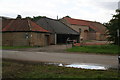
The property market in LN2 2ND is characterised by a high rate of home ownership (74%), suggesting a community of long-term residents rather than a transient rental market. The predominant accommodation type is houses, which is typical for areas with low population density and a mature demographic. This indicates a housing stock that is likely older, with traditional layouts and possibly larger living spaces compared to newer developments. The small area size of 2.1 km² means the market is limited in scale, with fewer properties available than in larger towns or cities. For buyers, this could mean competition for a limited number of homes, particularly if the area is seen as desirable for its safety and amenities. The focus on owner-occupation also implies that rental properties are less common, potentially making it harder for renters to find options. However, the stability of the market may appeal to investors seeking long-term value in a low-risk environment.
House Prices in LN2 2ND
Showing 4 properties
| Address | Type | Beds | Baths | Last Sale Price | Last Sale Date | |
|---|---|---|---|---|---|---|
| The Grange, Back Lane, Grange De Lings, Lincoln, LN2 2ND | Detached | - | - | - | - | |
| 1, Hall Farm Cottages, Hall Lane, Nettleham, Lincoln, LN2 2ND | house | - | - | - | - | |
| Hall Farm, Hall Lane, Nettleham, Lincoln, LN2 2ND | Detached | 3 | 1 | - | - | |
| 2, Hall Farm Cottages, Hall Lane, Nettleham, Lincoln, LN2 2ND | house | - | - | - | - |
Energy Efficiency in LN2 2ND
The lifestyle in LN2 2ND is shaped by its proximity to essential amenities. Nearby retail options include Lincolnshire Co-operative Co, Iceland Nettleham, and Waitrose Lincoln, providing a range of shopping choices from local cooperatives to national chains. These stores cater to daily needs, from groceries to household goods, ensuring convenience for residents. The presence of Lincoln Central Railway Station adds to the area’s accessibility, allowing easy travel to Lincoln’s urban centres for dining, leisure, or cultural activities. While the data does not specify parks or recreational facilities, the lack of environmental constraints like AONB or protected woodlands suggests open spaces may be available nearby. The combination of retail access and transport links creates a functional lifestyle, where residents can balance local convenience with regional opportunities.
Amenities
Schools
Residents of LN2 2ND have access to two nearby schools: High Leas Education Centre and Northmoor Primary School – Lincoln Campus, both of which are independent institutions. Independent schools often offer specialised curricula or smaller class sizes, which may appeal to families seeking tailored education. However, the absence of Ofsted ratings or performance data means the quality of these schools cannot be assessed here. The presence of two independent schools suggests a choice for parents, though it is unclear if they cater to different age groups or educational philosophies. For families prioritising school options, this mix could be advantageous, but the lack of state school options may limit alternatives. The proximity of these schools to the area implies that commuting times are likely short, supporting a family-friendly environment.
| Rank | School | Type | Entry gender | Ages |
|---|
Explore more schools in this area
Go to Schools tabDemographics
The demographic profile of LN2 2ND is defined by its median age of 47, with the majority of residents falling within the 30–64 age range. This suggests a population skewed towards middle-aged adults, many of whom may be in their peak working years or nearing retirement. The 74% home ownership rate indicates a community where most residents are settled in their properties, rather than renting. Accommodation is primarily houses, which aligns with the area’s low population density of 133 people per km². The predominant ethnic group is White, reflecting a homogenous demographic makeup. While no specific deprivation data is provided, the high home ownership and stable age distribution imply a relatively secure economic environment. The absence of significant diversity metrics means the area may lack the cultural variety found in more ethnically mixed regions. For families or professionals seeking a stable, low-risk environment, this profile offers a predictable, settled community dynamic.
Household Size
Accommodation Type
Tenure
Ethnic Group
Religion
Household Composition
Age
Household Deprivation
NS-SEC
Explore more demographic insights in this area
Go to Demographics tabPlanning
Planning Constraints
- Flood RiskPremium
- Ramsar Wetland SitesPremium
- Area of Outstanding Natural BeautyPremium
- Protected Nature ReservePremium
- Protected WoodlandPremium