Area Overview for LN2 2LG
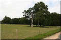
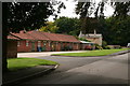
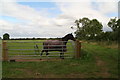
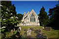
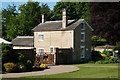
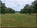
Photos of LN2 2LG


Area Information
Living in LN2 2LG offers a compact, residential experience within a small cluster of 4 hectares, home to 2,353 residents. The area’s modest size fosters a tight-knit community, with a median age of 47 and a strong presence of adults aged 30–64. This suggests a stable, established population, with 74% owning their homes. The area is predominantly composed of houses, reflecting a traditional, family-oriented character. Proximity to Lincoln’s amenities, including independent schools and rail links, adds practicality to daily life. With broadband scores of 92 and mobile coverage of 82, residents enjoy reliable digital connectivity, supporting both work and leisure. The low flood risk and absence of protected natural sites mean planning constraints are minimal, making it a straightforward area for buyers. However, its small footprint means the housing stock is limited, requiring careful consideration for those seeking properties in the immediate vicinity.
- Area Type
- Postcode
- Area Size
- 4.0 hectares
- Population
- 2353
- Population Density
- 133 people/km²
LN2 2LG is a predominantly owner-occupied area, with 74% of properties in private hands. The housing stock is almost entirely composed of houses, with no flats or apartments present. This suggests a traditional, family-focused market, likely appealing to those seeking spacious, established homes. The small area size means the property market is limited, with few new developments. Buyers should consider the proximity to Lincoln’s amenities, including schools and rail links, which enhance the area’s appeal. However, the limited housing stock may lead to competition for available properties. For those prioritising privacy and a low-density environment, this area offers a straightforward, stable option. The lack of planning constraints, such as protected natural sites, also simplifies the buying process, though the small footprint means expansion is unlikely.
House Prices in LN2 2LG
Showing 19 properties
Energy Efficiency in LN2 2LG
Residents of LN2 2LG have access to a range of amenities within practical reach. The area includes five retail outlets, notably Lincolnshire Co-operative Co and Waitrose Lincoln, offering grocery and daily essentials. Three railway stations provide transport links to Lincoln and surrounding areas, while RAF Scampton airport is nearby, though primarily a military facility. For leisure, the absence of named parks or recreational spaces suggests limited green areas, but the low population density may offer more private outdoor space. The retail options and rail connectivity enhance convenience, allowing residents to shop, commute, and travel with ease. The character of the area is defined by its traditional, low-density housing and proximity to Lincoln’s infrastructure, making it suitable for those valuing accessibility without urban congestion.
Amenities
Schools
Residents of LN2 2LG have access to two independent schools: High Leas Education Centre and Northmoor Primary School – Lincoln Campus. Both institutions are privately run, offering alternative educational options for families. The presence of independent schools may appeal to parents seeking structured, fee-paying education, though no Ofsted ratings are provided in the data. The mix of school types is limited, with no state schools listed, which could be a consideration for those preferring public education. For families prioritising independent schooling, the proximity to these institutions is a key advantage. However, the small area size means school choices are restricted to these two options. Parents should evaluate whether the curriculum and facilities align with their children’s needs, as the data does not include details on academic performance or extracurricular offerings.
| Rank | School | Type | Entry gender | Ages |
|---|
Explore more schools in this area
Go to Schools tabDemographics
LN2 2LG’s population of 2,353 is spread across 4 hectares, equating to 133 people per square kilometre. The median age of 47 indicates a mature demographic, with 74% of residents owning their homes. This high homeownership rate suggests long-term residency and stability. The area is dominated by houses, with no flats or apartments recorded, reflecting a traditional housing stock. The predominant ethnic group is White, with no specific data on other demographics. The population density, while low, ensures a balance between private space and community access. For families, the presence of independent schools nearby aligns with the age profile, catering to children aged 30–64. The absence of significant deprivation metrics implies a generally stable quality of life, though the small population size means limited diversity in local services or social dynamics.
Household Size
Accommodation Type
Tenure
Ethnic Group
Religion
Household Composition
Age
Household Deprivation
NS-SEC
Explore more demographic insights in this area
Go to Demographics tabPlanning
Planning Constraints
- Flood RiskPremium
- Ramsar Wetland SitesPremium
- Area of Outstanding Natural BeautyPremium
- Protected Nature ReservePremium
- Protected WoodlandPremium