Area Overview for LN2 1SQ
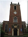
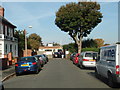
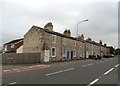
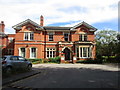
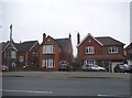
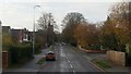
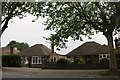
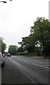
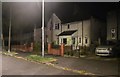
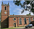
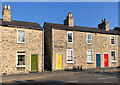
Photos of LN2 1SQ

Area Information
Living in LN2 1SQ means being part of a tightly knit residential cluster in England, where 1,567 people reside across 9,602 square metres. The area’s high population density — 163,196 people per square kilometre — reflects its compact nature, yet it offers a sense of community typical of small, established neighbourhoods. Residents here are predominantly adults aged 30–64, with a median age of 47, suggesting a mature, stable population. The area is largely owner-occupied, with 80% of homes in private ownership, and most properties are houses rather than flats. Proximity to Lincoln Central Railway Station and nearby airports like RAF Scampton and RAF Waddington ensures connectivity, while local shops and amenities cater to daily needs. For those prioritising safety, the area scores 85/100 for low crime risk, and flood risk is negligible. LN2 1SQ is ideal for buyers seeking a quiet, well-connected residential spot with limited but practical infrastructure.
- Area Type
- Postcode
- Area Size
- 9602 m²
- Population
- 1567
- Population Density
- 3114 people/km²
The property market in LN2 1SQ is characterised by a high rate of home ownership — 80% of properties are owner-occupied — and a predominance of houses over flats. This suggests a market skewed towards established residents rather than rental properties, which may limit availability for buyers seeking investment opportunities. The compact size of the area, covering just 9,602 square metres, means the housing stock is limited, and properties are likely to be in close proximity to one another. Given the high population density, the area may see competition for homes, particularly for those prioritising proximity to nearby amenities like rail stations and retail hubs. Buyers should consider the small footprint of the area and its immediate surroundings, as expansion options may be constrained. The focus on houses also implies that properties may be larger than average for the region, though this depends on individual listings.
House Prices in LN2 1SQ
Showing 17 properties
| Address | Type | Beds | Baths | Last Sale Price | Last Sale Date | |
|---|---|---|---|---|---|---|
| 33 Broadway, Lincoln, LN2 1SQ | Detached | 3 | 1 | £385,000 | Dec 2025 | |
| 11 Broadway, Lincoln, LN2 1SQ | Semi-detached | 4 | 3 | £420,000 | Oct 2024 | |
| 15 Broadway, Lincoln, LN2 1SQ | Detached | 3 | 1 | £340,000 | Jun 2024 | |
| 17 Broadway, Lincoln, LN2 1SQ | Detached | 3 | 1 | £350,000 | Jul 2020 | |
| 23 Broadway, Lincoln, LN2 1SQ | Semi-detached | 3 | 1 | £189,950 | Feb 2014 | |
| 3 Broadway, Lincoln, LN2 1SQ | Detached | 4 | - | £230,000 | Dec 2013 | |
| 25 Broadway, Lincoln, LN2 1SQ | house | - | - | £190,000 | Dec 2009 | |
| 7 Broadway, Lincoln, LN2 1SQ | Semi-detached | - | - | £215,000 | Nov 2007 | |
| 1 Broadway, Lincoln, LN2 1SQ | Detached | - | - | £90,000 | Jul 1999 | |
| 5 Broadway, Lincoln, LN2 1SQ | Detached | - | - | £91,000 | Jul 1997 |
Energy Efficiency in LN2 1SQ
Daily life in LN2 1SQ is shaped by its proximity to practical amenities. The area includes five retail outlets, with the Lincolnshire Co-operative Co listed multiple times, suggesting a focus on local shopping. Three railway stations — Lincoln Central, Hykeham, and Saxilby — provide easy access to regional transport, while two nearby airports — RAF Scampton and RAF Waddington — cater to those requiring air travel. The compact nature of the area means residents can reach these amenities without long commutes. The retail options, though limited, indicate a basic level of convenience for everyday needs. The presence of multiple rail stations also implies a degree of connectivity to surrounding towns, allowing residents to access broader leisure and employment opportunities. While the area lacks extensive parks or recreational spaces, its practical amenities support a functional lifestyle for those prioritising accessibility over expansive green spaces.
Amenities
Schools
The only notable educational institution near LN2 1SQ is Bishop Grosseteste University, categorised as an “other” type in the data. This suggests the area lacks primary or secondary schools for local children, which could be a consideration for families. The absence of named schools in the data indicates that residents may need to look beyond the immediate vicinity for educational facilities. For those prioritising schools, this highlights a potential gap in local infrastructure, requiring reliance on nearby towns or commuting. The mix of amenities in the area — including rail stations and retail — may partially offset this by offering connectivity to broader services. However, the lack of specific school data means buyers should investigate further to understand the full range of educational options available.
| Rank | School | Type | Entry gender | Ages |
|---|
Explore more schools in this area
Go to Schools tabDemographics
The demographic profile of LN2 1SQ is defined by a median age of 47, with the majority of residents falling within the 30–64 age range. This suggests a community of established professionals and families, rather than a younger or elderly population. Home ownership is high at 80%, indicating a strong presence of long-term residents. The predominant accommodation type is houses, which aligns with the area’s low density and residential character. The predominant ethnic group is White, though specific diversity metrics are not provided. The high population density — 163,196 people per square kilometre — means the area is intensely populated despite its small size. This density, combined with the age profile, implies a stable, mature community with limited turnover. For buyers, this suggests a neighbourhood where property values may be influenced by local demand and the appeal of owner-occupied housing.
Household Size
Accommodation Type
Tenure
Ethnic Group
Religion
Household Composition
Age
Household Deprivation
NS-SEC
Explore more demographic insights in this area
Go to Demographics tabPlanning
Planning Constraints
- Flood RiskPremium
- Ramsar Wetland SitesPremium
- Area of Outstanding Natural BeautyPremium
- Protected Nature ReservePremium
- Protected WoodlandPremium