Area Overview for LN2 1SH
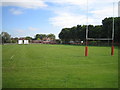
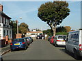
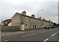
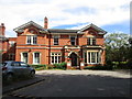
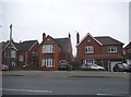
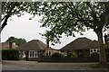
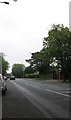
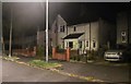
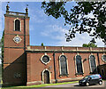
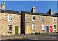
Photos of LN2 1SH


Area Information
Living in LN2 1SH means being part of a tightly knit residential cluster in England, where 1567 people reside across just 1.1 hectares. This high population density creates a compact, community-focused environment, ideal for those seeking proximity to essential services and transport links. The area is characterised by its predominantly owner-occupied housing stock, with 80% of homes owned by residents. Daily life here is shaped by its small-scale nature, where local amenities and nearby infrastructure provide convenience without the sprawl of larger towns. The presence of multiple rail stations, including Lincoln Central and Hykeham, ensures easy access to regional hubs, while nearby airports like RAF Scampton and RAF Waddington cater to those with commuting or travel needs. Despite its size, LN2 1SH offers a balance of practicality and accessibility, making it a viable choice for those prioritising connectivity and a settled, mature community.
- Area Type
- Postcode
- Area Size
- 1.1 hectares
- Population
- 1567
- Population Density
- 3114 people/km²
The property market in LN2 1SH is largely defined by its high home ownership rate of 80%, indicating a strong presence of owner-occupied homes. The accommodation type is predominantly houses, which contrasts with areas dominated by rental properties or flats. This suggests a market tailored to long-term residents rather than transient tenants, offering a sense of permanence. The small area size and high population density mean that properties are likely to be closely spaced, with limited scope for expansion. For buyers, this implies a focus on established homes rather than new developments. The proximity to rail stations and airports may also influence property values, appealing to commuters or those requiring regular travel. However, the compact nature of the area means that buyers should consider the limited availability of properties and the potential for a competitive market.
House Prices in LN2 1SH
Showing 20 properties
| Address | Type | Beds | Baths | Last Sale Price | Last Sale Date | |
|---|---|---|---|---|---|---|
| 18 Broadway, Lincoln, LN2 1SH | Retail | 4 | 2 | £595,000 | Apr 2022 | |
| 26 Broadway, Lincoln, LN2 1SH | house | 3 | - | £320,000 | Jan 2022 | |
| 4 Broadway, Lincoln, LN2 1SH | house | - | - | £256,500 | Aug 2021 | |
| 16 Broadway, Lincoln, LN2 1SH | house | - | - | £255,000 | Aug 2018 | |
| 10 Broadway, Lincoln, LN2 1SH | Semi-detached | 3 | 1 | £255,000 | Jul 2017 | |
| 24 Broadway, Lincoln, LN2 1SH | Semi-detached | 3 | 1 | £196,000 | May 2015 | |
| 42 Broadway, Lincoln, LN2 1SH | Detached | 3 | 1 | £235,000 | Aug 2014 | |
| 32 Broadway, Lincoln, LN2 1SH | house | 3 | - | £180,000 | Aug 2012 | |
| 2 Broadway, Lincoln, LN2 1SH | house | 5 | - | £174,000 | Oct 2011 | |
| 6 Broadway, Lincoln, LN2 1SH | Semi-detached | - | - | £165,000 | Sep 2006 |
Energy Efficiency in LN2 1SH
Daily life in LN2 1SH is shaped by its proximity to essential amenities. The area includes five retail outlets, such as Tesco Lincoln and Lincolnshire Co-operative Co, offering convenience for shopping and daily necessities. Three rail stations provide straightforward access to nearby towns and cities, while the presence of RAF Scampton and RAF Waddington adds a unique character to the region. Although the data does not specify parks or leisure facilities, the compact nature of the area suggests that residents may rely on nearby towns for recreational activities. The mix of retail, transport, and military infrastructure creates a practical, no-frills lifestyle, prioritising accessibility and connectivity over expansive leisure options.
Amenities
Schools
The nearest educational institution to LN2 1SH is Bishop Grosseteste University, categorised as an 'other' type of school. While no primary or secondary schools are listed in the data, the presence of a university may indicate access to higher education opportunities for local residents. This could be beneficial for families with older children or those seeking postgraduate study. However, the absence of primary or secondary schools within the area suggests that families may need to rely on nearby towns or villages for schooling. The lack of specific Ofsted ratings or additional school names means that prospective residents should investigate further to understand the full range of educational options available in the surrounding region.
| Rank | School | Type | Entry gender | Ages |
|---|
Explore more schools in this area
Go to Schools tabDemographics
The community in LN2 1SH is predominantly composed of adults aged 30–64, with a median age of 47. This suggests a stable, middle-aged population, likely with established careers and families. Home ownership is high, with 80% of residents owning their properties, reflecting a long-term commitment to the area. The accommodation type is primarily houses, indicating a more traditional residential layout compared to flats or apartments. The predominant ethnic group is White, though specific data on diversity or deprivation is not provided. The high population density—146,141 people per square kilometre—suggests a compact, possibly multi-generational living pattern. This demographic profile implies a community focused on stability, with residents likely prioritising security, local amenities, and ease of access to transport over larger urban conveniences.
Household Size
Accommodation Type
Tenure
Ethnic Group
Religion
Household Composition
Age
Household Deprivation
NS-SEC
Explore more demographic insights in this area
Go to Demographics tabPlanning
Planning Constraints
- Flood RiskPremium
- Ramsar Wetland SitesPremium
- Area of Outstanding Natural BeautyPremium
- Protected Nature ReservePremium
- Protected WoodlandPremium