Area Overview for LN13 9SP
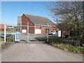
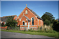
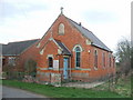
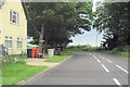
Photos of LN13 9SP
Area Information
LN13 9SP is a small, tightly knit residential postcode area in England, covering just 1.0 hectares. With a population of 1,977 and a density of 28 people per square kilometre, it is a quiet, low-density neighbourhood where community ties are likely strong. The area’s compact size means it is easy to navigate on foot or by bicycle, and its modest population suggests a slower pace of life compared to larger urban centres. Daily life here is likely shaped by the surrounding local amenities and the character of the housing stock. As a residential cluster, LN13 9SP may cater to families and long-term residents rather than commuters, with its proximity to a primary school and basic retail options. The area’s low population density and modest size suggest it is not a commercial hub, but rather a place where residents can enjoy a sense of privacy and local familiarity. For those considering living here, the balance between space and convenience is a key factor, with the area’s small footprint offering a manageable environment for those seeking a quieter lifestyle.
- Area Type
- Postcode
- Area Size
- 1.0 hectares
- Population
- 1977
- Population Density
- 28 people/km²
The property market in LN13 9SP is characterised by a high rate of home ownership—78% of residents own their homes—suggesting a strong preference for long-term residency over rental living. The accommodation type is predominantly houses, which is typical for small, low-density areas where larger properties are more common. This indicates that the housing stock is likely to consist of family homes rather than apartments or flats, which are less prevalent in such settings. For buyers, this means the area may not be a hotspot for short-term investment or rental properties, but rather a place where homeowners seek stability. The limited size of the area—just 1.0 hectare—means the housing stock is finite, which could influence property values and availability. Buyers should consider the local demand for family homes and the potential for long-term appreciation in a low-density, owner-occupied market.
House Prices in LN13 9SP
Showing 12 properties
| Address | Type | Beds | Baths | Last Sale Price | Last Sale Date | |
|---|---|---|---|---|---|---|
| Verini, Parklands, Mumby, LN13 9SP | Bungalow | - | - | £250,000 | Aug 2024 | |
| Rayell, Parklands, Mumby, LN13 9SP | Bungalow | - | - | £285,000 | Feb 2023 | |
| Highlands, Parklands, Mumby, LN13 9SP | Bungalow | - | - | £150,000 | Nov 2021 | |
| Cherryvale, Parklands, Mumby, LN13 9SP | Bungalow | - | - | £151,000 | Jul 2020 | |
| Wildwind, Parklands, Mumby, LN13 9SP | Detached | 5 | 2 | £217,500 | Dec 2016 | |
| Byways, Parklands, Mumby, LN13 9SP | Bungalow | - | - | £175,000 | Oct 2015 | |
| Willowdown, Parklands, Mumby, LN13 9SP | Detached | - | - | £48,000 | Jul 1995 | |
| Weltevreden, 8 Parklands, Mumby, LN13 9SP | Bungalow | 3 | 2 | - | - | |
| Woodlea, Parklands, Mumby, LN13 9SP | Bungalow | 4 | 1 | - | - | |
| Parklands Bungalow, Parklands, Mumby, LN13 9SP | Bungalow | 2 | - | - | - |
Energy Efficiency in LN13 9SP
The lifestyle in LN13 9SP is shaped by its proximity to basic retail amenities, including five notable venues such as Spar, Spar – Chapel St., and the Lincolnshire Co-operative Co. These shops provide essential services for daily living, from groceries to local goods. While the data does not mention dining options, parks, or leisure facilities, the presence of a primary school and the area’s low density suggest a focus on family-friendly, low-traffic environments. The compact nature of the area means residents can likely access these amenities without long commutes. The retail options listed indicate a small-scale, community-oriented shopping experience, which may appeal to those prioritising convenience over large commercial centres. However, the absence of specific details on leisure or recreational facilities means the full range of lifestyle options remains unclear.
Amenities
Schools
The nearest school to LN13 9SP is St Helena’s Church of England Primary School in Willoughby, which serves the local community. This is a primary school with an Ofsted rating of ‘satisfactory’. While no secondary schools are listed in the data, the presence of a primary school suggests that families with young children may find the area suitable for their needs. The single school listed indicates that parents may need to look beyond the immediate vicinity for secondary education options. However, the proximity of St Helena’s provides a foundational educational resource for the area. The ‘satisfactory’ rating means the school meets basic standards but may not excel in areas such as academic performance or extracurricular provision. Families should consider additional research into secondary school options if they require a full range of educational facilities.
| Rank | School | Type | Entry gender | Ages |
|---|
Explore more schools in this area
Go to Schools tabDemographics
The residents of LN13 9SP are predominantly adults aged 30–64, with a median age of 47. This suggests a mature, stable community where many residents may be in their prime working years or nearing retirement. Home ownership is high, at 78%, indicating a strong presence of long-term residents who have established roots in the area. The accommodation type is primarily houses, which aligns with the lower population density and the typical layout of small residential clusters. The predominant ethnic group is White, which reflects the broader demographic patterns of rural and semi-rural areas in England. While no specific data on deprivation is provided, the high home ownership rate and low population density may suggest a relatively stable economic environment. However, the absence of detailed diversity metrics means the community’s full demographic composition remains partially unexplored.
Household Size
Accommodation Type
Tenure
Ethnic Group
Religion
Household Composition
Age
Household Deprivation
NS-SEC
Explore more demographic insights in this area
Go to Demographics tabPlanning
Planning Constraints
- Flood RiskPremium
- Ramsar Wetland SitesPremium
- Area of Outstanding Natural BeautyPremium
- Protected Nature ReservePremium
- Protected WoodlandPremium