Area Overview for LN11 9TR
Photos of LN11 9TR
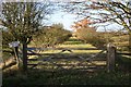
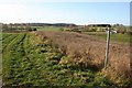
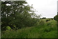
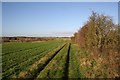
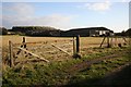
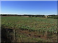
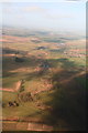
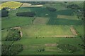
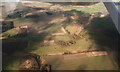
9 photos from this area
Area Information
Key information about the LN11 9TR including its size, population, and administrative classification.
- Area Type
- Postcode
- Area Size
- 1.7 km²
- Population
- 2101
- Population Density
- 18 people/km²
House Prices in LN11 9TR
29
Properties
£135,929
Average Sold Price
£74,000
Lowest Price
£287,500
Highest Price
Showing 29 properties
| Address | Type | Beds | Baths | Last Sale Price | Last Sale Date | |
|---|---|---|---|---|---|---|
| Edensor, Station Road, Donington On Bain, LN11 9TR | Bungalow | 3 | 2 | £172,500 | Jan 2021 | |
| Bradford House, Station Road, Donington On Bain, LN11 9TR | Detached | 4 | 1 | £287,500 | Aug 2016 | |
| Bradgate, Station Road, Donington On Bain, LN11 9TR | Bungalow | - | - | £140,000 | Jul 2007 | |
| Cornerstone, Station Road, Donington On Bain, LN11 9TR | Detached | - | - | £86,000 | Feb 2002 | |
| Magrats Bungalow, Station Road, Donington On Bain, LN11 9TR | Detached | - | - | £74,000 | May 2001 | |
| Maple Lodge, Station Road, Donington On Bain, LN11 9TR | Semi-detached | 2 | 1 | £115,000 | Dec 1999 | |
| Wold View Cottage, Station Road, Donington On Bain, LN11 9TR | Detached | - | - | £76,500 | Oct 1996 | |
| 3 Station Road, Donington On Bain, LN11 9TR | Semi-detached | 4 | 1 | - | - | |
| The Burrow, Station Road, Donington On Bain, LN11 9TR | Land | - | - | - | - | |
| The Brambles, Station Road, Donington On Bain, LN11 9TR | Detached | - | - | - | - |
Page 1 of 3
Energy Efficiency in LN11 9TR
Amenities
Schools
| Rank | School | Type | Entry gender | Ages |
|---|
Explore more schools in this area
Go to Schools tabDemographics
Household Size
Two person
most common
Accommodation Type
Houses
most common
Tenure
78
majority
Ethnic Group
White
most common
Religion
N/A
most common
Household Composition
N/A
most common
Age
47
median
Adults (30-64 years)
most common
Household Deprivation
N/A
with no deprivation
NS-SEC
35
in Lower managerial occupations
Explore more demographic insights in this area
Go to Demographics tabPlanning
Planning Constraints
- Flood RiskPremium
- Ramsar Wetland SitesPremium
- Area of Outstanding Natural BeautyPremium
- Protected Nature ReservePremium
- Protected WoodlandPremium