Area Overview for LN11 9TN
Photos of LN11 9TN
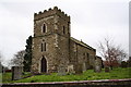
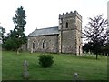
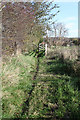
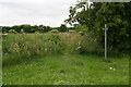
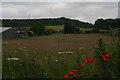
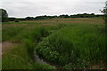
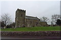
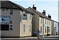
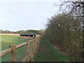
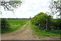
38 photos from this area
Area Information
Key information about the LN11 9TN including its size, population, and administrative classification.
- Area Type
- Postcode
- Area Size
- 7.6 hectares
- Population
- 2101
- Population Density
- 18 people/km²
House Prices in LN11 9TN
12
Properties
£293,483
Average Sold Price
£73,950
Lowest Price
£500,000
Highest Price
Showing 12 properties
| Address | Type | Beds | Baths | Last Sale Price | Last Sale Date | |
|---|---|---|---|---|---|---|
| Lilac Farm, Chapel Lane, Donington On Bain, LN11 9TN | Detached | 4 | 1 | £345,000 | Nov 2025 | |
| Chapel House, Chapel Lane, Donington On Bain, LN11 9TN | Detached | 3 | 1 | £500,000 | Jul 2023 | |
| The Old Chapel, Chapel Lane, Donington On Bain, LN11 9TN | Detached | 4 | 4 | £500,000 | Jul 2023 | |
| Ferncroft, Chapel Lane, Donington On Bain, LN11 9TN | Bungalow | 3 | 2 | £217,000 | Jun 2014 | |
| Glebe Corner, Chapel Lane, Donington On Bain, LN11 9TN | Semi-detached | - | - | £124,950 | Jun 2008 | |
| Vestry View, Chapel Lane, Donington On Bain, LN11 9TN | Semi-detached | - | - | £73,950 | Aug 2002 | |
| Garth Cottage, Chapel Lane, Donington On Bain, LN11 9TN | Detached | 4 | - | - | - | |
| Sunnyside, Chapel Lane, Donington On Bain, LN11 9TN | Detached | - | - | - | - | |
| Bradda, Chapel Lane, Donington On Bain, LN11 9TN | Detached | - | - | - | - | |
| Former Amble Cottage Caravan, Chapel Lane, Donington On Bain, LN11 9TN | Retail | 3 | 2 | - | - |
Page 1 of 2
Energy Efficiency in LN11 9TN
Amenities
Schools
| Rank | School | Type | Entry gender | Ages |
|---|
Explore more schools in this area
Go to Schools tabDemographics
Household Size
Two person
most common
Accommodation Type
Houses
most common
Tenure
78
majority
Ethnic Group
White
most common
Religion
N/A
most common
Household Composition
N/A
most common
Age
47
median
Adults (30-64 years)
most common
Household Deprivation
N/A
with no deprivation
NS-SEC
35
in Lower managerial occupations
Explore more demographic insights in this area
Go to Demographics tabPlanning
Planning Constraints
- Flood RiskPremium
- Ramsar Wetland SitesPremium
- Area of Outstanding Natural BeautyPremium
- Protected Nature ReservePremium
- Protected WoodlandPremium