Area Overview for Donington
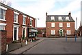
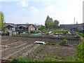
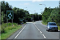
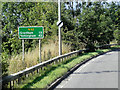
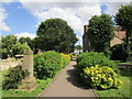
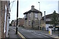
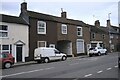
Photos of Donington


Area Information
Living in Donington offers a compact, well-defined urban experience within England’s built-up areas. Covering 1.4 km², the area is characterised by a mature population, with a median age of 70, suggesting a community with established residents and a strong sense of continuity. Home ownership is high at 73%, reflecting a stable housing market where most residents live in properties they own. Daily life here is shaped by proximity to essential services, including five retail outlets such as Co-op Donington and a single railway station at Swineshead, offering practical transport links. The area’s safety score of 71 indicates a below-average crime risk, contributing to a secure environment. With broadband connectivity rated 89 (good) and mobile coverage 79 (fair), residents enjoy reliable internet access for both work and leisure. Donington’s blend of local amenities, modest size, and low crime risk makes it an appealing choice for those seeking a settled, community-focused lifestyle.
- Area Type
- Built Up Area 250
- Area Size
- 1.4 km²
- Population
- Not available
- Population Density
- Not available
Donington’s lifestyle is shaped by its proximity to essential amenities. Five retail outlets, including Co-op Donington, offer daily shopping convenience, while the Swineshead Railway Station provides a direct link to broader transport networks. The area’s small size ensures that most services are accessible on foot or by bike, fostering a community-oriented environment. Though the data does not mention parks or leisure facilities, the presence of multiple retail options and a railway station suggests a practical, low-maintenance lifestyle. Residents can enjoy a mix of local shopping and easy travel, making Donington suitable for those prioritising convenience over expansive recreational spaces.
Amenities
Schools
Donington’s schools include The Donington Cowley Endowed Primary School, which holds an Ofsted rating of ‘good’, and The Thomas Cowley High School, listed as both a primary and academy school. Cowley Academy is also present as an academy. This mix of school types provides families with options, though the data does not clarify whether these are separate institutions or if there is overlap in their roles. The presence of an endowed primary school suggests a tradition of local education, while the academy model may indicate a focus on specialist or improved resources. Families with children may benefit from the combination of primary and secondary education options, though the specific performance of the schools beyond Ofsted ratings is not detailed.
| Rank | School | Type | Entry gender | Ages |
|---|
Explore more schools in this area
Go to Schools tabDemographics
Donington’s population skews significantly towards older residents, with a median age of 70 and the most common age range encompassing the total population. This suggests a community where many residents are retired or have long-standing ties to the area. Home ownership is robust at 73%, indicating a preference for long-term residency over rental properties. The data does not specify household composition or accommodation types, but the high home ownership rate implies a mix of family homes and single-occupancy properties. The predominant ethnic group and religious affiliation are not detailed, but the lack of specific figures suggests a relatively homogenous demographic profile. While no deprivation data is provided, the area’s safety and connectivity scores suggest a quality of life that supports independent living for older residents.