Area Overview for Willoughby with Sloothby
Photos of Willoughby with Sloothby
Area Information
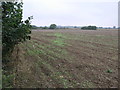
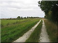
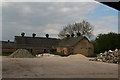
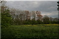
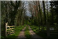
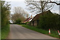
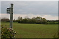
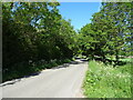
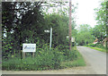
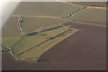
Living in Willoughby with Sloothby offers a distinct experience as a civil parish covering an area of 20.8 km² in England. This settlement is defined by its rural character and the specific constraints of its landscape. The location sits within an Area of Outstanding Natural Beauty, a designation that protects the countryside but implies strict planning restrictions for future development. You will also find protected woodland within the parish boundaries, contributing to the green infrastructure but potentially limiting expansion. The area carries a critical level of flood risk, which is a significant practical consideration for any property purchase you make here. Unlike urban centres, daily life in Willoughby with Sloothby revolves around a close connection to the natural environment and agricultural lands. The combination of exceptional natural beauty and environmental hazards creates a unique setting for residents who value tranquility alongside caution regarding climate impacts. Understanding these physical boundaries and risks is essential before considering homes in this specific parish.
- Area Type
- Parish
- Area Size
- 20.8 km²
- Population
- Not available
- Population Density
- Not available
Demographics
The community profile of Willoughby with Sloothby skews significantly towards older residents. The median age in the area is 70 years, indicating a retirement-focused population structure. This demographic reality shapes the local demand for housing, with a strong preference for properties suitable for later-life living. Home ownership stands at 78 per cent, demonstrating that the vast majority of residents live in their own homes rather than renting. This high level of tenure stability suggests a settled and established community where long-term residents form the core of neighbourhood life. While the data provided does not specify the breakdown of household sizes, the concentration of elderly residents typically correlates with younger households living alone or in couples without dependent children. The high ownership rate also implies fewer buy-to-let investors are active in this specific market compared to more dynamic urban parishes. You are looking at a settlement where people have deep roots and a desire to remain in their local surroundings for the long term.
Household Size
Accommodation Type
Tenure
Ethnic Group
Religion
Household Composition
Age
Household Deprivation
NS-SEC
Explore more demographic insights in this area
Go to Demographics tabPlanning
Planning Constraints
- Flood RiskPremium
- Ramsar Wetland SitesPremium
- Area of Outstanding Natural BeautyPremium
- Protected Nature ReservePremium
- Protected WoodlandPremium