Area Overview for Ingoldmells and Chapel St Leonards
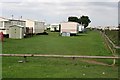
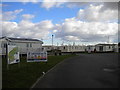
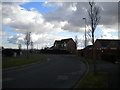
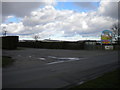
Photos of Ingoldmells and Chapel St Leonards

Area Information
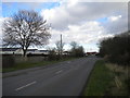
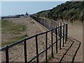
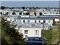
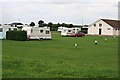
Living in Ingoldmells and Chapel St Leonards means residing within a built-up area that spans 6.8 square kilometres on the north Norfolk coast. This locality represents a distinct residential zone rather than a bustling city centre, offering a settled pace of life for its inhabitants. The community is characterised by long-established homes and a strong sense of local identity that defines daily existence here. You will find yourself in a setting where the immediate environment prioritises stability over rapid turnover or transient living. The geography supports a neighbourhood where residents rely on four-season lifestyles and proximity to coastal features, even if those features lie just beyond the immediate housing limits. Prospective buyers should understand that this area functions as a self-contained settlement with clear boundaries. It combines the convenience of nearby town transport links with the relative quietness of a dedicated residential block. The infrastructure supports standard domestic needs without the density found in larger urban centres. You can expect a landscape dominated by single-family dwellings rather than high-rise blocks, creating a domestic atmosphere that appeals to those seeking a traditional British seaside suburb. The scale of the area ensures that local services remain accessible while maintaining a degree of seclusion that larger conurbations cannot offer. families considering homes in Ingoldmells and Chapel St Leonards will appreciate the straightforward layout of the locality. There is no confusion over where the town begins and ends, making navigation simple for both pedestrians and drivers. The established nature of the estate means you are purchasing into a mature community where character-defining features have remained consistent for decades.
- Area Type
- Built Up Area 250
- Area Size
- 6.8 km²
- Population
- Not available
- Population Density
- Not available
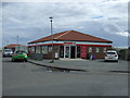
Daily life in Ingoldmells and Chapel St Leonards centres on local convenience and established amenities. Retail options are plentiful within practical reach, with five major stores located nearby. You will find a Morrisons Daily and Heron Ingoldmells, alongside a Tesco Ingoldmells, providing access to essential groceries and household goods. These supermarkets mean you can complete most shopping needs without travelling further afield. Transport accessibility supports this lifestyle, with Skegness Railway Station serving as the primary rail link for residents who require train services. The presence of a coach station further enhances mobility for those needing long-distance or inter-regional bus travel. These transport hubs are integrated into the local layout, meaning you do not need excessive planning for weekend trips. While the specific amenities description focuses on retail and transport, the area naturally supports the needs of a 65% owner-occupied population. This suggests a lifestyle focused on established routines rather than nightlife or transient entertainment. The concentration of stores like Tesco and Morrisons indicates that essential services are available without requiring a car journey. You can spend your mornings sourcing fresh produce locally and return to your home without unnecessary travel. The combination of nearby supermarkets and reliable transport creates a balanced environment for daily living.
Amenities
Schools
Families considering homes in Ingoldmells and Chapel St Leonards have access to several educational institutions within the immediate vicinity. Two primary schools serve the local catchment, ensuring young children have options for early education. Ingoldmells Primary School operates as a standard primary establishment for the local neighbourhood. Chapel St Leonards Primary School holds a good Ofsted rating, indicating a standard of education that meets government expectations. This positive inspection outcome provides assurance regarding the quality of instruction at this specific location. For more advanced education, Ingoldmells Academy stands as the area's secondary institution. It operates as an academy and also carries a good Ofsted rating. This rating confirms that the school maintains high standards in its curriculum delivery and student management. Families will have confidence that their children receive a broad and balanced education within this public system. Beyond the state sector, Morfields Study Centre offers independent education options for those seeking alternative school environments. The presence of an independent school provides a choice for parents who wish to tailor their child's education to specific philosophical or academic approaches. The mix of academy, state primary, and independent provision gives you flexibility in selecting the right environment for your children. All listed institutions operate under current regulatory frameworks, ensuring accountability and quality monitoring.
| Rank | School | Type | Entry gender | Ages |
|---|
Explore more schools in this area
Go to Schools tabDemographics
The population profile of Ingoldmells and Chapel St Leonards reflects a settled, mature community. The median age stands at 70 years, indicating that the majority of residents belong to older age groups. This demographic factor shapes the local infrastructure and the types of services that remain in operation. You will find a population that has likely lived in the same households for extended periods, creating stable neighbourhood relations. House ownership accords with this older demographic profile, with 65% of residents owning their homes outright or with a mortgage. This high rate of ownership suggests financial stability and a long-term commitment to the locality. The remaining 35% of households rely on other accommodation arrangements, which might include renting or living with family members. The data does not specify the exact breakdown of residential units beyond the total ownership figure. Ethnic and religious diversity within the area remains unrecorded in the available statistics. You should assume the population follows traditional local patterns unless specific inquiries reveal otherwise. The household composition data is available but does not enumerate specific family sizes per dwelling. This information underscores a community defined by tradition rather than rapid demographic shifts. Living here means engaging with a group of peoles who share common historical ties to the region. The age skew means that local planning decisions often prioritise healthcare access and leisure facilities suitable for seniors over amenities targeting young professionals or teenagers.