Area Overview for Wyberton
Photos of Wyberton


Area Information
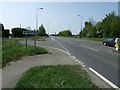
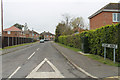
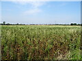
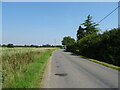
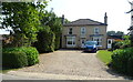
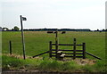
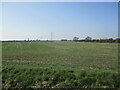
Wyberton is a civil parish covering an area size of 15.8 km² in England. It presents a setting defined by clear boundary lines rather than the commercial density found in urban centres. Living in Wyberton means navigating an environment where the rural character takes precedence over high-rise developments or traffic-heavy thoroughfares. The parish offers a straightforward living experience for those seeking a location that prioritises space over convenience. There are no adopted tall skyscrapers or industrial zones within these specific limits, ensuring that the visual landscape remains consistent with its countryside designation. You can expect a settlement structure that supports a quieter pace of life compared to major cities. The area presents a distinct alternative for individuals and families who prefer to keep their distance from the constant bustle of metropolitan hubs. Your daily routine will reflect the scale of this small settlement, where the 15.8 km² boundary defines the extent of your immediate surroundings. This compact nature means that travel times are short if you need to access the wider region, but you must plan your journey out of the parish to reach larger facilities. The location serves as a practical base for those who value a grounded lifestyle over rapid transit options. ### The community within Wyberton has a distinctly mature demographic profile. The median age for residents is 70 years, indicating that the population skews heavily towards older adults. Most of the age data falls under the total age category, confirming that this is not a youthful enclave but rather a settlement for retirees and the elderly. With a home ownership level of 65%, a significant majority of households own their properties outright or with a mortgage. This high rate suggests stability and long-term settlement rather than a transient rental market. The household composition reflects this trend, as total figures align with the ownership statistics to show a settled population. You will find that the diverse ethnic makeup is recorded under total statistics, while religious affiliations are also noted as total figures within the parish records. For those considering homes in Wyberton, the age profile means you are joining a community where service providers may cater to senior needs. The 65% ownership figure guarantees that you are buying into a stable market where properties have remained with families or individuals for decades. There is no significant influx of young professionals moving in rapidly, which creates a calm atmosphere but also means local amenities may reflect the needs of an older generation. ### The housing landscape in Wyberton is dominated by owner-occupied dwellings rather than private rentals. With a home ownership percentage of 65%, three out of every four properties are likely owned by individuals or families. This structure means that the local estate market will feature a high volume of sales from private owners rather than developers or let agencies. The predominance of owned homes suggests that the housing stock consists largely of traditional houses and cottages suitable for long-term residence. You will not find a concentration of student accommodations or temporary lodging units within this parish. The 65% ownership statistic indicates that the market is geared towards buyers looking to settle permanently rather than those seeking a flexibile tenancy. When viewing homes in Wyberton, expect a variety of established properties that have been maintained over many years. The accommodation type is recorded as total across the board, reinforcing the idea that the stock is mixed but heavily weighted towards private ownership. If you are looking to buy a house, the likelihood of finding a shared ownership scheme is low. Instead, you are participating in a market where sellers have established roots here. The 65% figure confirms that this is a classic owner-occupied village settlement where property values are influenced by family history and local sentiment rather than speculative investment trends. ### Digital connectivity in Wyberton supports a robust lifestyle for remote workers and average internet users. The fixed broadband quality score stands at 82, which rates as good, ensuring reliable speeds for streaming, video calls, and large file transfers. Mobile coverage scores 84, a solid rating that provides excellent signal strength throughout the parish for smartphones and tablets. Living in Wyberton, you can depend on consistent internet access without the frequent dropouts found in more remote rural locations. The high scores imply that your daily digital routine will not be interrupted by poor network performance. Whether you work from home or simply need to stay connected, the infrastructure meets modern standards. The broadband performance allows you to handle multiple connected devices simultaneously without significant lag. The mobile network quality ensures that you can make calls or use GPS navigation confidently while wandering the 15.8 km² area. For those who rely heavily on cloud services or online banking, these connectivity levels provide sufficient headroom for heavy usage. You do not need to compromise on your digital life when choosing to settle in this location. The technology available here mirrors the capabilities found in more densely populated towns, removing the usual friction associated with rural broadband. ### Safety considerations in Wyberton present a mixture of favorable conditions and notable environmental risks. The crime risk assessment yields a score of 59 out of 100, which places the area in a warning category for medium crime risk. Crime rates are around average compared to other locations, meaning you must adopt standard security precautions for your home and car. While the criminal threat is not elevated, it is not absent, so vigilance remains important. On the environmental front, the flood risk assessment is critical with a score of 90.4. High flood risk coverage indicates that parts of the parish are prone to flooding, which you must factor into your site selection and insurance planning. Property buyers should specifically check flood maps for any potential development site. The area also contains Ramsar wetland sites, triggering a warning level for planning constraints with a score of 7.08. This limitation means future development is restricted in zones protecting these special nature sites. Additionally, protected nature reserves are present in the parish, sharing the same planning constraint score of 7.08. These areas preserve local wildlife but limit building options nearby. The area passes the assessment for Areas of Outstanding Natural Beauty and protected woodland with a score of 0, confirming no coverage under those specific constraints. Ultimately, living in Wyberton requires accepting these environmental realities alongside standard crime prevention measures. ### What is the age profile of people living in Wyberton?The median age for residents is 70 years, meaning the population is predominantly ageing. Most age data is recorded under the total category, confirming that this is a community suited to retirees and older adults rather than families with young children looking for school services nearby. How reliable is the internet connection in the area?Digital infrastructure in Wyberton is strong. The fixed broadband quality score is 82, advertising as a good connection. Mobile coverage scores 84, described as excellent, ensuring you have reliable high-speed internet and strong signal strength for working from home across the 15.8 km² parish. Are there any environmental risks I should be aware of?Yes, there are specific environmental constraints. The flood risk assessment is critical with a score of 90.4. The area also contains Ramsar wetland sites and protected nature reserves which create planning constraints with a warning level score of 7.08, potentially limiting development on those specific plots. Is it a safe place to call home?The crime risk assessment gives a warning level with a score of 59, indicating medium crime risk where rates are around average. You should apply standard security precautions, but the situation is not significantly worse than many other parts of the country. The overall safety record is reasonable provided you take normal care. Who typically owns the properties in Wyberton?Home ownership stands at 65%, meaning the majority of homes are privately owned rather than rented. This high percentage indicates a stable market where residents have long-term ties to the civil parish instead of a fleet of temporary tenants or investors.
- Area Type
- Parish
- Area Size
- 15.8 km²
- Population
- Not available
- Population Density
- Not available
Demographics
The community within Wyberton has a distinctly mature demographic profile. The median age for residents is 70 years, indicating that the population skews heavily towards older adults. Most of the age data falls under the total age category, confirming that this is not a youthful enclave but rather a settlement for retirees and the elderly. With a home ownership level of 65%, a significant majority of households own their properties outright or with a mortgage. This high rate suggests stability and long-term settlement rather than a transient rental market. The household composition reflects this trend, as total figures align with the ownership statistics to show a settled population. You will find that the diverse ethnic makeup is recorded under total statistics, while religious affiliations are also noted as total figures within the parish records. For those considering homes in Wyberton, the age profile means you are joining a community where service providers may cater to senior needs. The 65% ownership figure guarantees that you are buying into a stable market where properties have remained with families or individuals for decades. There is no significant influx of young professionals moving in rapidly, which creates a calm atmosphere but also means local amenities may reflect the needs of an older generation. ### The housing landscape in Wyberton is dominated by owner-occupied dwellings rather than private rentals. With a home ownership percentage of 65%, three out of every four properties are likely owned by individuals or families. This structure means that the local estate market will feature a high volume of sales from private owners rather than developers or let agencies. The predominance of owned homes suggests that the housing stock consists largely of traditional houses and cottages suitable for long-term residence. You will not find a concentration of student accommodations or temporary lodging units within this parish. The 65% ownership statistic indicates that the market is geared towards buyers looking to settle permanently rather than those seeking a flexibile tenancy. When viewing homes in Wyberton, expect a variety of established properties that have been maintained over many years. The accommodation type is recorded as total across the board, reinforcing the idea that the stock is mixed but heavily weighted towards private ownership. If you are looking to buy a house, the likelihood of finding a shared ownership scheme is low. Instead, you are participating in a market where sellers have established roots here. The 65% figure confirms that this is a classic owner-occupied village settlement where property values are influenced by family history and local sentiment rather than speculative investment trends. ### Digital connectivity in Wyberton supports a robust lifestyle for remote workers and average internet users. The fixed broadband quality score stands at 82, which rates as good, ensuring reliable speeds for streaming, video calls, and large file transfers. Mobile coverage scores 84, a solid rating that provides excellent signal strength throughout the parish for smartphones and tablets. Living in Wyberton, you can depend on consistent internet access without the frequent dropouts found in more remote rural locations. The high scores imply that your daily digital routine will not be interrupted by poor network performance. Whether you work from home or simply need to stay connected, the infrastructure meets modern standards. The broadband performance allows you to handle multiple connected devices simultaneously without significant lag. The mobile network quality ensures that you can make calls or use GPS navigation confidently while wandering the 15.8 km² area. For those who rely heavily on cloud services or online banking, these connectivity levels provide sufficient headroom for heavy usage. You do not need to compromise on your digital life when choosing to settle in this location. The technology available here mirrors the capabilities found in more densely populated towns, removing the usual friction associated with rural broadband. ### Safety considerations in Wyberton present a mixture of favorable conditions and notable environmental risks. The crime risk assessment yields a score of 59 out of 100, which places the area in a warning category for medium crime risk. Crime rates are around average compared to other locations, meaning you must adopt standard security precautions for your home and car. While the criminal threat is not elevated, it is not absent, so vigilance remains important. On the environmental front, the flood risk assessment is critical with a score of 90.4. High flood risk coverage indicates that parts of the parish are prone to flooding, which you must factor into your site selection and insurance planning. Property buyers should specifically check flood maps for any potential development site. The area also contains Ramsar wetland sites, triggering a warning level for planning constraints with a score of 7.08. This limitation means future development is restricted in zones protecting these special nature sites. Additionally, protected nature reserves are present in the parish, sharing the same planning constraint score of 7.08. These areas preserve local wildlife but limit building options nearby. The area passes the assessment for Areas of Outstanding Natural Beauty and protected woodland with a score of 0, confirming no coverage under those specific constraints. Ultimately, living in Wyberton requires accepting these environmental realities alongside standard crime prevention measures. ### What is the age profile of people living in Wyberton?The median age for residents is 70 years, meaning the population is predominantly ageing. Most age data is recorded under the total category, confirming that this is a community suited to retirees and older adults rather than families with young children looking for school services nearby. How reliable is the internet connection in the area?Digital infrastructure in Wyberton is strong. The fixed broadband quality score is 82, advertising as a good connection. Mobile coverage scores 84, described as excellent, ensuring you have reliable high-speed internet and strong signal strength for working from home across the 15.8 km² parish. Are there any environmental risks I should be aware of?Yes, there are specific environmental constraints. The flood risk assessment is critical with a score of 90.4. The area also contains Ramsar wetland sites and protected nature reserves which create planning constraints with a warning level score of 7.08, potentially limiting development on those specific plots. Is it a safe place to call home?The crime risk assessment gives a warning level with a score of 59, indicating medium crime risk where rates are around average. You should apply standard security precautions, but the situation is not significantly worse than many other parts of the country. The overall safety record is reasonable provided you take normal care. Who typically owns the properties in Wyberton?Home ownership stands at 65%, meaning the majority of homes are privately owned rather than rented. This high percentage indicates a stable market where residents have long-term ties to the civil parish instead of a fleet of temporary tenants or investors.
Household Size
Accommodation Type
Tenure
Ethnic Group
Religion
Household Composition
Age
Household Deprivation
NS-SEC
Explore more demographic insights in this area
Go to Demographics tabPlanning
Planning Constraints
- Flood RiskPremium
- Ramsar Wetland SitesPremium
- Area of Outstanding Natural BeautyPremium
- Protected Nature ReservePremium
- Protected WoodlandPremium