Area Overview for Burbage
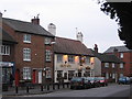
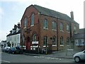
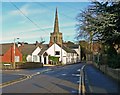
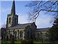
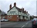
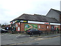
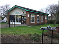
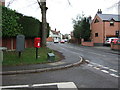
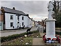
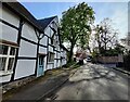
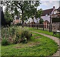
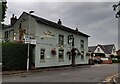
Photos of Burbage
Area Information
Living in Burbage offers a distinct experience for those seeking a civil parish with a defined character and manageable scale. This community spans 12.6 square kilometres and holds a population of 5,520 residents. The area has a population density of 439 people per square kilometre, creating an environment that is neither completely isolated nor densely packed. You will find a setting that balances rural tranquility with sufficient accessibility, making it a practical choice for families or retirees who value space. The layout allows for a clear understanding of local amenity distances, as the total area size is compact enough for easy navigation. Daily life here revolves around a stable community structure where neighbours often know one another well. The specific demographic profile suggests a quiet rhythm to daily routines, supported by a high rate of home ownership that permeates the neighbourhood landscape. When considering homes in Burbage, you are looking at a location with established boundaries and a shared sense of purpose among its inhabitants. The area does not rely on tourism or transient populations; instead, it focuses on long-term residents. This stability contributes to a predictable environment where local services and infrastructure are tailored to established needs. The parish status of Burbage indicates a level of local governance that prioritises the specific interests of its 5,520 citizens. Whether you are driving into the village or walking through the streets, the physical size of the parish ensures that distances remain familiar. You gain a clear picture of the territory before you settle down, removing the uncertainty often found in larger, more complex urban developments. The presence of a relatively high density for a rural parish means that essential services are within a practical reach. This density supports a local economy that can sustain small businesses and community facilities without the overwhelming commercialisation seen in city centres. The 12.6-kilometre square kilometre expanse allows for green spaces that remain integral to the local landscape rather than being squeezed into urban varnish. Residents enjoy a lifestyle where the local environment directly shapes their daily activities. This makes Burbage a compelling option for anyone who wants a home with a clear identity and a community that functions as a cohesive unit. The data reflects a place where the population is settled and the physical space supports a consistent way of life.
- Area Type
- Parish
- Area Size
- 12.6 km²
- Population
- 5520
- Population Density
- 439 people/km²
Demographics
The community in Burbage is defined by a very specific age profile, with a median age of 70 years. This figure alone tells you that the neighbourhood is predominantly retired or near-retired. The most common age range captured in the local statistics covers the total population, indicating that the bulk of residents fall within older demographic brackets. You should expect a calm, mature atmosphere where social interactions often revolve around clubs, local groups, or quiet neighbourhood gatherings. The high proportion of older residents means that community facilities are likely oriented towards leisure, health, and social engagement rather than typical family services. Home ownership stands at an impressive 86% within Burbage. This statistic confirms that the vast majority of residents own their homes outright or with a mortgage they can manage. Very few people rent in this parish, which creates a stable environment where long-term investment is the norm. Accommodation types reflect this ownership model, with a significant portion of the housing stock consisting of detached or semi-detached properties suitable for mature families. The data shows that the total household composition aligns closely with older couples or single-person households living independently. Ethnic diversity and religious affiliation are recorded in the local census but do not significantly alter the traditional character of the area. The predominant ethnic group represents the overall population composition, which leans heavily towards the native majority typical of rural English parishes. Religion statistics, while some specific breakdowns may vary, show a diverse spiritual landscape that includes various denominations common across the countryside. The 86% ownership rate and the median age of 70 create a demographic ecosystem where neighbours have lived their entire lives within the same community. This consistency fosters a strong sense of locality and mutual reliance that is hallmark of rural life.
Household Size
Accommodation Type
Tenure
Ethnic Group
Religion
Household Composition
Age
Household Deprivation
NS-SEC
Explore more demographic insights in this area
Go to Demographics tabPlanning
Planning Constraints
- Flood RiskPremium
- Ramsar Wetland SitesPremium
- Area of Outstanding Natural BeautyPremium
- Protected Nature ReservePremium
- Protected WoodlandPremium