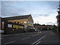
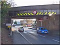
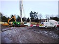
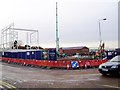
Area Overview for Hinckley
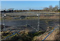
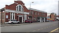
Photos of Hinckley


Area Information
Living in Hinckley offers a distinct identity as a town firmly established within the Leicestershire landscape. This built-up area spans 14.7 km² and supports a resident population of 23,586 people. The density stands at 1,606 people per km², suggesting a residential environment that balances community proximity with sufficient space. You will find this town functions as a hub where daily life revolves around local amenities and established transport links. The area operates as a practical base for those seeking a settled community rather than an urban metropolis. Moving around the town is straightforward given the presence of four rail stations within practical reach, including Hinckley Railway Station itself. Connectivity extends further with lines to Nuneaton Railway Station and Bermuda Park Railway Station. These connections facilitate travel across the region while keeping daily commutes manageable for local employment. The town size allows for easy navigation without the congestion typical of larger cities. Residents can expect an environment where local services remain accessible without long travel times. The character of Hinckley is defined by its function as a residential heartland with robust infrastructure. You will encounter a neighbourhood where shops, schools, and transport hubs are integrated into the daily rhythm. The area serves as a reliable homebase for families and professionals alike. Its compact nature ensures that essential needs are met locally, reducing reliance on distant centres. This setup supports a lifestyle focused on convenience and stability.
- Area Type
- Built Up Area 250
- Area Size
- 14.7 km²
- Population
- 23586
- Population Density
- 1606 people/km²
Daily life in Hinckley is supported by a concentration of retail outlets and transport hubs within practical reach of every resident. The town features five main retail locations that cater to your weekly shopping needs. Sainsburys Hinckley, Tesco Hinckley, and Lidl Hinckley form the core grocery offering for the local population. These supermarkets provide a full range of food items and household essentials without the need to travel into larger cities. Your daily convenience is further enhanced by four railway stations located near the area. Hinckley Railway Station serves as the primary gateway, while Nuneaton Railway Station, Bermuda Park Railway Station, and Shenton Railway Station offer additional travel connections. These stations facilitate easy commutes and leisure trips, integrating Hinckley into the wider transport network. You can commute to workplaces in nearby towns while maintaining a local lifestyle. The layout of amenities ensures that essential services remain close to home. Residents do not need to drive far to find shops, public transport, or leisure facilities. The proximity of Sainsburys, Tesco, and Lidl allows for quick grocery runs. Train passengers can access booking halls and ticket offices at Hinckley, Shenton, Nuneaton, or Bermuda Park easily. This blend of local retail and regional transport creates a balanced lifestyle where you can manage errands locally while retaining access to broader opportunities when required.
Amenities
Schools
Education options near Hinckley include several primary schools, each with specific locations and quality ratings. Westfield Infant School holds an outstanding Ofsted rating, establishing a high standard for early learning. Westfield Junior School also receives a good rating, providing a proven educational path for children progressing to secondary years. Both Westfield institutions serve the immediate locality, ensuring that families have access to rated providers nearby. Other primary options include Hinckley Parks Primary School, Burbage Junior School, and Battling Brook Community Primary School. Each of these institutions operates within the catchment for the 23,586 residents of the built-up area. None of these schools provide data on their specific age ranges or curriculum specialisation, but their presence confirms a network of primary education focused on local communities. The mix of outstanding and good ratings suggests a generally high-performing sector for primary education. For residents living in Hinckley, these schools offer reliable options without the need for extensive travel to larger towns. You can expect your children to attend one of these five listed primary schools depending on address location. The concentration of primary providers indicates strong community investment in early education. This setup supports families who wish their children to remain close to home while receiving instruction from staff in centres with recognised quality marks. The availability of multiple sites ensures flexibility in school placement.
| Rank | School | Type | Entry gender | Ages |
|---|
Explore more schools in this area
Go to Schools tabDemographics
The community profile in Hinckley reflects a mature settlement with significant established residential tenure. Data indicates that 74% of households in the area are owner-occupied. This high level of ownership suggests a stable, long-term community where many residents have taken roots over generations. The median age for residents is 70 years old, pointing towards an older population demographic. This age profile shapes the local services and social needs of the town, favouring practicality and familiarity over transient trends. Household composition patterns align with the high ownership rate, indicating families and retirees rather than nomadic workers dominate the housing market. You will find predominantly traditional housing solutions catering to those seeking permanence in this 14.7 km² footprint. While specific breakdowns for ethnic groups and religious affiliations are not detailed, the prevailing demographic is stable. The population density of 1,606 people per km² ensures that life remainsCommunity-focused without becoming overcrowded. This demographic mix creates a predictable environment for newcomers. The high proportion of owners often implies lower rental turnover and a stronger sense of local investment. For those considering homes in Hinckley, this means buying in an area where residents value long-term stability. The town operates as a place where life settles down, supported by a population that has lived here for decades. The age structure and ownership statistics together paint a clear picture of a established locality.