Area Overview for LE9 9JJ
Photos of LE9 9JJ
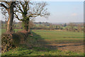
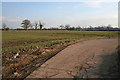
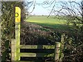
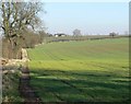
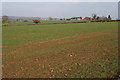
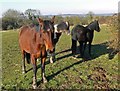
6 photos from this area
Area Information
Key information about the LE9 9JJ including its size, population, and administrative classification.
- Area Type
- Postcode
- Area Size
- 3.5 km²
- Population
- 1973
- Population Density
- 182 people/km²
House Prices in LE9 9JJ
90
Properties
£417,581
Average Sold Price
£57,000
Lowest Price
£2,400,000
Highest Price
Showing 90 properties
| Address | Type | Beds | Baths | Last Sale Price | Last Sale Date | |
|---|---|---|---|---|---|---|
| Nibelheim, 29 Leicester Lane, Desford, LE9 9JJ | house | 5 | 2 | £375,000 | Dec 2024 | |
| 10 Leicester Lane, Desford, LE9 9JJ | Detached | 4 | 2 | £465,000 | Sep 2024 | |
| 9 Leicester Lane, Desford, LE9 9JJ | house | - | - | £450,000 | May 2024 | |
| 7 Leicester Lane, Desford, LE9 9JJ | Detached | 5 | 1 | £495,000 | Apr 2024 | |
| Greystones, Leicester Lane, Desford, LE9 9JJ | Bungalow | 5 | 3 | £470,000 | Feb 2024 | |
| The Hawthorns, Leicester Lane, Desford, LE9 9JJ | house | 4 | 3 | £2,400,000 | Nov 2022 | |
| 8 Leicester Lane, Desford, LE9 9JJ | Detached | 4 | 2 | £410,000 | Aug 2022 | |
| Yalbalgo, Leicester Lane, Kirby Muxloe, LE9 9JJ | Detached | 2 | 3 | £500,000 | Mar 2022 | |
| Michaelmas Cottage, Leicester Lane, Desford, LE9 9JJ | house | - | - | £500,000 | Feb 2022 | |
| 33 Leicester Lane, Desford, LE9 9JJ | house | - | - | £190,000 | Jul 2021 |
Page 1 of 9
Energy Efficiency in LE9 9JJ
Amenities
Schools
| Rank | School | Type | Entry gender | Ages |
|---|
Explore more schools in this area
Go to Schools tabDemographics
Household Size
Two person
most common
Accommodation Type
Houses
most common
Tenure
89
majority
Ethnic Group
White
most common
Religion
N/A
most common
Household Composition
N/A
most common
Age
47
median
Adults (30-64 years)
most common
Household Deprivation
N/A
with no deprivation
NS-SEC
47
in Lower managerial occupations
Explore more demographic insights in this area
Go to Demographics tabPlanning
Planning Constraints
- Flood RiskPremium
- Ramsar Wetland SitesPremium
- Area of Outstanding Natural BeautyPremium
- Protected Nature ReservePremium
- Protected WoodlandPremium