Area Overview for LE8 6YU
Photos of LE8 6YU
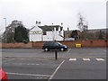

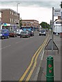
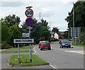
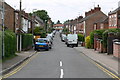

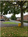
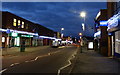
54 photos from this area
Area Information
Key information about the LE8 6YU including its size, population, and administrative classification.
- Area Type
- Postcode
- Area Size
- 6280 m²
- Population
- 1614
- Population Density
- 1196 people/km²
House Prices in LE8 6YU
16
Properties
£188,586
Average Sold Price
£55,000
Lowest Price
£328,500
Highest Price
Showing 16 properties
| Address | Type | Beds | Baths | Last Sale Price | Last Sale Date | |
|---|---|---|---|---|---|---|
| 2 Rumsey Drive, Whetstone, LE8 6YU | Bungalow | 2 | 1 | £290,000 | Feb 2025 | |
| 8 Rumsey Drive, Whetstone, LE8 6YU | Retail | 2 | 1 | £242,000 | Dec 2022 | |
| 17 Rumsey Drive, Whetstone, LE8 6YU | Semi-detached | 2 | - | £218,000 | Mar 2021 | |
| 14 Rumsey Drive, Whetstone, LE8 6YU | Bungalow | - | - | £290,000 | Mar 2019 | |
| 1 Rumsey Drive, Whetstone, LE8 6YU | Detached | 4 | - | £328,500 | Aug 2018 | |
| 4 Rumsey Drive, Whetstone, LE8 6YU | Bungalow | 3 | 2 | £238,000 | Jul 2017 | |
| 12 Rumsey Drive, Whetstone, LE8 6YU | Bungalow | 2 | - | £147,000 | Jun 2013 | |
| 11 Rumsey Drive, Whetstone, LE8 6YU | Semi-detached | - | - | £101,000 | Dec 2002 | |
| 5 Rumsey Drive, Whetstone, LE8 6YU | Detached | 3 | 2 | £106,950 | Apr 2001 | |
| 6 Rumsey Drive, Whetstone, LE8 6YU | Detached | - | - | £58,000 | Jun 1997 |
Page 1 of 2
Energy Efficiency in LE8 6YU
Amenities
Schools
| Rank | School | Type | Entry gender | Ages |
|---|
Explore more schools in this area
Go to Schools tabDemographics
Household Size
Two person
most common
Accommodation Type
Houses
most common
Tenure
64
majority
Ethnic Group
White
most common
Religion
N/A
most common
Household Composition
N/A
most common
Age
47
median
Adults (30-64 years)
most common
Household Deprivation
N/A
with no deprivation
NS-SEC
28
in Lower managerial occupations
Explore more demographic insights in this area
Go to Demographics tabPlanning
Planning Constraints
- Flood RiskPremium
- Ramsar Wetland SitesPremium
- Area of Outstanding Natural BeautyPremium
- Protected Nature ReservePremium
- Protected WoodlandPremium