Area Overview for LE8 4FP
Photos of LE8 4FP
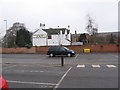

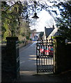
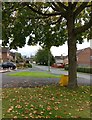
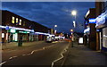
54 photos from this area
Area Information
Key information about the LE8 4FP including its size, population, and administrative classification.
- Area Type
- Postcode
- Area Size
- 2.1 hectares
- Population
- 1567
- Population Density
- 3736 people/km²
House Prices in LE8 4FP
45
Properties
£166,680
Average Sold Price
£44,750
Lowest Price
£242,000
Highest Price
Showing 45 properties
| Address | Type | Beds | Baths | Last Sale Price | Last Sale Date | |
|---|---|---|---|---|---|---|
| 65 The Crescent, Blaby, LE8 4FP | Semi-detached | 3 | 1 | £235,000 | Jun 2024 | |
| 57 The Crescent, Blaby, LE8 4FP | Semi-detached | 3 | - | £234,000 | May 2024 | |
| 1 The Crescent, Blaby, LE8 4FP | house | 3 | 1 | £242,000 | Jul 2022 | |
| 55 The Crescent, Blaby, LE8 4FP | house | - | - | £190,000 | Sep 2021 | |
| 51 The Crescent, Blaby, LE8 4FP | house | - | - | £200,000 | Apr 2021 | |
| 43 The Crescent, Blaby, LE8 4FP | Semi-detached | 3 | - | £183,000 | Feb 2020 | |
| 23 The Crescent, Blaby, LE8 4FP | Semi-detached | 4 | - | £225,000 | Jan 2020 | |
| 49 The Crescent, Blaby, LE8 4FP | Semi-detached | 3 | 1 | £195,000 | Dec 2018 | |
| 35 The Crescent, Blaby, LE8 4FP | house | - | - | £160,000 | Dec 2017 | |
| 15 The Crescent, Blaby, LE8 4FP | house | - | - | £105,000 | Nov 2017 |
Page 1 of 5
Energy Efficiency in LE8 4FP
Amenities
Schools
| Rank | School | Type | Entry gender | Ages |
|---|
Explore more schools in this area
Go to Schools tabDemographics
Household Size
Family (3-5 people)
most common
Accommodation Type
Houses
most common
Tenure
72
majority
Ethnic Group
White
most common
Religion
N/A
most common
Household Composition
N/A
most common
Age
47
median
Adults (30-64 years)
most common
Household Deprivation
N/A
with no deprivation
NS-SEC
29
in Lower managerial occupations
Explore more demographic insights in this area
Go to Demographics tabPlanning
Planning Constraints
- Flood RiskPremium
- Ramsar Wetland SitesPremium
- Area of Outstanding Natural BeautyPremium
- Protected Nature ReservePremium
- Protected WoodlandPremium