Area Overview for LE8 4DL
Photos of LE8 4DL

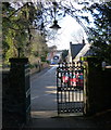
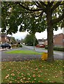
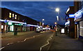
54 photos from this area
Area Information
Key information about the LE8 4DL including its size, population, and administrative classification.
- Area Type
- Postcode
- Area Size
- 2.3 hectares
- Population
- 1567
- Population Density
- 3736 people/km²
House Prices in LE8 4DL
70
Properties
£200,535
Average Sold Price
£87,950
Lowest Price
£307,500
Highest Price
Showing 70 properties
| Address | Type | Beds | Baths | Last Sale Price | Last Sale Date | |
|---|---|---|---|---|---|---|
| 14 Laurel Road, Blaby, LE8 4DL | Semi-detached | 3 | 1 | £257,500 | Sep 2025 | |
| 58 Laurel Road, Blaby, LE8 4DL | Semi-detached | 3 | - | £207,148 | Feb 2025 | |
| 9 Laurel Road, Blaby, LE8 4DL | Semi-detached | 3 | 1 | £307,500 | Dec 2024 | |
| 55 Laurel Road, Blaby, LE8 4DL | Semi-detached | 3 | 1 | £240,000 | Jul 2024 | |
| 23 Laurel Road, Blaby, LE8 4DL | Semi-detached | 3 | - | £270,000 | Mar 2024 | |
| 15 Laurel Road, Blaby, LE8 4DL | house | - | - | £246,000 | Apr 2023 | |
| 30 Laurel Road, Blaby, LE8 4DL | Retail | 3 | 1 | £283,000 | Sep 2022 | |
| 28 Laurel Road, Blaby, LE8 4DL | Semi-detached | 3 | 1 | £260,000 | Apr 2022 | |
| 8 Laurel Road, Blaby, LE8 4DL | house | - | - | £260,000 | Dec 2021 | |
| 64 Laurel Road, Blaby, LE8 4DL | house | 3 | - | £245,000 | May 2021 |
Page 1 of 7
Energy Efficiency in LE8 4DL
Amenities
Schools
| Rank | School | Type | Entry gender | Ages |
|---|
Explore more schools in this area
Go to Schools tabDemographics
Household Size
Family (3-5 people)
most common
Accommodation Type
Houses
most common
Tenure
72
majority
Ethnic Group
White
most common
Religion
N/A
most common
Household Composition
N/A
most common
Age
47
median
Adults (30-64 years)
most common
Household Deprivation
N/A
with no deprivation
NS-SEC
29
in Lower managerial occupations
Explore more demographic insights in this area
Go to Demographics tabPlanning
Planning Constraints
- Flood RiskPremium
- Ramsar Wetland SitesPremium
- Area of Outstanding Natural BeautyPremium
- Protected Nature ReservePremium
- Protected WoodlandPremium