Area Overview for LE67 1UF
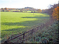
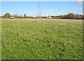
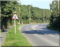
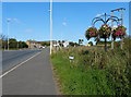
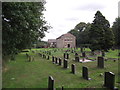
Photos of LE67 1UF


Area Information
Living in LE67 1UF offers a compact, residential experience shaped by its small footprint of 4,860 square metres and a population of 2,151 people. This postcode area, though modest in size, supports a community with a population density of 509 people per square kilometre, creating a tightly knit environment. The area’s character is defined by its focus on housing, with 76% of residents owning their homes. Daily life here is influenced by its proximity to key amenities, including a railway station and local shops, while its low crime risk and minimal environmental constraints suggest a stable, low-stress living environment. LE67 1UF is not a sprawling suburb but a defined cluster, where residents share access to nearby services and a relatively uniform demographic profile. For those seeking a quiet, established neighbourhood with practical infrastructure, this area provides a straightforward alternative to larger urban centres. Its limited size means that most needs can be met within a short walk or drive, though its appeal may lie in its simplicity rather than diversity.
- Area Type
- Postcode
- Area Size
- 4860 m²
- Population
- 2151
- Population Density
- 509 people/km²
The property market in LE67 1UF is characterised by high home ownership, with 76% of residents living in owner-occupied homes. This suggests a stable, long-term market with limited rental activity. The area is primarily composed of houses, which are more common than flats or apartments, reflecting a preference for traditional, standalone properties. Given the small size of the postcode area, the housing stock is likely limited in volume, making it a niche market for buyers seeking a specific type of property. The dominance of houses may appeal to families or individuals looking for space and privacy, though the lack of high-rise or mixed-use developments could limit options for those prioritising density. Buyers should consider that the area’s small size means competition for properties may be higher, and the market is unlikely to cater to short-term investors or those seeking rental income. The focus on owner-occupation also implies that properties are held by residents with a vested interest in maintaining the area’s character.
House Prices in LE67 1UF
Showing 1 properties
| Address | Type | Beds | Baths | Last Sale Price | Last Sale Date | |
|---|---|---|---|---|---|---|
| Barratt House, Cartwright Way, Bardon Hill, LE67 1UF | Office | - | - | - | - |
Energy Efficiency in LE67 1UF
Residents of LE67 1UF have access to a range of local amenities within practical reach. The area includes five retail outlets, such as Asda Browns, Morrisons Daily, and Budgens Shell, providing essential shopping and fueling options. These shops cater to daily needs, reducing the necessity for long trips to larger centres. The presence of Shackerstone Railway Station adds to the area’s connectivity, enabling travel to nearby destinations. While the data does not mention parks or leisure facilities, the absence of planning constraints such as protected woodlands or AONB areas suggests that open spaces may be limited. The lifestyle here is defined by convenience and proximity, with amenities focused on practicality rather than luxury. For those valuing self-sufficiency and ease of access to services, the area’s shops and transport links offer a straightforward, no-frills approach to daily life.
Amenities
Schools
The nearest school to LE67 1UF is Ellistown Community Primary School, a primary institution with an Ofsted rating of ‘good’. This school serves the local community, offering education for younger children in the area. The absence of secondary schools or other educational institutions within the data suggests that families may need to look beyond LE67 1UF for secondary education. However, the presence of a well-rated primary school is a positive factor for those prioritising early education. The single school listed indicates a focused, localised approach to education, which may suit families seeking a close-knit environment. For buyers, the availability of a primary school within reach is a practical consideration, though additional research would be needed to identify secondary options. The school’s rating provides reassurance about the quality of education available, though it does not address broader educational needs beyond primary level.
| Rank | School | Type | Entry gender | Ages |
|---|
Explore more schools in this area
Go to Schools tabDemographics
The community in LE67 1UF is predominantly middle-aged, with a median age of 47 and the majority of residents falling within the 30–64 age range. Home ownership is high, at 76%, indicating a stable population with long-term residency. The area is largely composed of houses, reflecting a preference for standalone properties over flats or apartments. The predominant ethnic group is White, though specific data on diversity or deprivation is not provided. This demographic profile suggests a mature, settled population with established family structures. The absence of detailed data on income or deprivation means that quality of life indicators must be inferred from other metrics, such as low crime rates and good digital connectivity. The age distribution implies a community with a mix of working-age adults and retirees, potentially influencing local services and amenities. For buyers, this profile may indicate a neighbourhood with less turnover and a focus on long-term living rather than transient populations.
Household Size
Accommodation Type
Tenure
Ethnic Group
Religion
Household Composition
Age
Household Deprivation
NS-SEC
Explore more demographic insights in this area
Go to Demographics tabPlanning
Planning Constraints
- Flood RiskPremium
- Ramsar Wetland SitesPremium
- Area of Outstanding Natural BeautyPremium
- Protected Nature ReservePremium
- Protected WoodlandPremium