Area Overview for LE65 1SH
Photos of LE65 1SH
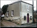
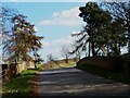
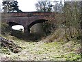
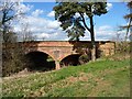
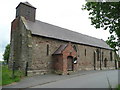
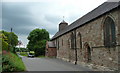
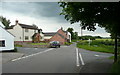
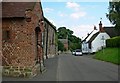
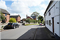
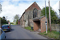
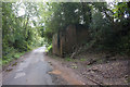
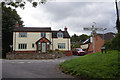
27 photos from this area
Area Information
Key information about the LE65 1SH including its size, population, and administrative classification.
- Area Type
- Postcode
- Area Size
- 1.2 hectares
- Population
- 1648
- Population Density
- 128 people/km²
House Prices in LE65 1SH
29
Properties
£149,700
Average Sold Price
£44,000
Lowest Price
£220,000
Highest Price
Showing 29 properties
| Address | Type | Beds | Baths | Last Sale Price | Last Sale Date | |
|---|---|---|---|---|---|---|
| 83 St Matthews Avenue, Worthington, LE65 1SH | Semi-detached | 3 | 1 | £192,500 | Mar 2025 | |
| 81 St Matthews Avenue, Worthington, LE65 1SH | Semi-detached | 3 | 1 | £220,000 | Nov 2024 | |
| 82 St Matthews Avenue, Worthington, LE65 1SH | Semi-detached | 3 | 1 | £162,000 | Aug 2024 | |
| 72 St Matthews Avenue, Worthington, LE65 1SH | Semi-detached | 3 | 1 | £164,000 | Aug 2023 | |
| 68 St Matthews Avenue, Worthington, LE65 1SH | Semi-detached | 3 | 1 | £170,000 | Feb 2022 | |
| 84 St Matthews Avenue, Worthington, LE65 1SH | Detached | 3 | 1 | £143,500 | Sep 2020 | |
| 70 St Matthews Avenue, Worthington, LE65 1SH | house | - | - | £145,000 | May 2019 | |
| 89 St Matthews Avenue, Worthington, LE65 1SH | Semi-detached | 3 | 2 | £136,000 | Mar 2016 | |
| 80 St Matthews Avenue, Worthington, LE65 1SH | house | 3 | - | £120,000 | Apr 2010 | |
| 67 St Matthews Avenue, Worthington, LE65 1SH | house | 3 | - | £44,000 | Dec 2002 |
Page 1 of 3
Energy Efficiency in LE65 1SH
Amenities
Schools
| Rank | School | Type | Entry gender | Ages |
|---|
Explore more schools in this area
Go to Schools tabDemographics
Household Size
Two person
most common
Accommodation Type
Houses
most common
Tenure
79
majority
Ethnic Group
White
most common
Religion
N/A
most common
Household Composition
N/A
most common
Age
47
median
Adults (30-64 years)
most common
Household Deprivation
N/A
with no deprivation
NS-SEC
40
in Lower managerial occupations
Explore more demographic insights in this area
Go to Demographics tabPlanning
Planning Constraints
- Flood RiskPremium
- Ramsar Wetland SitesPremium
- Area of Outstanding Natural BeautyPremium
- Protected Nature ReservePremium
- Protected WoodlandPremium