Area Overview for LE65 1RE
Photos of LE65 1RE
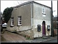
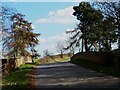
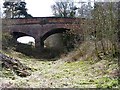
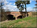
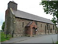
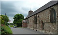
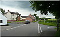
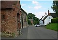
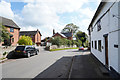
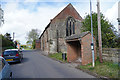
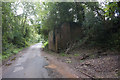
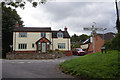
27 photos from this area
Area Information
Key information about the LE65 1RE including its size, population, and administrative classification.
- Area Type
- Postcode
- Area Size
- 4.6 hectares
- Population
- 1648
- Population Density
- 128 people/km²
House Prices in LE65 1RE
22
Properties
£279,400
Average Sold Price
£222,000
Lowest Price
£355,000
Highest Price
Showing 22 properties
| Address | Type | Beds | Baths | Last Sale Price | Last Sale Date | |
|---|---|---|---|---|---|---|
| 12 Church Street, Worthington, LE65 1RE | Detached | 4 | 2 | £355,000 | Nov 2019 | |
| The Laurels, 11 Church Street, Worthington, LE65 1RE | Detached | 4 | 2 | £335,000 | Jun 2018 | |
| 17 Church Street, Worthington, LE65 1RE | Bungalow | 3 | 2 | £240,000 | Jun 2012 | |
| 14 Church Street, Worthington, LE65 1RE | Detached | - | - | £245,000 | Jul 2005 | |
| The Birches, Church Street, Worthington, LE65 1RE | Detached | - | - | £222,000 | Jul 2001 | |
| 3 Church Street, Worthington, LE65 1RE | Cottage | 3 | 2 | - | - | |
| The Old Bakery, Church Street, Worthington, LE65 1RE | Detached | 4 | 1 | - | - | |
| 1 Church Street, Worthington, LE65 1RE | Semi-detached | 2 | 1 | - | - | |
| 15A Church Street, Worthington, LE65 1RE | Cottage | 3 | 1 | - | - | |
| 13B Church Street, Worthington, LE65 1RE | Terraced | 3 | 1 | - | - |
Page 1 of 3
Energy Efficiency in LE65 1RE
Amenities
Schools
| Rank | School | Type | Entry gender | Ages |
|---|
Explore more schools in this area
Go to Schools tabDemographics
Household Size
Two person
most common
Accommodation Type
Houses
most common
Tenure
79
majority
Ethnic Group
White
most common
Religion
N/A
most common
Household Composition
N/A
most common
Age
47
median
Adults (30-64 years)
most common
Household Deprivation
N/A
with no deprivation
NS-SEC
40
in Lower managerial occupations
Explore more demographic insights in this area
Go to Demographics tabPlanning
Planning Constraints
- Flood RiskPremium
- Ramsar Wetland SitesPremium
- Area of Outstanding Natural BeautyPremium
- Protected Nature ReservePremium
- Protected WoodlandPremium