Area Overview for LE6 0XB
Photos of LE6 0XB
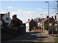
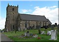
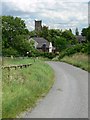
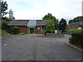
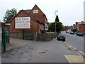
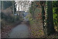
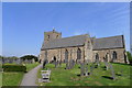
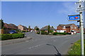
46 photos from this area
Area Information
Key information about the LE6 0XB including its size, population, and administrative classification.
- Area Type
- Postcode
- Area Size
- 9677 m²
- Population
- 1701
- Population Density
- 544 people/km²
House Prices in LE6 0XB
25
Properties
£201,624
Average Sold Price
£97,000
Lowest Price
£445,000
Highest Price
Showing 25 properties
| Address | Type | Beds | Baths | Last Sale Price | Last Sale Date | |
|---|---|---|---|---|---|---|
| 17 Heathbrook Drive, Ratby, LE6 0XB | Semi-detached | 3 | 1 | £267,000 | Aug 2023 | |
| 27 Heathbrook Drive, Ratby, LE6 0XB | Semi-detached | 3 | 1 | £287,500 | Jun 2023 | |
| 31 Heathbrook Drive, Ratby, LE6 0XB | house | - | - | £385,000 | Dec 2022 | |
| 8 Heathbrook Drive, Ratby, LE6 0XB | house | - | - | £290,000 | Oct 2022 | |
| 10 Heathbrook Drive, Ratby, LE6 0XB | house | 5 | - | £445,000 | Mar 2022 | |
| 33 Heathbrook Drive, Ratby, LE6 0XB | house | - | - | £286,000 | Mar 2019 | |
| 3 Heathbrook Drive, Ratby, LE6 0XB | house | 3 | - | £235,000 | Nov 2017 | |
| 20 Heathbrook Drive, Ratby, LE6 0XB | house | - | - | £152,500 | Nov 2016 | |
| 22 Heathbrook Drive, Ratby, LE6 0XB | Semi-detached | 2 | 1 | £149,000 | Mar 2016 | |
| 15 Heathbrook Drive, Ratby, LE6 0XB | Semi-detached | 3 | - | £156,000 | Jun 2012 |
Page 1 of 3
Energy Efficiency in LE6 0XB
Amenities
Schools
| Rank | School | Type | Entry gender | Ages |
|---|
Explore more schools in this area
Go to Schools tabDemographics
Household Size
Two person
most common
Accommodation Type
Houses
most common
Tenure
75
majority
Ethnic Group
White
most common
Religion
N/A
most common
Household Composition
N/A
most common
Age
47
median
Adults (30-64 years)
most common
Household Deprivation
N/A
with no deprivation
NS-SEC
35
in Lower managerial occupations
Explore more demographic insights in this area
Go to Demographics tabPlanning
Planning Constraints
- Flood RiskPremium
- Ramsar Wetland SitesPremium
- Area of Outstanding Natural BeautyPremium
- Protected Nature ReservePremium
- Protected WoodlandPremium