Area Overview for LE6 0NQ
Photos of LE6 0NQ
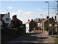
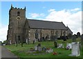
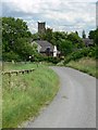
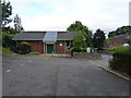
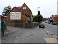
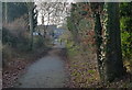
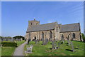
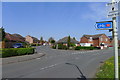

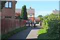
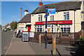
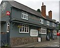
46 photos from this area
Area Information
Key information about the LE6 0NQ including its size, population, and administrative classification.
- Area Type
- Postcode
- Area Size
- 1.8 hectares
- Population
- 1701
- Population Density
- 544 people/km²
House Prices in LE6 0NQ
46
Properties
£156,074
Average Sold Price
£20,000
Lowest Price
£345,000
Highest Price
Showing 46 properties
| Address | Type | Beds | Baths | Last Sale Price | Last Sale Date | |
|---|---|---|---|---|---|---|
| 21 Tyler Road, Ratby, LE6 0NQ | Semi-detached | 2 | 1 | £216,000 | Mar 2025 | |
| 16 Tyler Road, Ratby, LE6 0NQ | Detached | 3 | 1 | £345,000 | Apr 2024 | |
| 10 Tyler Road, Ratby, LE6 0NQ | house | - | - | £236,000 | Nov 2022 | |
| 14 Tyler Road, Ratby, LE6 0NQ | Semi-detached | 3 | 2 | £237,500 | May 2020 | |
| 31 Tyler Road, Ratby, LE6 0NQ | Detached | 4 | 2 | £325,000 | Dec 2019 | |
| 42 Tyler Road, Ratby, LE6 0NQ | Detached | 4 | 2 | £315,000 | Aug 2018 | |
| 23 Tyler Road, Ratby, LE6 0NQ | Bungalow | 2 | 1 | £177,000 | Feb 2018 | |
| 30 Tyler Road, Ratby, LE6 0NQ | house | 3 | 2 | £234,000 | Nov 2017 | |
| 26 Tyler Road, Ratby, LE6 0NQ | house | - | - | £210,000 | Aug 2017 | |
| 43 Tyler Road, Ratby, LE6 0NQ | Detached | 4 | 3 | £310,000 | Mar 2017 |
Page 1 of 5
Energy Efficiency in LE6 0NQ
Amenities
Schools
| Rank | School | Type | Entry gender | Ages |
|---|
Explore more schools in this area
Go to Schools tabDemographics
Household Size
Two person
most common
Accommodation Type
Houses
most common
Tenure
75
majority
Ethnic Group
White
most common
Religion
N/A
most common
Household Composition
N/A
most common
Age
47
median
Adults (30-64 years)
most common
Household Deprivation
N/A
with no deprivation
NS-SEC
35
in Lower managerial occupations
Explore more demographic insights in this area
Go to Demographics tabPlanning
Planning Constraints
- Flood RiskPremium
- Ramsar Wetland SitesPremium
- Area of Outstanding Natural BeautyPremium
- Protected Nature ReservePremium
- Protected WoodlandPremium