Area Overview for LE5 6JJ
Photos of LE5 6JJ
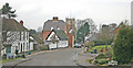
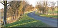
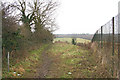
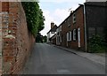
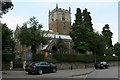
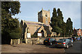
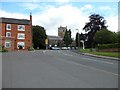
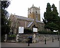
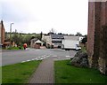
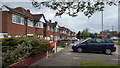
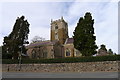
36 photos from this area
Area Information
Key information about the LE5 6JJ including its size, population, and administrative classification.
- Area Type
- Postcode
- Area Size
- 13.5 hectares
- Population
- 1747
- Population Density
- 234 people/km²
House Prices in LE5 6JJ
18
Properties
£250,646
Average Sold Price
£88,000
Lowest Price
£480,000
Highest Price
Showing 18 properties
| Address | Type | Beds | Baths | Last Sale Price | Last Sale Date | |
|---|---|---|---|---|---|---|
| 3 Swinstead Road, Leicester, LE5 6JJ | Bungalow | 3 | 2 | £405,000 | Sep 2025 | |
| 20 Swinstead Road, Leicester, LE5 6JJ | Bungalow | 3 | 2 | £480,000 | Mar 2024 | |
| 7 Swinstead Road, Leicester, LE5 6JJ | Retail | 2 | 1 | £270,000 | Jun 2022 | |
| 4 Swinstead Road, Leicester, LE5 6JJ | Bungalow | - | - | £315,000 | Apr 2021 | |
| 1 Swinstead Road, Leicester, LE5 6JJ | Bungalow | 2 | 1 | £247,000 | Jan 2020 | |
| 15 Swinstead Road, Leicester, LE5 6JJ | Bungalow | 3 | - | £355,000 | Aug 2018 | |
| 5 Swinstead Road, Leicester, LE5 6JJ | Detached | 2 | - | £190,000 | Nov 2012 | |
| 12 Swinstead Road, Leicester, LE5 6JJ | Detached | 3 | 1 | £299,950 | Apr 2007 | |
| 10 Swinstead Road, Leicester, LE5 6JJ | Detached | - | - | £189,950 | Oct 2006 | |
| 14 Swinstead Road, Leicester, LE5 6JJ | Detached | - | - | £145,000 | May 2003 |
Page 1 of 2
Energy Efficiency in LE5 6JJ
Amenities
Schools
| Rank | School | Type | Entry gender | Ages |
|---|
Explore more schools in this area
Go to Schools tabDemographics
Household Size
Two person
most common
Accommodation Type
Houses
most common
Tenure
81
majority
Ethnic Group
White
most common
Religion
N/A
most common
Household Composition
N/A
most common
Age
47
median
Adults (30-64 years)
most common
Household Deprivation
N/A
with no deprivation
NS-SEC
38
in Lower managerial occupations
Explore more demographic insights in this area
Go to Demographics tabPlanning
Planning Constraints
- Flood RiskPremium
- Ramsar Wetland SitesPremium
- Area of Outstanding Natural BeautyPremium
- Protected Nature ReservePremium
- Protected WoodlandPremium