Area Overview for LE5 5NA
Photos of LE5 5NA
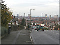
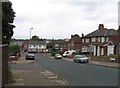
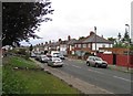
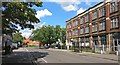
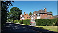
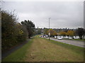
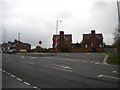
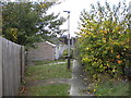
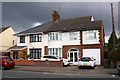
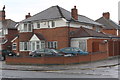
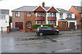
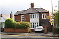
35 photos from this area
Area Information
Key information about the LE5 5NA including its size, population, and administrative classification.
- Area Type
- Postcode
- Area Size
- 5.3 hectares
- Population
- 2002
- Population Density
- 5322 people/km²
House Prices in LE5 5NA
20
Properties
£190,603
Average Sold Price
£54,000
Lowest Price
£383,000
Highest Price
Showing 20 properties
| Address | Type | Beds | Baths | Last Sale Price | Last Sale Date | |
|---|---|---|---|---|---|---|
| 54 Ethel Road, Leicester, LE5 5NA | Bungalow | 3 | 1 | £383,000 | Jan 2024 | |
| 26 Ethel Road, Leicester, LE5 5NA | Semi-detached | 3 | 1 | £292,500 | Sep 2018 | |
| 34 Ethel Road, Leicester, LE5 5NA | Semi-detached | 5 | 3 | £340,000 | Mar 2016 | |
| 40 Ethel Road, Leicester, LE5 5NA | Semi-detached | 3 | 1 | £200,000 | Jun 2013 | |
| 24 Ethel Road, Leicester, LE5 5NA | house | - | - | £250,000 | Jul 2007 | |
| 56 Ethel Road, Leicester, LE5 5NA | Bungalow | - | - | £193,500 | Jun 2007 | |
| 30 Ethel Road, Leicester, LE5 5NA | Semi-detached | 3 | 2 | £178,786 | Feb 2007 | |
| 28 Ethel Road, Leicester, LE5 5NA | Semi-detached | 3 | 1 | £133,000 | May 2003 | |
| 48 Ethel Road, Leicester, LE5 5NA | Detached | - | - | £136,500 | Sep 2002 | |
| 50 Ethel Road, Leicester, LE5 5NA | Detached | - | - | £66,000 | Aug 1999 |
Page 1 of 2
Energy Efficiency in LE5 5NA
Amenities
Schools
| Rank | School | Type | Entry gender | Ages |
|---|
Explore more schools in this area
Go to Schools tabDemographics
Household Size
Family (3-5 people)
most common
Accommodation Type
Houses
most common
Tenure
62
majority
Ethnic Group
asian_total
most common
Religion
N/A
most common
Household Composition
N/A
most common
Age
47
median
Adults (30-64 years)
most common
Household Deprivation
N/A
with no deprivation
NS-SEC
13
in Lower managerial occupations
Explore more demographic insights in this area
Go to Demographics tabPlanning
Planning Constraints
- Flood RiskPremium
- Ramsar Wetland SitesPremium
- Area of Outstanding Natural BeautyPremium
- Protected Nature ReservePremium
- Protected WoodlandPremium